- Muskwa Ranges
-
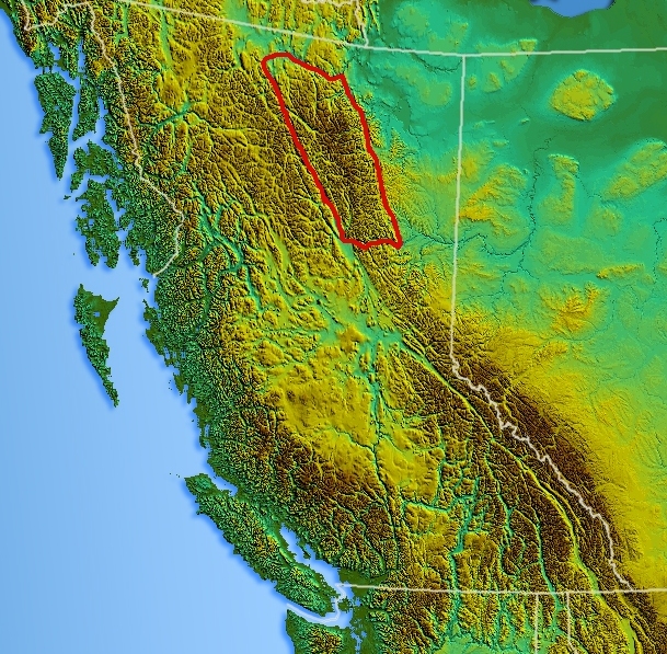
Muskwa Ranges Range Country Canada Province British Columbia Part of Canadian Rockies Highest point Ulysses Mountain - elevation 3,024 m (9,921 ft) Area 66,987 km2 (25,864 sq mi) 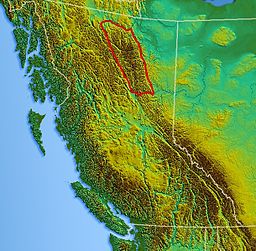 Location map of Muskwa Ranges
The Muskwa Ranges are a group of mountain ranges in northern British Columbia, Canada. They are part of the Northern Rockies section of the Rocky Mountains and are bounded on their west by the Rocky Mountain Trench and on their east by the Rocky Mountain Foothills. They are delimited on the north by the Liard River and on the south by the Peace Reach of the Lake Williston reservoir (formerly the Peace River), south of which the next major grouping of the Rockies is the Hart Ranges.
The Muskwa Ranges cover a surface of 97,388 km² and stretch for 424 km from north to south.[1]
Contents
Mountains and peaks
- Ulysses Mountain- 3,024 m (9,921 ft)
- Mount Sylvia- 2,940 m (9,646 ft)
- Mount Lloyd George- 2,938 m (9,639 ft)
- Great Rock Peak- 2,929 m (9,610 ft)
- Mount Roosevelt- 2,814 m (9,232 ft)
- Great Snow Mountain- 2,813 m (9,229 ft)
- Mount Peck- 2,807 m (9,209 ft)
- Churchill Peak- 2,770 m (9,088 ft)
- Yedhe Mountain- 2,717 m (8,914 ft)
- Gataga Peak- 2,533 m (8,310 ft)
Sub-ranges
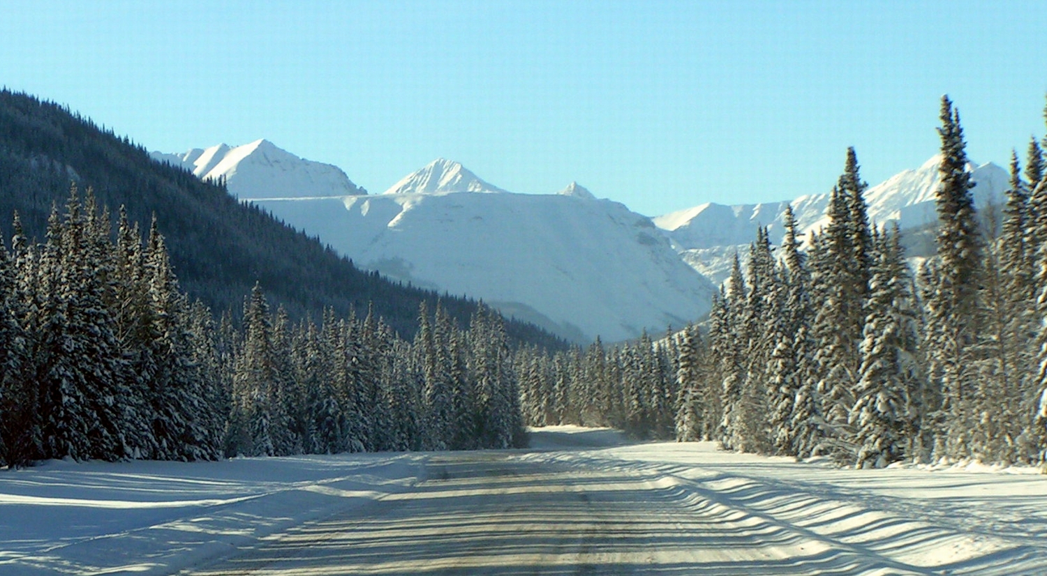
 The Alaska Highway crossing the Muskwa Ranges
- Akie Range
- Battle of Britain Range
- Deserters Range
- Gataga Ranges
- Rabbit Plateau
- Sentinel Range
- Stone Range
- Terminal Range
- Tochieka Range
- Tower of London Range
- Truncate Range
See also
References
- ^ Peakbagger - Muskwa Ranges
- "Muskwa Ranges". BC Geographical Names. http://apps.gov.bc.ca/pub/bcgnws/names/8362.html.
 Canadian Rockies
Ranges - Ball
- Bare
- Beaverfoot
- Blue
- Bow
- Crowsnest
- Elk
- Fairholme
- Flathead
- High Rock
- Kananaskis
- Livingstone
- Lizard
- Maligne
- Massive
- Misty
- Morrissey
- Palliser
- President
- Queen Elizabeth
- Rainbow
- Ram
- Sawback
- Sentinel
- Sir Winston Churchill
- Slate
- South Jasper
- Sundance
- Terminal
- Tower of London
- Vermilion
- Victoria Cross
- Waputik
- Continental Ranges
- Hart Ranges
- Muskwa Ranges
Mountains Passes Glaciers Parks and protected areas World Heritage Sites- Canadian Rocky Mountain Parks World Heritage Site
- Waterton-Glacier International Peace Park
National- Parks: Banff
- Jasper
- Kootenay
- Yoho
- Waterton Lakes
- Historic Sites: Jasper House
- Jasper Park Information Centre
- Yellowhead Pass
- Athabasca Pass
- Howse Pass
- Kootenae House
- Kicking Horse Pass
- Skoki Ski Lodge
- Twin Falls Tea House
- Abbot Pass Refuge Cabin
- Cave and Basin
- Banff Park Museum
- Sulphur Mountain Cosmic Ray Station
- First Oil Well in Western Canada
Provincial (AB)- Parks: Bow Valley
- Bragg Creek
- Elbow-Sheep
- Ghost River
- Kananaskis
- Peter Lougheed
- Sheep River
- Siffleur
- Spray Valley
- White Goat
- Willmore
- Historic Sites: Frank Slide
Provincial (BC)Ski resorts - Castle Mountain
- Fernie
- Fortress Mountain
- Lake Louise
- Little Mac
- Marmot Basin
- Mount Norquay
- Nakiska
- Powder King
- Sunshine Village
Communities See also: Geography of Canada portalCategories:- Mountain ranges of British Columbia
- Canadian Rockies
- Northern Interior of British Columbia
- British Columbia Interior geography stubs
Wikimedia Foundation. 2010.