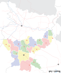
Dugda

Dugda
Dugda
—  city  —
Dugda
Location of Dugda
in Jharkhand and India
Coordinates 23°45′N 86°10′E / 23.75°N 86.17°E / 23.75; 86.17Coordinates: 23°45′N 86°10′E / 23.75°N 86.17°E / 23.75; 86.17
Country India
State Jharkhand
District(s) Bokaro
Population 18,864 (2001)
Time zone IST (UTC+05:30)
Area

Elevation


218 metres (715 ft)

Dugda (also known as Deonagar) is a census town in Bokaro district in the state of Jharkhand, India. It is a small township, constructed during the 1970s,is situated under the foot of several small hills. Residents of the township are primarily employees of Dugda Coal Washery under Bharat Coking Coal Limited (BCCL).

Contents

Geography

Dugda is located at 23°45′N 86°10′E / 23.75°N 86.17°E / 23.75; 86.17.[1] It has an average elevation of 218 metres (715 feet).

Demographics

As of 2001 India census,[2] Dugda had a population of 18,864. Males constitute 54% of the population and females 46%. Dugda has an average literacy rate of 66%, higher than the national average of 59.5%: male literacy is 77% and, female literacy is 54%. In Dugda, 14% of the population is under 6 years of age.

Transport

The town is connected through roads and rail. The railway hault (as is better known) is a single line (broadguage) connection between Katrasgarh and Chandrapura.

References

  1. ^ Falling Rain Genomics, Inc - Dugda
  2. ^ "Census of India 2001: Data from the 2001 Census, including cities, villages and towns (Provisional)". Census Commission of India. Archived from the original on 2004-06-16. http://web.archive.org/web/20040616075334/http://www.censusindia.net/results/town.php?stad=A&state5=999. Retrieved 2008-11-01. 


Wikimedia Foundation. 2010.

Игры ⚽ Поможем написать реферат

Look at other dictionaries:

  • Dugda — Original name in latin Dugda Name in other language Dugda State code IN Continent/City Asia/Kolkata longitude 23.74516 latitude 86.17175 altitude 213 Population 20400 Date 2012 11 08 …   Cities with a population over 1000 database

  • Dugda Bora — is one of the 180 woredas in the Oromia Region of Ethiopia. Part of the Misraq Shewa Zone located in the Great Rift Valley, Dugda Bora is bordered on the southeast by Lake Zway, on the south by Adami Tullu and Jido Kombolcha, on the west by the… …   Wikipedia

  • Dugda Bora (woreda) — 8°10′N 38°50′E / 8.167, 38.833 Dugda Bora est un des 180 woredas de la région Oromia …   Wikipédia en Français

  • Ziway Dugda — is one of the 180 woredas in the Oromia Region of Ethiopia. Part of the Arsi Zone located in the Great Rift Valley, Ziway Dugda is bordered on the south by Munesa, on the west and north by the Misraq Shewa Zone, on the east by Hitosa, and on the… …   Wikipedia

  • Ziway Dugda (woreda) — 8°00′N 39°00′E / 8, 39 Ziway est un des 180 woredas de la région Oromia …   Wikipédia en Français

  • List of woredas of the Oromia Region — This is a list of the 180 woredas, or districts, in the Oromia Region of Ethiopia, compiled from material on the Central Statistical Agency [http://www.csa.gov.et/text files/2005 national statistics.htm website] . NOEDITSECTION A*Abay Chomen *Abe …   Wikipedia

  • Munesa — is one of the 180 woredas in the Oromia Region of Ethiopia. Part of the Arsi Zone located in the Great Rift Valley, Munesa is bordered on the south by Kofele, on the west by the Mirab Shewa Zone and Lake Langano, on the northwest by Ziway Dugda,… …   Wikipedia

  • Liste des woredas de la région Oromia — Voici la liste des 180 woredas de la région Oromia en Éthiopie.Cette liste est élaborée grâce au rapport de la CSA[1] (Central Statistical Agency). Sommaire : Haut A B C D E F G H I J K L M N O P Q R S …   Wikipédia en Français

  • List of India-related articles — Articles (arranged alphabetically) related to India or Indian culture include: NOTOC List of India related topics People are listed by their first names. 1231 SGM 3 STR 2002 Gujarat violence 2005 in India ( previous years ) 2004 Indian Ocean… …   Wikipedia

  • Arsi Zone — Arsi (or Arssi) is one of the 12 zones of the Oromia Region in Ethiopia. Arsi is also the name of a former province. Both the Zone and the former province are named after a subgroup of the Oromo, who inhabit both. Arsi is bordered on the south by …   Wikipedia

Share the article and excerpts

Direct link
Do a right-click on the link above
and select “Copy Link”