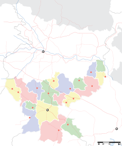
- Malkera
-
Malkera — city — Coordinates 23°47′N 86°18′E / 23.78°N 86.3°ECoordinates: 23°47′N 86°18′E / 23.78°N 86.3°E Country India State Jharkhand District(s) Dhanbad Population 9,804 (2001[update]) Time zone IST (UTC+05:30) Area
• 183 metres (600 ft)
Malkera is a census town in Dhanbad district in the Indian state of Jharkhand.
Geography
Malkera is located at 23°47′N 86°18′E / 23.78°N 86.3°E[1]. It has an average elevation of 183 metres (600 feet).
Demographics
As of 2001[update] India census[2], Malkera had a population of 9804. Males constitute 54% of the population and females 46%. Malkera has an average literacy rate of 64%, higher than the national average of 59.5%: male literacy is 75%, and female literacy is 52%. In Malkera, 14% of the population is under 6 years of age.here Tata groups have coal mines.Tata steel also developed labour township here.Malkera constituted of place like choutidih,lal bungalow, new colony, trigunait basti, green basti. nearest market place is katras which is at 15 minutes drive.It has well maintained green patched area managed by TISCO. Malkera is at a distance of 20 km from Dhanbad town and 70 km from Bokaro Steel. since there is no English medium school situated here, children have to go either to D.A.V,sijua or DE'NOBLI which are at a distance of 5 km to 6 km from here.The only high school situated here is Bhubneswar Trigunait Memorial high school(Hindi medium).
References
- ^ Falling Rain Genomics, Inc - Malkera
- ^ "Census of India 2001: Data from the 2001 Census, including cities, villages and towns (Provisional)". Census Commission of India. Archived from the original on 2004-06-16. http://web.archive.org/web/20040616075334/http://www.censusindia.net/results/town.php?stad=A&state5=999. Retrieved 2008-11-01.
Categories:- Jharkhand geography stubs
- Cities and towns in Dhanbad district
Wikimedia Foundation. 2010.


