- Maithon
-
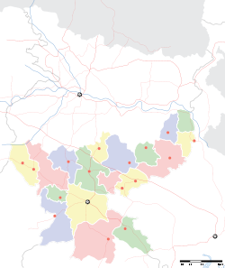
Maithon — city — Coordinates 23°47′N 86°49′E / 23.78°N 86.81°ECoordinates: 23°47′N 86°49′E / 23.78°N 86.81°E Country India State Jharkhand District(s) Dhanbad Population 19,728 (2001[update]) Time zone IST (UTC+05:30) Maithon is a census town in Dhanbad district in the Indian state of Jharkhand. It is situated on the banks of river Barakar.The name has been derived from Maithan or Mai-Ka-Than(Hindi) or Ma-Er-Than(Bangla), the "than" being a apa-bhransha or a local pronunciation of Sanskrit/Bangla "Sthan" for "place". The place of Mai or Ma or mother, refers to Goddes Durga or Ma Kalyaneswari of the famous Kalyaneswari temple nearby.
Contents
Maithon Dam
Maithon Dam, of the Damodar Valley Corporation, constitutes one of the most accomplished and successful river valley projects of India, which was a part of the First Five Year Plan after India's independence.it is nearby durgapur.durgapur referred to as [RUHR]OF INDIA IN WEST BENGAL.
Demographics
As of 2001[update] India census[1], Maithon had a population of 19,728. Males constitute 53% of the population and females 47%. Maithon has an average literacy rate of 74%, higher than the national average of 59.5%: male literacy is 81%, and female literacy is 67%. In Maithon, 11% of the population is under 6 years of age.
Culture
The Kalyaneshwari temple 6 km away from the Maithon dam is considered to be the seat to a very powerful deity, Ma Kalyaneshwari. The temple was erected in the early 1900s .
Education
Major Schools:
- De Nobili School,Maithon: Founded on 24 January 1980
- Kendriya Vidyalaya maithon dam: founded on 18th august 1985 [1]
- Loyola school: a Jesuit school
- Right Bank High School Maithon
- Left Bank High School
- Jawahar Navodaya Vidyalaya
- Middle school
- Left Bank Primary School
- Major Colleges:
- BSK College
- Inter college
References
- ^ "Census of India 2001: Data from the 2001 Census, including cities, villages and towns (Provisional)". Census Commission of India. Archived from the original on 2004-06-16. http://web.archive.org/web/20040616075334/http://www.censusindia.net/results/town.php?stad=A&state5=999. Retrieved 2008-11-01.
Categories:- Cities and towns in Dhanbad district
- Jharkhand geography stubs
Wikimedia Foundation. 2010.


