Mugma

Mugma
Mugma
—  city  —
Mugma
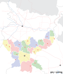
Location of Mugma
in Jharkhand and India
Coordinates 23°46′N 86°44′E / 23.77°N 86.73°E / 23.77; 86.73Coordinates: 23°46′N 86°44′E / 23.77°N 86.73°E / 23.77; 86.73
Country India
State Jharkhand
District(s) Dhanbad
Population 2,978 (2001)
Time zone IST (UTC+05:30)
Area

Elevation


132 metres (433 ft)

Mugma is a census town in Dhanbad district in the Indian state of Jharkhand.

Contents

Geography

Mugma is located at 23°46′N 86°44′E / 23.77°N 86.73°E / 23.77; 86.73[1]. It has an average elevation of 132 metres (433 feet).

Demographics

As of 2001 India census[2], Mugma had a population of 2,978. Males constitute 56% of the population and females 44%. Mugma has an average literacy rate of 54%, lower than the national average of 59.5%: male literacy is 66%, and female literacy is 39%. In Mugma, 13% of the population is under 6 years of age.

Education

Major Schools: De Nobili School, Mugma

References

  1. ^ Falling Rain Genomics, Inc - Mugma
  2. ^ "Census of India 2001: Data from the 2001 Census, including cities, villages and towns (Provisional)". Census Commission of India. Archived from the original on 2004-06-16. http://web.archive.org/web/20040616075334/http://www.censusindia.net/results/town.php?stad=A&state5=999. Retrieved 2008-11-01. 


Wikimedia Foundation. 2010.

Игры ⚽ Поможем решить контрольную работу

Look at other dictionaries:

  • Mugma — Original name in latin Mugma Name in other language Mugma State code IN Continent/City Asia/Kolkata longitude 23.77015 latitude 86.72746 altitude 145 Population 3195 Date 2012 11 08 …   Cities with a population over 1000 database

  • Muchamiel — Mutxamel Muchamiel Escudo …   Wikipedia Español

  • Dhanbad — This article is about the municipality in India. For its namesake district, see Dhanbad district. Dhanbad   city   …   Wikipedia

  • List of India-related articles — Articles (arranged alphabetically) related to India or Indian culture include: NOTOC List of India related topics People are listed by their first names. 1231 SGM 3 STR 2002 Gujarat violence 2005 in India ( previous years ) 2004 Indian Ocean… …   Wikipedia

  • Asansol — Infobox Indian Jurisdiction native name = Asansol type = city skyline = Asanso 1.jpg skyline caption =Asansol Railway Station built in 1885 latd = 23.68 longd = 86.98 locator position = right state name = West Bengal district = Bardhaman leader… …   Wikipedia

  • Dhanbad district — This article is about the district. For its eponymous headquarters, see Dhanbad. Dhanbad district धनबाद जिला Location of Dhanbad district in Jharkhand …   Wikipedia

  • Chatra district — This article is about the district. For its eponymous headquarters, see Chatra. Chatra district चतरा जिला Location of Chatra district in Jharkhand …   Wikipedia

  • Dhanwar, Giridih — Dhanwar   city   …   Wikipedia

  • Chandaur —   city   …   Wikipedia

  • Chandrapura —   town   …   Wikipedia

Share the article and excerpts

Direct link
Do a right-click on the link above
and select “Copy Link”