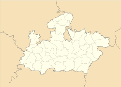
- Chichli
-
Chichli — city — Coordinates 22°50′N 78°49′E / 22.83°N 78.82°ECoordinates: 22°50′N 78°49′E / 22.83°N 78.82°E Country India State Madhya Pradesh District(s) Narsimhapur Population 9,250 (2001[update]) Time zone IST (UTC+05:30) Area
• 349 metres (1,145 ft)
Chichli is a census town in Narsimhapur district in the state of Madhya Pradesh, India.
Contents
Geography
Chichli is located at 22°50′N 78°49′E / 22.83°N 78.82°E.[1] It has an average elevation of 349 metres (1145 feet). Chichli is located at about 200 km from Bhopal the capital of the state of Madhya Pradesh and 9 Km from Gadarwara. The Sakkar & Seeta reva river flows through it rendering the surrounding farmland fertile. The larger Narmada River is 26 km away. Gadarwara lies on the main road from Jabalpur to Mumbai(Bombay) 30 miles west of Narsinghpur civil station. 80 km away,
Industry
Chichli is Famous for make Brass pot, also called Brass Township because all type metals pot makes here.
Places of interest
1.CHOUGAN KILA is Famous Historical destination.From Chichli 20Km/2hours journey. 2.RANI DAHAR is Famous Nature destination.From Chichli 10Km/2hours journey. 3.LUCK MAHADEV is Famous religious destination.From Chichli 18Km/2hours journey. 4.CHOTA JABALPUR Famous Nature destination.From Chichli 10Km/2hours journey.
Transport
Rail
9 km Distance Gadarwara Railway Station Near Chichli
Road
Chichli is connected to other parts of India
Local Transport
Chichli has a public transport system. operates buses and Local transport also includes Auto rickshaw, Van and Local City Ride Buses called Nagar Seva. Many cab services have recently started serving the Town. bus terminals Chichli bus stand .
Sport
Kabaddi is Famous Game of chichli, Every Year organized Dolgyaras fair in Rajmahal stadium. In kabaddi Patiyogita here men & women both player are play kabaddi.
Demographics
As of 2001[update] India census,[2] Chichli had a population of 9250. Males constitute 53% of the population and females 47%. Chichli has an average literacy rate of 66%, higher than the national average of 59.5%; with male literacy of 71% and female literacy of 59%. 15% of the population is under 6 years of age.
References
- ^ Falling Rain Genomics, Inc - Chichli
- ^ "Census of India 2001: Data from the 2001 Census, including cities, villages and towns (Provisional)". Census Commission of India. Archived from the original on 2004-06-16. http://web.archive.org/web/20040616075334/http://www.censusindia.net/results/town.php?stad=A&state5=999. Retrieved 2008-11-01.
Cities and towns in Jabalpur Division Balaghat district Chhindwara district Amarwara • Ambada • Badkuhi • Barkuhi • Bhamodi • Chandameta-Butaria • Chaurai Khas • Chhindwara • Damua • Deogarh • Dighawani • Dongar Parasia • Harrai • Iklehra • Jamai • Jata Chhapar • Kali Chhapar • Lodhikheda • Mohgaon • Neuton Chikhli Kalan • Pal Chourai • Panara • Pandhurna • Patalkot • Sausar • Sethia • SirgoraJabalpur district Barela • Bhedaghat • Bilpura • Gun Carriage Factory Jabalpur • Gwarighat • Jabalpur • Jabalpur Cantonment • Majholi • Manegaon • Ordnance Factory Khamaria • Panagar • Patan • Pipariya • Shahpura • Sihora • Suhagi • Vehicle Fac. JabalpurKatni district Mandla district Narsinghpur district Seoni district Related topics Cities and towns
in other DivisionsCategories:- Cities and towns in Narsinghpur district
- Madhya Pradesh geography stubs
Wikimedia Foundation. 2010.


