- Majholi
-
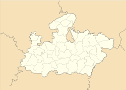
Majholi — city — Coordinates 23°30′N 79°55′E / 23.5°N 79.92°ECoordinates: 23°30′N 79°55′E / 23.5°N 79.92°E Country India State Madhya Pradesh District(s) Jabalpur Population 11,308 (2001[update]) Time zone IST (UTC+05:30) Area
• 385 metres (1,263 ft)
Majholi is a town and a nagar panchayat in Jabalpur district in the Indian state of Madhya Pradesh.
Majholi Is Home Town Mr. Manish Saraf Directo Tmc Computer Education Majholi in Shri Vishnu Varah Tampile majholi jabalpur madhya pradesh india
Demographics
As of 2001[update] India census[1], Majholi had a population of 11,308. Males constitute 52% of the population and females 48%. Majholi has an average literacy rate of 65%, higher than the national average of 59.5%: male literacy is 75%, and female literacy is 54%. In Majholi, 15% of the population is under 6 years of age.
References
- ^ "Census of India 2001: Data from the 2001 Census, including cities, villages and towns (Provisional)". Census Commission of India. Archived from the original on 2004-06-16. http://web.archive.org/web/20040616075334/http://www.censusindia.net/results/town.php?stad=A&state5=999. Retrieved 2008-11-01.
Cities and towns in Jabalpur Division Balaghat district Chhindwara district Amarwara • Ambada • Badkuhi • Barkuhi • Bhamodi • Chandameta-Butaria • Chaurai Khas • Chhindwara • Damua • Deogarh • Dighawani • Dongar Parasia • Harrai • Iklehra • Jamai • Jata Chhapar • Kali Chhapar • Lodhikheda • Mohgaon • Neuton Chikhli Kalan • Pal Chourai • Panara • Pandhurna • Patalkot • Sausar • Sethia • SirgoraJabalpur district Barela • Bhedaghat • Bilpura • Gun Carriage Factory Jabalpur • Gwarighat • Jabalpur • Jabalpur Cantonment • Majholi • Manegaon • Ordnance Factory Khamaria • Panagar • Patan • Pipariya • Shahpura • Sihora • Suhagi • Vehicle Fac. JabalpurKatni district Mandla district Narsinghpur district Seoni district Related topics Cities and towns
in other DivisionsCategories:- Cities and towns in Jabalpur district
- Madhya Pradesh geography stubs
Wikimedia Foundation. 2010.


