- Dighawani
-
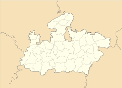
Dighawani — city — Coordinates 22°12′17″N 78°49′2″E / 22.20472°N 78.81722°ECoordinates: 22°12′17″N 78°49′2″E / 22.20472°N 78.81722°E Country India State Madhya Pradesh District(s) Chhindwara Population 7,935 (2001[update]) Time zone IST (UTC+05:30) Dighawani is a census town in Chhindwara district in the state of Madhya Pradesh, India.
Demographics
As of 2001[update] India census[1], Dighawani had a population of 7935. Males constitute 53% of the population and females 47%. Dighawani has an average literacy rate of 61%, higher than the national average of 59.5%: male literacy is 70% and, female literacy is 51%. In Dighawani, 13% of the population is under 6 years of age.
References
- ^ "Census of India 2001: Data from the 2001 Census, including cities, villages and towns (Provisional)". Census Commission of India. Archived from the original on 2004-06-16. http://web.archive.org/web/20040616075334/http://www.censusindia.net/results/town.php?stad=A&state5=999. Retrieved 2008-11-01.
Cities and towns in Jabalpur Division Balaghat district Chhindwara district Amarwara • Ambada • Badkuhi • Barkuhi • Bhamodi • Chandameta-Butaria • Chaurai Khas • Chhindwara • Damua • Deogarh • Dighawani • Dongar Parasia • Harrai • Iklehra • Jamai • Jata Chhapar • Kali Chhapar • Lodhikheda • Mohgaon • Neuton Chikhli Kalan • Pal Chourai • Panara • Pandhurna • Patalkot • Sausar • Sethia • SirgoraJabalpur district Barela • Bhedaghat • Bilpura • Gun Carriage Factory Jabalpur • Gwarighat • Jabalpur • Jabalpur Cantonment • Majholi • Manegaon • Ordnance Factory Khamaria • Panagar • Patan • Pipariya • Shahpura • Sihora • Suhagi • Vehicle Fac. JabalpurKatni district Mandla district Narsinghpur district Seoni district Related topics Cities and towns
in other DivisionsCategories:- Cities and towns in Chhindwara district
Wikimedia Foundation. 2010.


