- Chipstead, Surrey
-
Coordinates: 51°18′53″N 0°09′45″W / 51.3147°N 0.1626°W
Chipstead 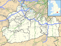
 Chipstead
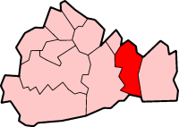
Chipstead shown within SurreyPopulation <6,000 OS grid reference TQ278569 District Reigate and Banstead Shire county Surrey Region South East Country England Sovereign state United Kingdom Post town Coulsdon Postcode district CR5 Dialling code 01737 Police Surrey Fire Surrey Ambulance South East Coast EU Parliament South East England UK Parliament Reigate List of places: UK • England • Surrey Chipstead, Surrey is a commuter village primarily in the north-eastern corner of the county. In reality it spreads across the administrative border with the London Borough of Croydon; for example Chipstead Valley Primary School is administered by the London Borough of Croydon. Neighbouring villages include Woodmansterne, Banstead, Coulsdon, Hooley and Kingswood.
Contents
History
The village lay within the Reigate hundred.
Chipstead appears in Domesday Book as Tepestede. It was held by William de Wateville. Its Domesday assets were: 3 hides; 7 ploughs, 1 mill worth £1, woodland worth 5 hogs. It rendered £8.[1]
Today
The census area Chipstead, Hooley and Woodmansterne has a population of 6.912.[2] Today Chipstead does not have a clearly defined village centre; instead there are several small areas of economic activity in a leafy, largely residential area.
The village is home to many societies, some of which are linked to the village church, St Margaret's. Another focal point of the village is a small parade of shops, near to the station.
Within the vicinity of Chipstead, there are several sports clubs, many taking the Chipstead name. Chipstead F.C. has a minor claim to fame as some of Footballers' Wives was filmed here. Chipstead Rugby Football Club is also situated in the village. They play in Surrey League 1 and have been open since 1960.[3]
There are also numerous stables nearby; there is also an amateur dramatics society with a little theatre of its own created out of an old stable block.
Despite having some of the most expensive housing in the area, the residents of Chipstead continue to resist the installation of street lighting, particularly in the southern parts of the village.
In 2007 the local resident's associations combined to launch a village website, www.chipsteadvillage.org[1]
Chipstead Downs is a Site of Special Scientific Interest (SSSI). To the north-west of the village is Banstead Heath, an area of open common land which is used by many groups. There is a large car park just north of the village on the road to Banstead. This area is maintained by the Banstead Commons Conservators. [2]
Transport
Chipstead railway station is on the Tattenham Corner Line.
There are no bus services through the village, although route 166 run by Arriva London for London Buses passes the edge of the area to serve neighbouring Woodmansterne. For other services and connections it is preferable to travel to Banstead or Coulsdon.
References
External links
 Media related to Chipstead, Surrey at Wikimedia Commons
Towns, villages and hamlets in the Reigate and Banstead District of Surrey, England  Banstead · Burgh Heath · Chipstead · Earlswood · Hooley · Horley · Kingswood · Lower Kingswood · Meadvale · Merstham · Netherne-on-the-Hill · Nork · Redhill · Reigate · Salfords · Sidlow · South Park · Tadworth · Tattenham Corner · Walton-on-the-Hill · Whitebushes · Woodhatch · WoodmansterneCategories:
- Villages in Surrey
- Reigate and Banstead

Wikimedia Foundation. 2010.