- Chipstead, Kent
-
Coordinates: 51°17′07″N 0°08′57″E / 51.285250°N 0.149050°E
Chipstead 
 Chipstead
Chipstead shown within KentParish Chevening District Sevenoaks Shire county Kent Region South East Country England Sovereign state United Kingdom Police Kent Fire Kent Ambulance South East Coast EU Parliament South East England List of places: UK • England • Kent Chipstead is a small village in the parish of Chevening, near Sevenoaks, Kent and just off the A21 and A25 roads. It is rapidly becoming part of the built up area of Sevenoaks. It is also within a short distance of the M25 motorway, though not visible from it.
Although small in size, it has various attractions and features, including traditional southern English village architecture and a large lake. The village has two public houses: the "George and Dragon", a 16th Century Coaching Inn on the High Street, and the "Bricklayers Arms" on Chevening Road opposite the lake.
Chipstead Lake (also known as Longford Lake) is man-made, the result of gravel extraction during the 20th century. It has an area of 30 hectares (74 acres) and is used for:
Chipstead was served by Chevening Halt railway station on the Westerham Valley Branch Line running between Westerham and Dunton Green; it opened in 1881 and closed in 1961. The closest railway station is now Sevenoaks. Chipstead village is now served by the 401 Sevenoaks-Westerham bus and the 452 Sevenoaks Station Circular commuter bus.
Chipstead is a comfortable, quiet community. There is a thriving residents' association, which has voiced opinions over issues such as traffic control in the area.
External links
Towns and villages in the Sevenoaks district of Kent, England 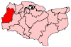 Ash · Badgers Mount · Bough Beech · Brasted · Brasted Chart · Chartwell · Chevening · Chiddingstone · Chiddingstone Causeway · Chiddingstone Hoath · Chipstead · Cowden · Crockenhill · Crockham Hill · Dunton Green · Edenbridge · Eynsford · Farningham · Fawkham · Fawkham Green · Fordcombe · Four Elms · Godden Green · Halstead · Hartley · Hever · Hextable · Hodsoll Street · Horton Kirby · Ide Hill · Kemsing · Knockholt · Leigh · Markbeech · New Ash Green · Otford · Penshurst · Ridley · Riverhead · Seal · Seal Chart · Sevenoaks · Sevenoaks Weald · Shoreham · South Darenth · Sundridge · Swanley · Swanley Village · Toys Hill · Underriver · Well Hill · Westerham · West Kingsdown
List of places in Kent Categories:- Sevenoaks
- Villages in Kent
- Kent geography stubs


Wikimedia Foundation. 2010.