- Chiddingstone
-
Coordinates: 51°11′10″N 0°08′54″E / 51.186090°N 0.148450°E
Chiddingstone 
 Chiddingstone
Chiddingstone shown within KentOS grid reference TQ495455 District Sevenoaks Shire county Kent Region South East Country England Sovereign state United Kingdom Post town Edenbridge Police Kent Fire Kent Ambulance South East Coast EU Parliament South East England List of places: UK • England • Kent Chiddingstone is a village and civil parish in the Sevenoaks District of Kent, England.[1] The parish is located on the River Eden between Tonbridge and Edenbridge. The village of Chiddingstone Causeway is included in the parish.[2]
Contents
The village
Origin of name
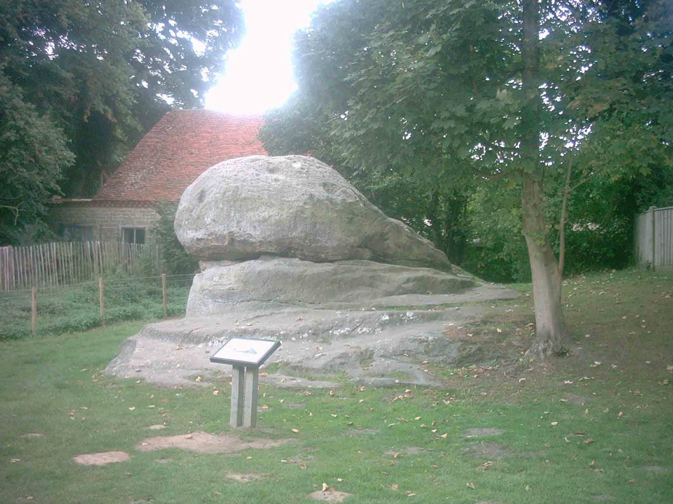
A popular theory is that the village takes its name from a large sandstone rock formation, situated on its outskirts, named the Chiding Stone. Chidingstone was a previous spelling used for the village.[3] Tradition asserts that the stone was used as a seat of judgement, mainly to remonstrate overbearing local wives. It has also been wrongly described as a Druidical ritual site and more convincingly suggested as being a landmark used as a Saxon boundary marker. Chiddingstone means "the stone of Chidda's tribe" — Chidda presumably being a local Saxon leader.
Ownership of village
Chiddingstone is unique in that, apart from the church and the Castle, the entire village is owned by the National Trust. It is described as being " the most perfect surviving example of a Tudor village in the county".
Film location
The village was used as a setting in the 1985 Merchant Ivory film "A Room with a View", in the scene where Lucy and Cecil take a walk after their engagement party. The High Street is seen from the end nearest to The Castle Inn. Michael Winner used Chiddingstone in his production of 'The Wicked Lady'. Terry Jones and the "Monty Python" team filmed here for 'Wind in the Willows'. 'Elizabeth R', starring Glenda Jackson was largely made here, as was Gerald Scarfe's 'Life of Hogarth'
Parish Church
 Church of St. Mary.
The parish church, dedicated to St Mary, enhances the look of the village, and is perhaps the fourth built on that site. In the churchyard is a gazebo dating from 1736 built by Henry Streatfeild; leading down into the family vault beneath which has a through flow of air provided by vents in two false altar tombs, one adjacent to the gazebo and the other some 30' north.
The church was almost destroyed by a lightning fire in 1624. In recent years it has had new heating, lighting and sound systems installed. In addition to this the chapel has been re-decorated and a lavatory has been built adjoining this.
The parish
There are several reserves in the area including:
- Sevenoaks Reserve and Jeffery Harrison Visitor Centre (Operated by Kent Wildlife Trust)
- Bough Beech Visitors Centre and Reserve (Operated by Kent Wildlife Trust)
- Chiddingstone Reserve (Operated by Kent Wildlife Trust)
Penshurst railway station is located in the village of Chiddingstone Causeway. It is on the line between Tonbridge and Redhill.
 The natural sandstone Chiding Stone
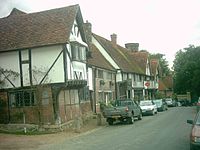 Chiddingstone High Street
.
External links
- History of Chiddingstone
- Village net article
- The Castle Inn
- Historic Kent article
- Roughwood's image gallery and historical notes
- Transcription of an article from the March 1894 edition of the Century Monthly Magazine describing the parish (with images)
References
- ^ The History of the Parish of Chiddingstone in Kent.
- ^ Chiddingstone Causeway.
- ^ Parishes: Chidingstone, The History and Topographical Survey of the County of Kent: Volume 3 (1797), pp. 210-227, British History Online.

Bough Beech Bough Beech Reservoir Charcott
Chiddingstone CausewayHever 
Tonbridge  Chiddingstone

Markbeech Chiddingstone Hoath Penshurst Towns and villages in the Sevenoaks district of Kent, England 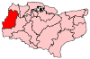 Ash · Badgers Mount · Bough Beech · Brasted · Brasted Chart · Chartwell · Chevening · Chiddingstone · Chiddingstone Causeway · Chiddingstone Hoath · Chipstead · Cowden · Crockenhill · Crockham Hill · Dunton Green · Edenbridge · Eynsford · Farningham · Fawkham · Fawkham Green · Fordcombe · Four Elms · Godden Green · Halstead · Hartley · Hever · Hextable · Hodsoll Street · Horton Kirby · Ide Hill · Kemsing · Knockholt · Leigh · Markbeech · New Ash Green · Otford · Penshurst · Ridley · Riverhead · Seal · Seal Chart · Sevenoaks · Sevenoaks Weald · Shoreham · South Darenth · Sundridge · Swanley · Swanley Village · Toys Hill · Underriver · Well Hill · Westerham · West Kingsdown
List of places in Kent Categories:- Sevenoaks
- Villages in Kent
- Civil parishes in Kent


Wikimedia Foundation. 2010.