- Darent Valley Path
-
 Map courtesy of OpenStreetMap
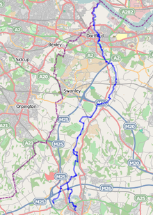
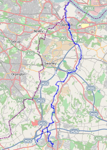
The waymarked path Darent Valley Path is 19 miles (31 km) long, following the River Darent from the banks of the River Thames at Dartford through the Kent Downs Area of Outstanding Natural Beauty to the Greensand Hills above Sevenoaks.It is close to Shoreham Village and Otford Village.
The route is well served by public transport making it ideal to break into manageable walks. Train stations are situated at Sevenoaks, Bat & Ball (Sevenoaks), Otford, Eynsford, Farningham Road & Dartford, and there are many bus routes along the route.
Route Directions
There are two options when starting from the Southern end of the route;
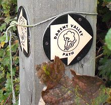
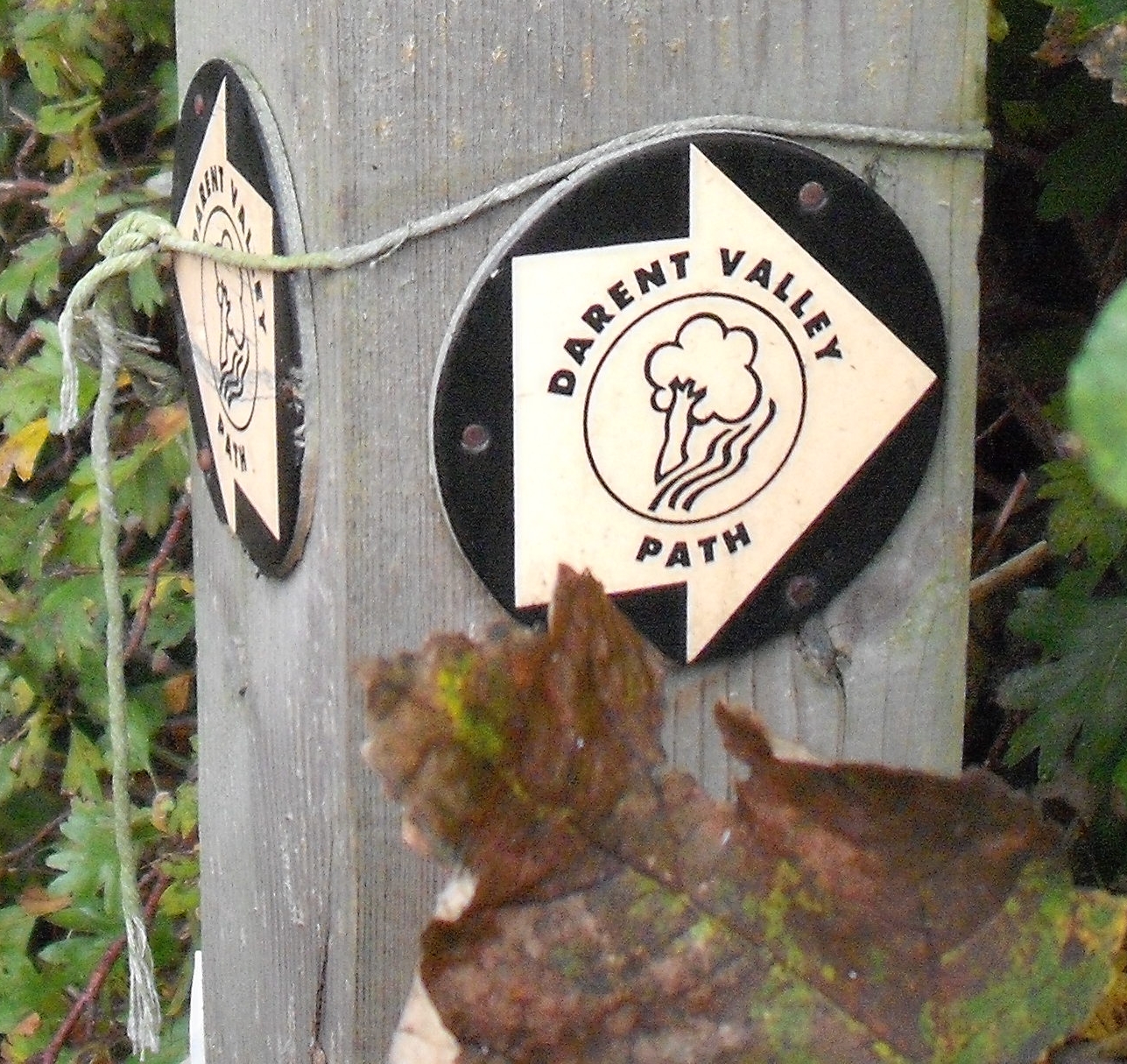
- A The Eastern arm starts close to Sevenoaks train station in Bradbourne Park Road, and quickly enters the small parks which include Bradbourne lakes. Exiting onto the A25, Bradbourne Vale Road, which must be crossed with care. The path and gate is easily missed, and the wooden post bearing the Darenth Valley Path sign is partially obscured at the grass field currently occupied by horses (September 2009). The route is well signposted from here to its junction with the Western arm at the railway bridge above Otford.
- B The Western arm starts opposite the Bricklayers Arms PH in Chevening Road, Chipstead Sevenoaks. An information board marks the start of the route which follows paths around Chipstead lake before cutting across country towards Dunton Green. Although the route is signposted, the signs are partially obscured by undergrowth in places & a map showing the route is recommended. After passing under the M26 the route climbs to the A224 which must be crossed near to The Rose and Crown public house, before heading North along London Road. A small path lined by a hedge & low wall next to the Donington Manor Hotel leads into the countryside, and shares its route with the North Downs Way, meeting up with the Eastern arm at the railway bridge above Otford.
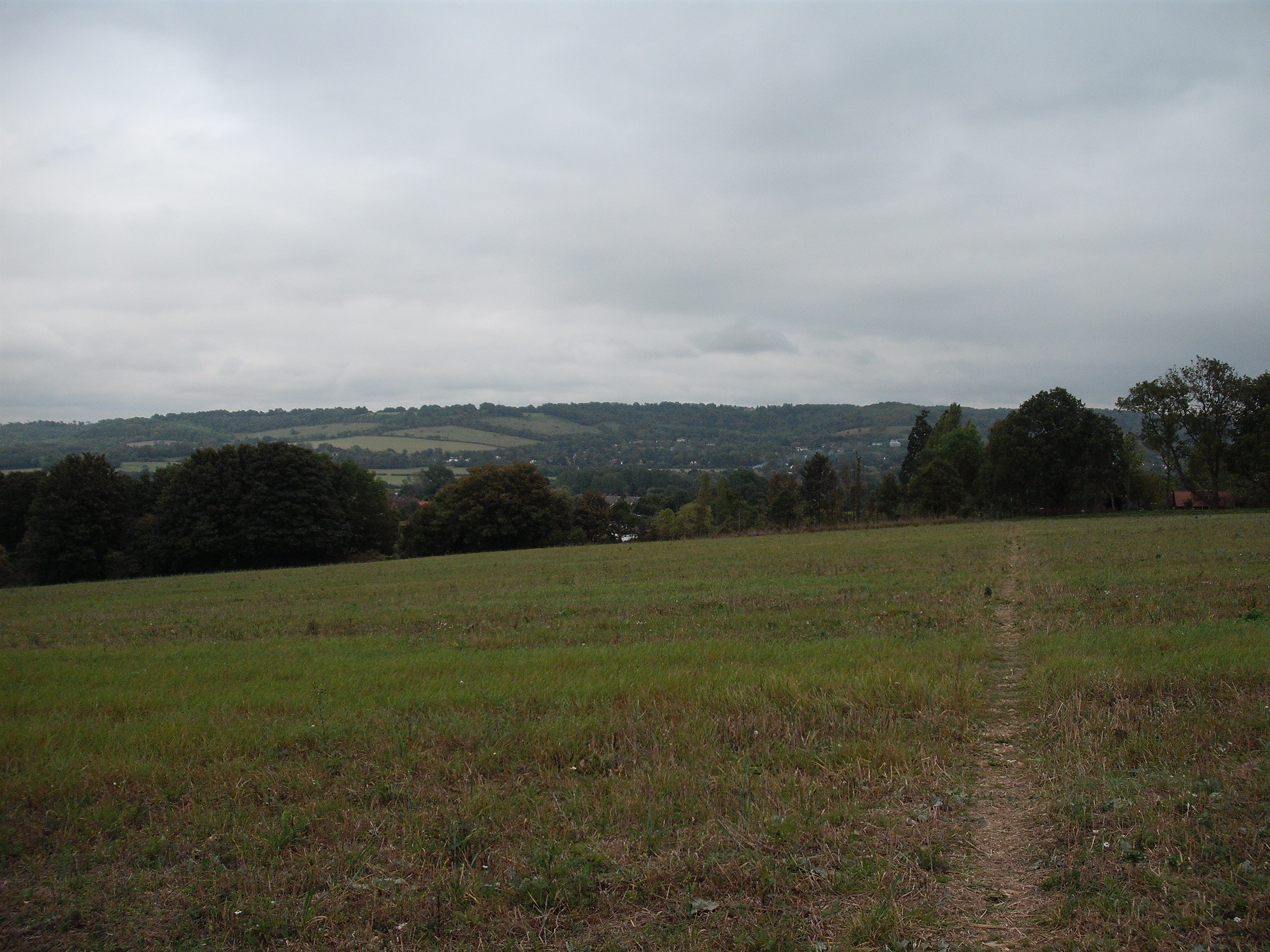
 Footpath approaching railway bridge above Otford
The route to Otford follows a small lane & estate roads, before crossing the river Darent where Pilgrims Way West becomes High Street, Otford. There are several shops and refreshment stops in Otford a short distance from the route. A private driveway immediately next to the river is the route from Otford, & this quickly changes to footpaths with stiles. Although the river is quickly lost from sight amongst trees & undergrowth, the river valley is very pretty. This well signposted section of the route passes through a golf course before entering the outskirts of Shoreham.
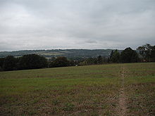
Shoreham provides a choice of routes, both very pretty in their own way. The route above the village which is first encountered passes close to a bench offering views across the valley, while the lower route close to the river has its own charm walking on the metaled path to the village outskirts.
Leaving Shoreham, the path follows the river closely as it heads through pleasant countryside towards Eynsford. At your next junction with a road (Redmans Lane), cross the road diagonally to your left, climb 5 or six steps, and follow the path along the field edge towards your right, which is much more pleasant & safer than the road below. At the end of the path, the route passes the rear of the Lullingstone visitor centre, which houses a small restaurant & gift shop. The nearby 'Hop shop' also supplies local produce & gifts. The path for the next mile is immediately beside the river, passing close to Lullingstone Castle & the World Garden of Plants. The small lane continues North, but your route is to the left, just prior to the Lullingstone Roman Villa.
Climbing several steps the route passes into farmland again before turning sharp right heading across the slope (keep the hedge to your left). The route passes close to Eagle Heights on your left, before crossing a small road & heading diagonally down the hill to Lullingstone Lane which is followed to the right before turning left into Sparepenny Lane. After about 100 metres a new pathway has been created parallel to the road, just to its right. Follow this path for most of the length of Sparepenny Lane, before returning to the road, turning right, and walking down the hill in Farningham to its junction with Dartford Road.
The path leaves Farningham through the rear car park of the hotel / restaurant at the junction. The path now follows the river closely for a short distance, before being separated by fences as the path passes close to Farningham Cricket Ground. At the junction with Franks Lane turn left, cross the bridge & turn immediately right along the path next to the river. The path passes through the Westminster fields playing fields with its small toilet block, before continuing beside the river into South Darenth.
Turn right into Station Road, then left along Holmesdale Road, which is followed through the village. There are refreshments & a few shops available here. At the bottom of Holmesdale Hill, turn left into a small driveway which quickly becomes a footpath leading across farmland to exit at the bottom of Darenth Hill. Carefully cross this busy road, & enter Darenth Road, opposite, which is followed to the footpath at its end. The path returns to follow the river, before you are forced away and along the A225 Hawley Road for several hundred metres, to pass under the A2.
Rejoin the path leading away from the road at the back of the recycle bins in the lay by, & follow the path beside the river as it passes into Dartford, going close to the industrial estate before reaching Dartford. Cross Powder Mill Lane, and follow the path between the lakes & river, heading to the foot tunnel passing under the busy & dangerous Princes Road. Princes Road marks the boundary for Central Park & the path passes through the park, exiting beside the museum & library. Turn right walking against the traffic flow along Market Street, & cross the road at the pelican crossing before following the road to the right along High Street. Immediately after Dartford Church, turn left into St Saviours Walk, & then pass through the underpass. Walk towards the river & locate the path passing to the rear of the offices, and follow to the wooden bridge close to Dartford train station. Do not cross the bridge, instead follow the path under the brick bridges & into Mill Pond Road, which must be crossed with care at one of the islands. At the roundabout turn right into Hythe Street (Lower), and after about 100 metres, take the path to the right leading over the river. Having crossed the river, turn immediately left & follow the path past the back of the industrial estates as it leaves habitation & heads into the country side towards the river Thames. The path travels under the busy A206, Bob Dunn Way, before following the flood defences out to the mouth of the river Darent where it joins the river Thames.
External links
Map of the route using OpenStreetMap data - Highlighted map of Darent Valley Footpath
Further reading
- Along and Around the Darent Valley Path - Sevenoaks-Dartford: Guidebook, Route Guide and Footpaths Maps Includes Ordnance Survey Maps, 1997, ISBN 978-1-873010-53-2
Wikimedia Foundation. 2010.