- Meadvale
-
Coordinates: 51°13′38″N 0°11′13″W / 51.22721°N 0.18707°W
Meadvale 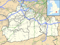
 Meadvale
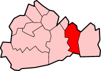
Meadvale shown within SurreyPopulation less than 6,000 OS grid reference TQ267491 District Reigate and Banstead Shire county Surrey Region South East Country England Sovereign state United Kingdom Post town REDHILL Postcode district RH1 Dialling code 01737 Police Surrey Fire Surrey Ambulance South East Coast EU Parliament South East England UK Parliament Reigate List of places: UK • England • Surrey Meadvale (or sometimes "Mead Vale") is a suburb of Redhill in the borough of Reigate and Banstead in Surrey to the south of Redhill and Reigate.
The census area Meadvale and St Johns has a population of 7,466.[1]
Contents
History
The history of Redhill owes its origins in pocket communities of Linkfield Street, Hooley, Wiggy, Little London and Meadvale.
Meadvale was known in the 19th century as Meads Hole. The name means meadowland hollow. There were a number of dwellings and pottery businesses scattered over the common including some kilns. The village had two butchers, a baker, a draper, a tailor and a grocer's shop. The first school was held in the village hall with a fee of one penny a week for each child. At the beginning of the 19th century, there was a tanyard adjoining Earlswood Common at the entrance to Meadvale.
Clarence Walk was once known as Cats Walk.
St John's was near the area called Little London and the cottages were called Crockeerty well, which provided the local water supply.
The area was bombed during World War II[2].
Local Celebrities
The painter Samuel Palmer lived in the village at the Chantry on Cronks Hill Road until his death in 1881.
References
The history of 34th Reigate (Meadvale) Scout group
External links
Towns, villages and hamlets in the Reigate and Banstead District of Surrey, England  Banstead · Burgh Heath · Chipstead · Earlswood · Hooley · Horley · Kingswood · Lower Kingswood · Meadvale · Merstham · Netherne-on-the-Hill · Nork · Redhill · Reigate · Salfords · Sidlow · South Park · Tadworth · Tattenham Corner · Walton-on-the-Hill · Whitebushes · Woodhatch · WoodmansterneCategories:
- Villages in Surrey
- Reigate and Banstead

Wikimedia Foundation. 2010.