- Muleshoe National Wildlife Refuge
-
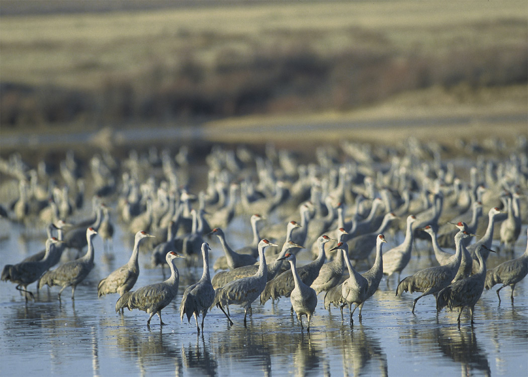
Muleshoe National Wildlife Refuge Protected Area 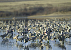 Sandhill Cranes at Muleshoe NWR
Country  United States
State  Texas
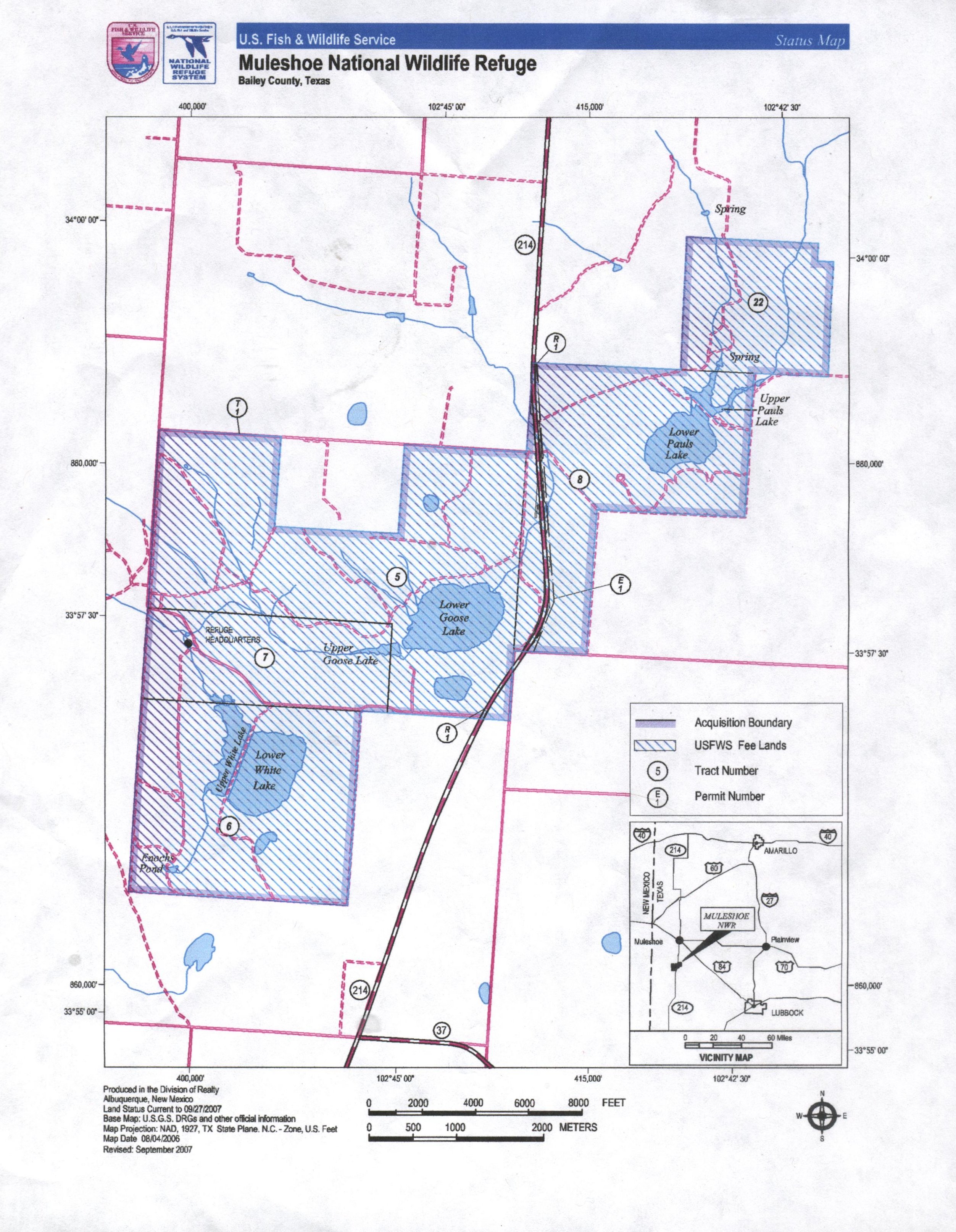
TexasRegion Bailey County Elevation 1,143 m (3,750 ft) Coordinates 33°57′14″N 102°45′44″W / 33.95389°N 102.76222°W Area 202.3 km2 (78 sq mi) Founded 1935 Management U.S. Fish and Wildlife Service - location Muleshoe, Texas 
Website: Muleshoe NWR 
Muleshoe National Wildlife Refuge is the oldest National Wildlife Refuge in the state of Texas, having been established in 1935. It is located about twenty miles (32 km) south of Muleshoe, the seat of Bailey County. It is some fifteen miles (24 km) north of Morton on Texas State Highway 214.
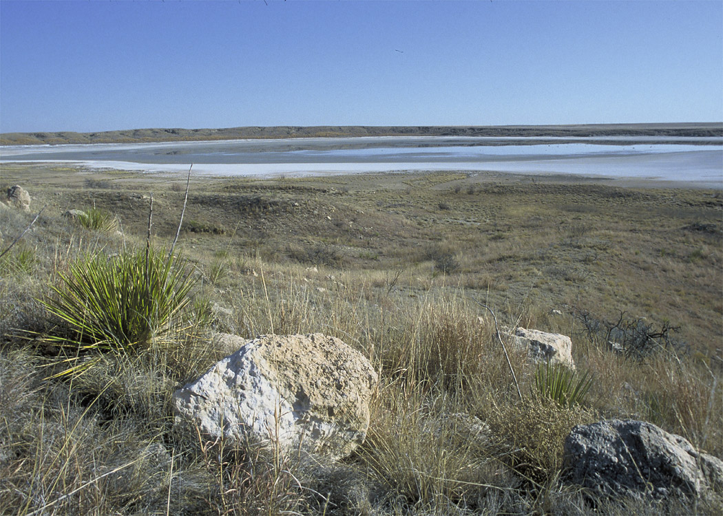
The refuge includes several intermittent salt lakes, some of which have been modified to extend their wet periods. Paul's Lake, on the east side of Highway 214, is spring fed, and hosts wildlife during times when the other lakes are dry.
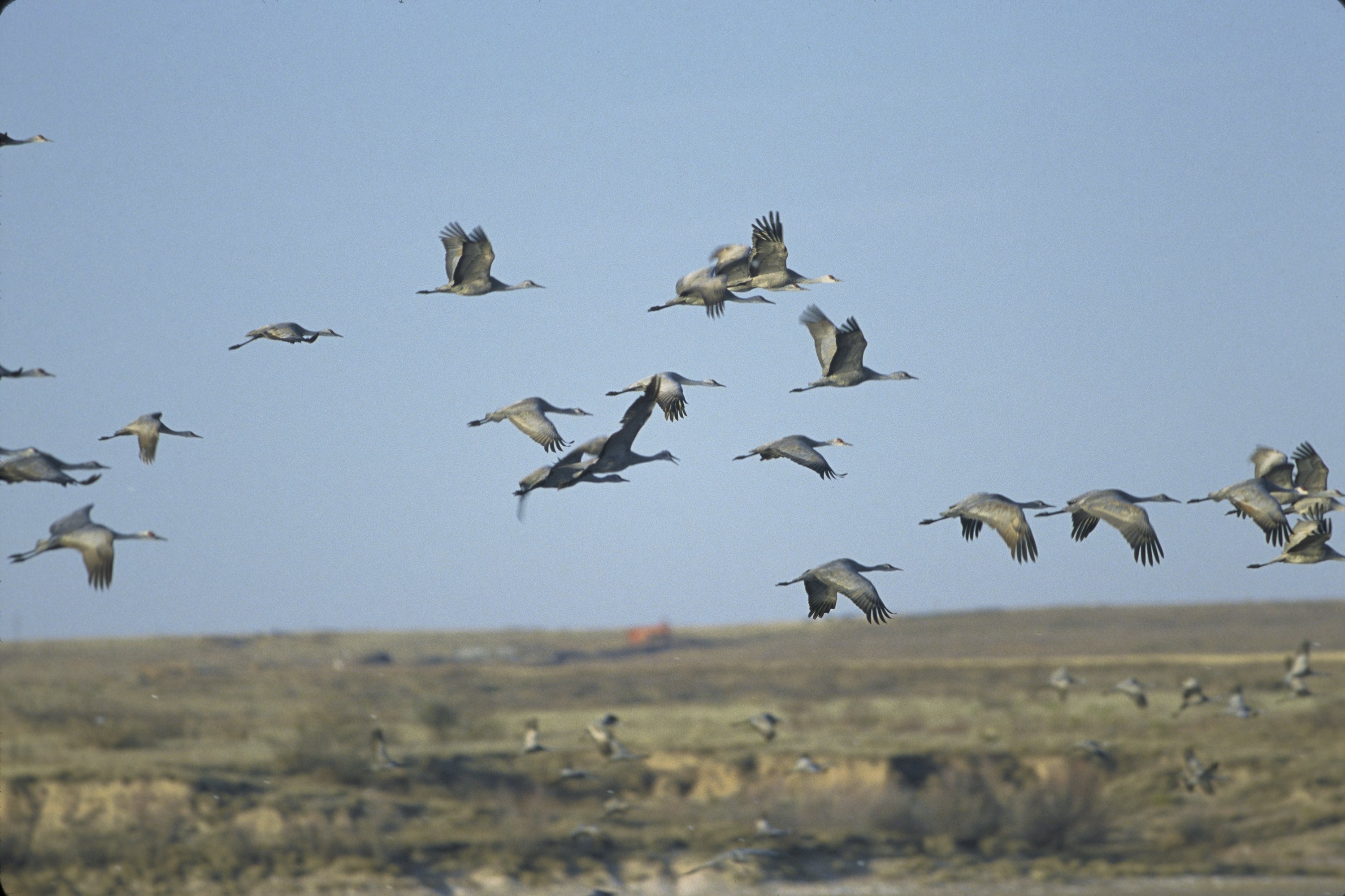
The 5,000-acre (20 km2) refuge is a stop for migratory waterfowl flying between Canada and Mexico. If sufficient water is present, during the winter it hosts tens of thousands of sandhill cranes. The largest number of cranes ever recorded was 250,000, during February, 1981.
The cranes are most visible at dawn and at dusk, as they leave the lakes during the day to feed in nearby fields.
Other wildlife includes wood warblers, meadowlarks, raptors, burrowing owls, blacktailed prairie dogs, jackrabbits, cottontail rabbits, coyotes, and badgers.
The prairie ecosystem includes plant life such as wildflowers, grasses, yucca, cacti, and mesquite. Rangeland management techniques include controlled burning and grazing.
Northeast of White Lake is a small area of white gypsum dunes, similar to those found at White Sands National Monument in New Mexico, though these are much less expansive.
-

Entrance to Muleshoe National Wildlife Refuge
-
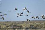
Sandhill Cranes in flight, Muleshoe National Wildlife Refuge
-

Upper Goose Lake, Muleshoe National Wildlife Refuge
See also
- Grulla National Wildlife Refuge
- Buffalo Lake National Wildlife Refuge
- Blackwater Draw
- Llano Estacado
External links
- Muleshoe National Wildlife Refuge Official Site
- Handbook of Texas Online: Muleshoe National Wildlife Refuge
Protected Areas of Texas Federal El Orcoquisac Archeological District · Fort Davis National Historic Site · Lyndon B. Johnson National Historical Park · Palo Alto Battlefield National Historical Park · San Antonio Missions National Historical ParkAnahuac · Aransas · Attwater Prairie Chicken · Balcones Canyonlands · Big Boggy · Brazoria · Buffalo Lake · Grulla · Hagerman · Laguna Atascosa · Lower Rio Grande Valley · McFaddin · Muleshoe · San Bernard · Santa Ana · Texas Point · Trinity RiverState Abilene · Atlanta · Balmorhea · Barton Warnock Environmental Education Center · Bastrop · Bentsen-Rio Grande Valley · Big Bend Ranch · Big Spring · Blanco · Boca Chica · Bonham · Brazos Bend · Buescher · Caddo Lake · Caprock Canyons · Cedar Hill · Choke Canyon · Cleburne · Colorado Bend · Cooper Lake · Copper Breaks · Daingerfield · Davis Mountains · Devils River State Natural Area · Devil's Sinkhole State Natural Area · Dinosaur Valley · Eisenhower · Enchanted Rock State Natural Area · Estero Llano Grande · Fairfield Lake · Falcon · Fort Boggy · Fort Parker State Park · Fort Richardson State Park · Franklin Mountains · Galveston Island · Garner · Goliad · Goose Island · Government Canyon State Natural Area · Guadalupe River · Hill Country State Natural Area · Honey Creek State Natural Area · Huntsville · Indian Lodge · Inks Lake · Kickapoo Cavern · Lake Arrowhead · Lake Bob Sandlin · Lake Brownwood · Lake Casa Blanca International · Lake Colorado City · Lake Corpus Christi · Lake Livingston · Lake Mineral Wells · Lake Somerville · Lake Tawakoni · Lake Texana · Lake Whitney · Lockhart · Longhorn Cavern · Lost Creek Reservoir State Trailway · Lost Maples State Natural Area · Martin Creek Lake · Martin Dies, Jr. · Matagorda Island · McKinney Falls · Meridian · Mission Tejas · Monahans Sandhills · Mother Neff State Park · Mustang Island · Palmetto · Palo Duro Canyon · Pedernales Falls · Possum Kingdom · Purtis Creek · Ray Roberts Lake · Resaca de la Palma · San Angelo · Sea Rim · Sheldon Lake · South Llano River · Stephen F. Austin · Tyler · Village Creek · Walter Umphrey · Wyler Aerial TramwayActon · Admiral Nimitz · Barrington Living History Farm at Washington-on-the-Brazos · Battleship TEXAS · Caddoan Mounds · Casa Navarro · Confederate Reunion Grounds · Eisenhower Birthplace · Fanthorp Inn · Fannin Battleground · Fort Griffin · Fort Lancaster · Fort Leaton · Fort McKavett · Fort Richardson · Fulton Mansion · Goliad · Hueco Tanks · Kreische Brewery · Landmark Inn · Levi Jordan Plantation · Lipantitlan · Lyndon B. Johnson · Magoffin Homestead · Mission Espiritu Santo · Mission Rosario · Monument Hill · Penn Farm · Point Isabel Lighthouse · Sabine Pass Battleground · Sam Bell Maxey House · Samuel T. Rayburn House · San Felipe · San Jacinto Battleground · Sauer-Beckmann Farm · Sebastopol House · Seminole Canyon · Starr Family Home · Varner–Hogg Plantation · Washington-on-the-Brazos · Zaragosa BirthplaceState Wildlife TrailsGreat Texas Coastal · Heart of Texas · Panhandle Plains · Prairies and PineywoodsCategories:- National Wildlife Refuges in Texas
- National Natural Landmarks in Texas
- Protected areas of Bailey County, Texas
- Protected areas established in 1935
- Texas protected area stubs
- Texas Panhandle geography stubs
-

Wikimedia Foundation. 2010.