- Monahans Sandhills State Park
-
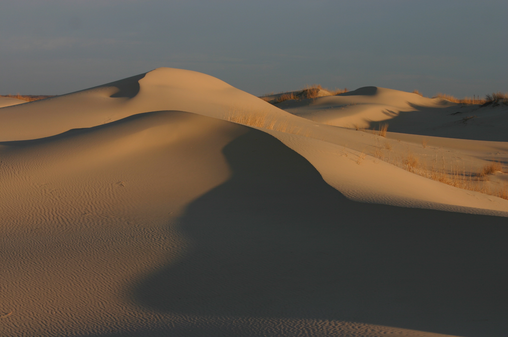
Monahans Sandhills State Park of Texas 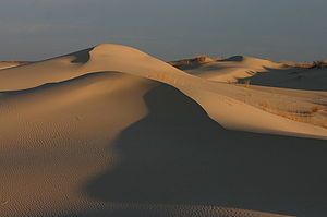 Sandhills at sunrise
Country  United States
State  Texas
TexasCounties Ward / Winkler Nearest town Monahans, Texas Elevation 840 m (2,756 ft) Coordinates 31°38′51″N 102°49′23″W / 31.6475°N 102.82306°W Area 15.5 km2 (6 sq mi) Founded 1957 Management Texas Parks and Wildlife Department 
Website: TPWD The Monahans Sandhills State Park is a 3,840-acre (1,550 ha) state park located in Ward County and Winkler County, Texas. The closest major town is Monahans, Texas, and the closest limited-access highway ingress is Exit 86 on Interstate 20.
-
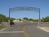
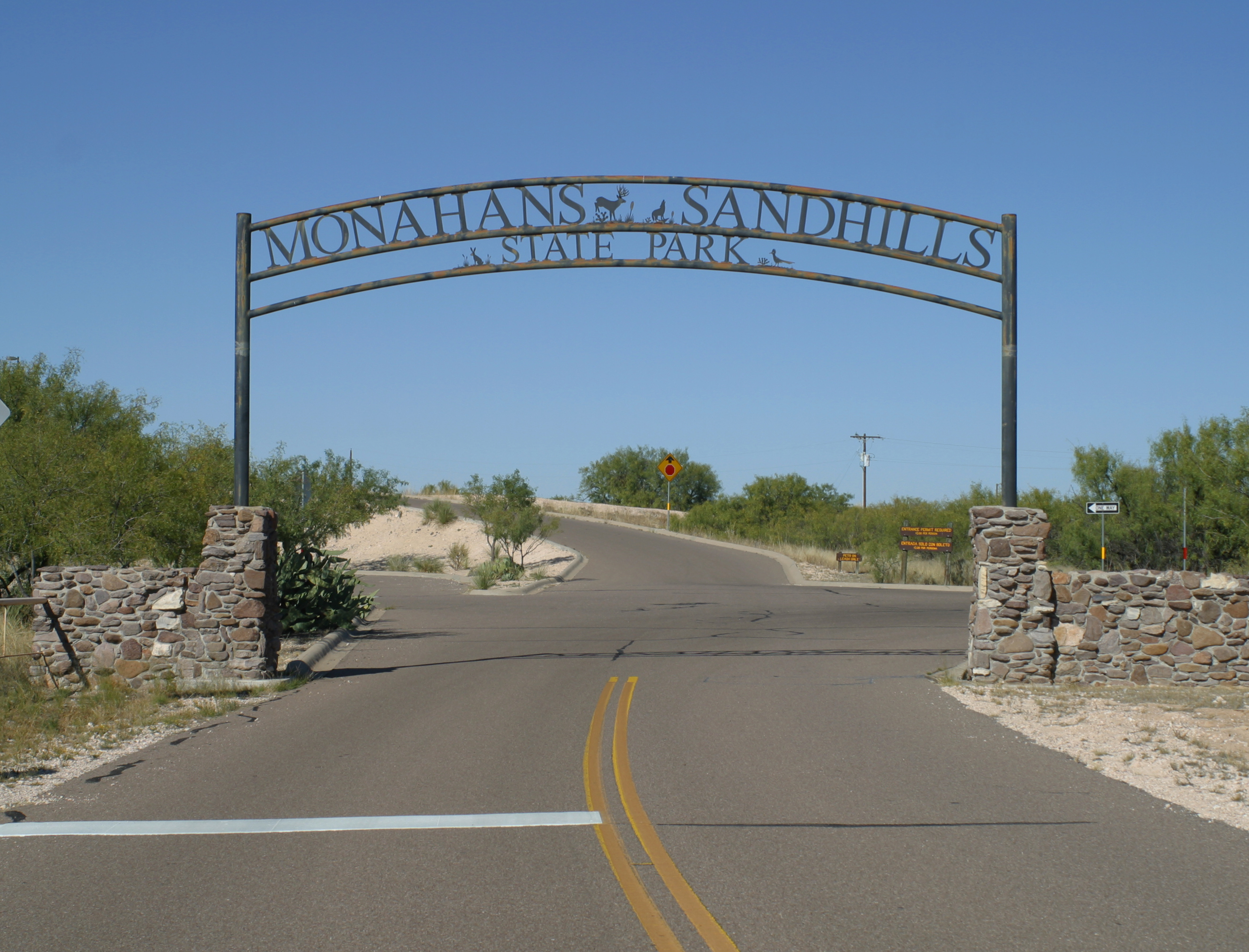
Entrance to Monahans Sandhills
-
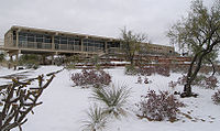
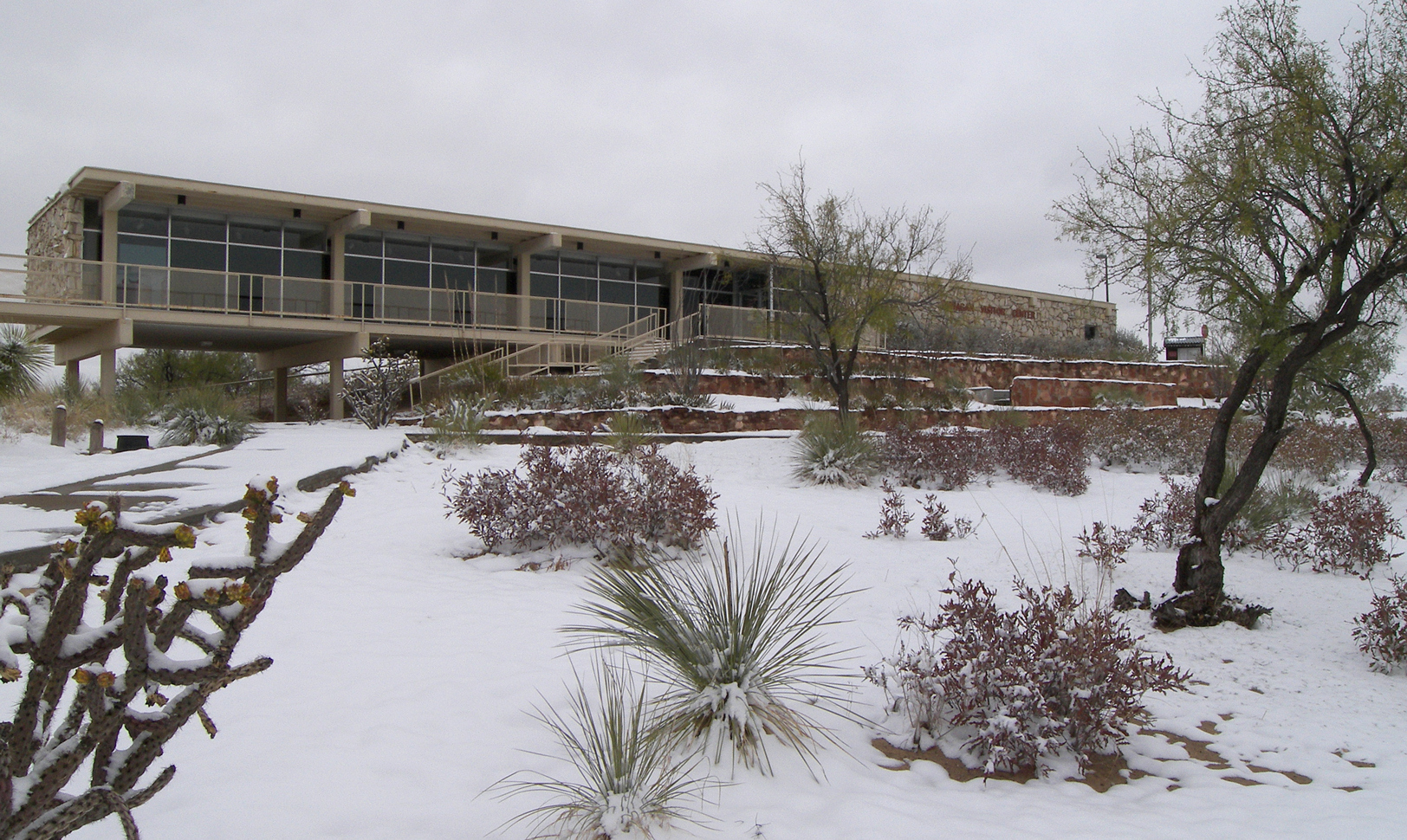
The Dunagan Visitor Center after a winter storm.
Features
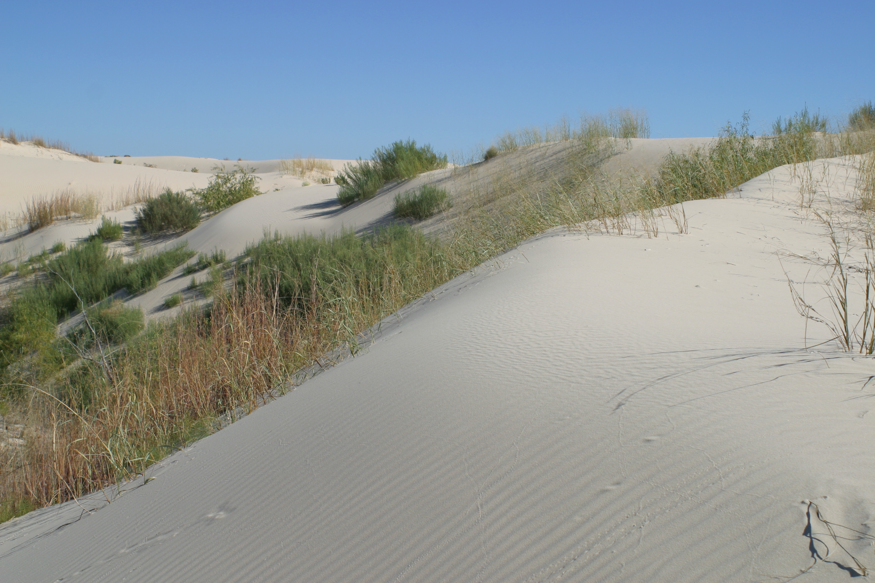
Monahans Sandhills State Park is noted for the presence of sand dunes up to 70 feet (21 m) high. Although desert-like, the Monahans Sandhills are not a desert; they are a part of a semi-arid ecosystem (average annual rainfall 12.3 inches (310 mm)) characterized by the presence of both groundwater and relatively nutrient-poor windblown sand. The Shinoak (Quercus havardii) is a local climax shrub, an unusual type of oak tree which because of local conditions often achieves full growth of only 4 feet (1.2 m) in height. Most of a Shinoak's biomass exists in the form of a lengthy root system reaching down to groundwater. If a Monahans sand dune has become stabilized and has stopped blowing about in the wind, that is often because a small grove of Shinoaks have stabilized the dune with their extensive root systems. Despite the sterility of the landscape, various rodents are relatively common, and several packs of Sandhills coyotes feed upon them.[1]
Much of the Monahans Sandhills are privately owned property. The state of Texas is operating a 99-year lease with the Sealy-Smith Foundation for the ranch on which most of the land of the state park is located; the park opened to the public in 1957, and the state park has leasehold rights to this parcel of the sand hills until 2056.[1]
The Monahans Sandhills are part of the Permian Basin of hydrocarbon formations, and some oil production continues in and around the state park.[1]
Visitors practice several local forms of recreation at the Monahans Sandhills, such as sand football, sand surfing, and sand tobogganing.[1]
-
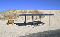
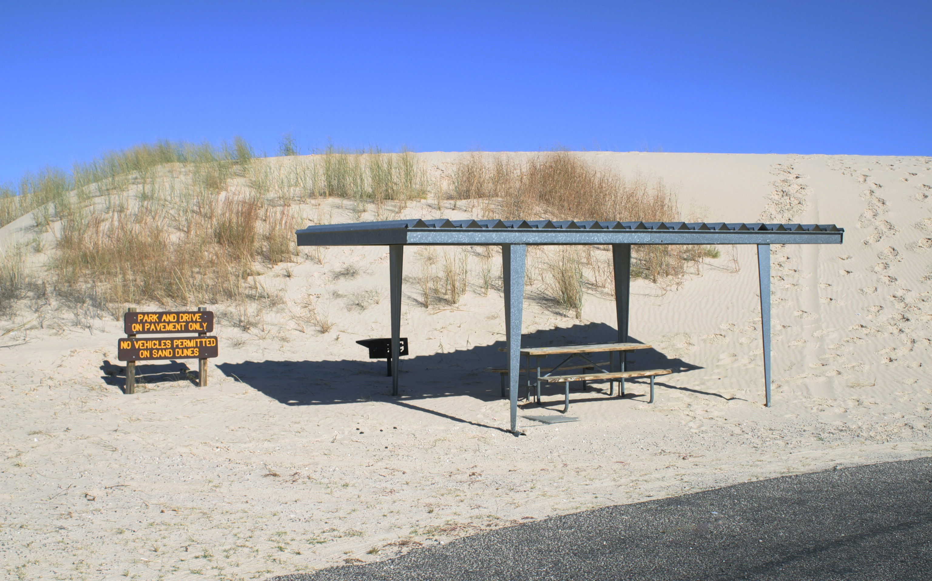
Picnic shelter at Monahans Sandhills
-
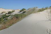
Sand encroaching on vegetation
See also
References
Protected Areas of Texas Federal El Orcoquisac Archeological District · Fort Davis National Historic Site · Lyndon B. Johnson National Historical Park · Palo Alto Battlefield National Historical Park · San Antonio Missions National Historical ParkAnahuac · Aransas · Attwater Prairie Chicken · Balcones Canyonlands · Big Boggy · Brazoria · Buffalo Lake · Grulla · Hagerman · Laguna Atascosa · Lower Rio Grande Valley · McFaddin · Muleshoe · San Bernard · Santa Ana · Texas Point · Trinity RiverState Abilene · Atlanta · Balmorhea · Barton Warnock Environmental Education Center · Bastrop · Bentsen-Rio Grande Valley · Big Bend Ranch · Big Spring · Blanco · Boca Chica · Bonham · Brazos Bend · Buescher · Caddo Lake · Caprock Canyons · Cedar Hill · Choke Canyon · Cleburne · Colorado Bend · Cooper Lake · Copper Breaks · Daingerfield · Davis Mountains · Devils River State Natural Area · Devil's Sinkhole State Natural Area · Dinosaur Valley · Eisenhower · Enchanted Rock State Natural Area · Estero Llano Grande · Fairfield Lake · Falcon · Fort Boggy · Fort Parker State Park · Fort Richardson State Park · Franklin Mountains · Galveston Island · Garner · Goliad · Goose Island · Government Canyon State Natural Area · Guadalupe River · Hill Country State Natural Area · Honey Creek State Natural Area · Huntsville · Indian Lodge · Inks Lake · Kickapoo Cavern · Lake Arrowhead · Lake Bob Sandlin · Lake Brownwood · Lake Casa Blanca International · Lake Colorado City · Lake Corpus Christi · Lake Livingston · Lake Mineral Wells · Lake Somerville · Lake Tawakoni · Lake Texana · Lake Whitney · Lockhart · Longhorn Cavern · Lost Creek Reservoir State Trailway · Lost Maples State Natural Area · Martin Creek Lake · Martin Dies, Jr. · Matagorda Island · McKinney Falls · Meridian · Mission Tejas · Monahans Sandhills · Mother Neff State Park · Mustang Island · Palmetto · Palo Duro Canyon · Pedernales Falls · Possum Kingdom · Purtis Creek · Ray Roberts Lake · Resaca de la Palma · San Angelo · Sea Rim · Sheldon Lake · South Llano River · Stephen F. Austin · Tyler · Village Creek · Walter Umphrey · Wyler Aerial TramwayActon · Admiral Nimitz · Barrington Living History Farm at Washington-on-the-Brazos · Battleship TEXAS · Caddoan Mounds · Casa Navarro · Confederate Reunion Grounds · Eisenhower Birthplace · Fanthorp Inn · Fannin Battleground · Fort Griffin · Fort Lancaster · Fort Leaton · Fort McKavett · Fort Richardson · Fulton Mansion · Goliad · Hueco Tanks · Kreische Brewery · Landmark Inn · Levi Jordan Plantation · Lipantitlan · Lyndon B. Johnson · Magoffin Homestead · Mission Espiritu Santo · Mission Rosario · Monument Hill · Penn Farm · Point Isabel Lighthouse · Sabine Pass Battleground · Sam Bell Maxey House · Samuel T. Rayburn House · San Felipe · San Jacinto Battleground · Sauer-Beckmann Farm · Sebastopol House · Seminole Canyon · Starr Family Home · Varner–Hogg Plantation · Washington-on-the-Brazos · Zaragosa BirthplaceState Wildlife TrailsGreat Texas Coastal · Heart of Texas · Panhandle Plains · Prairies and PineywoodsTexas Parks and Wildlife Department Categories:- Texas state parks
- Protected areas of Ward County, Texas
- Protected areas of Winkler County, Texas
- Texas protected area stubs
-

Wikimedia Foundation. 2010.