- Dinosaur Valley State Park
-
Dinosaur Valley State Park 
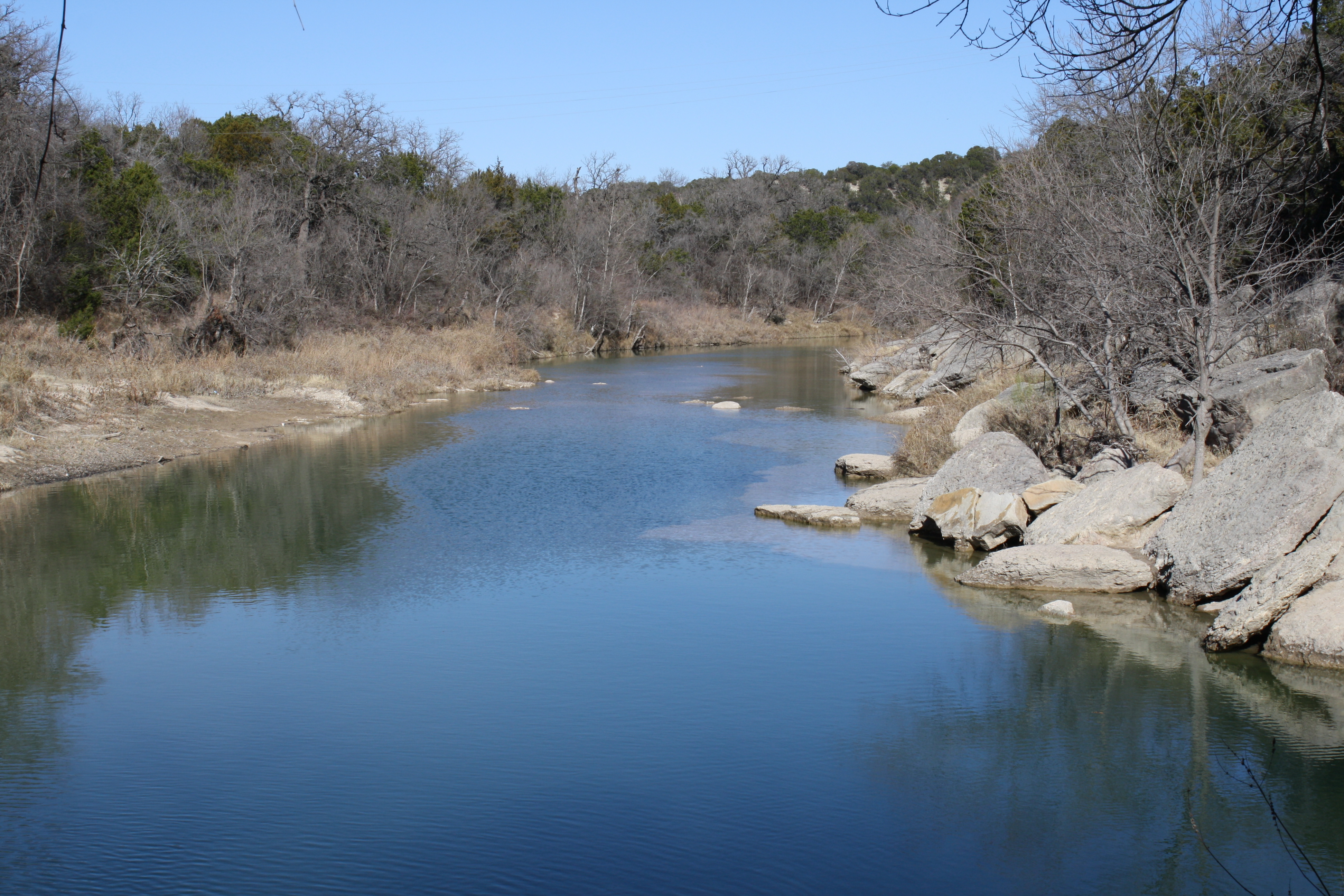
The Paluxy River in Dinosaur Valley State ParkLocation Somervell County, Texas Nearest city Glen Rose Coordinates 32°15′05.36″N 97°49′06.10″W / 32.2514889°N 97.818361°WCoordinates: 32°15′05.36″N 97°49′06.10″W / 32.2514889°N 97.818361°W Area 1,524.72 acres (617 ha) Established 1972 Governing body Texas Parks and Wildlife Department Dinosaur Valley State Park is a state park in Texas[1] near Glen Rose, Texas.
Contents
History
Dinosaur Valley State Park, located just northwest of Glen Rose in Somervell County, is a 1,524.72-acre (617 ha) scenic park set astride the Paluxy River. The land for the park was acquired from private owners under the State Parks Bonds Program during 1968 and opened to the public in 1972.[2] In addition to being a state park, it is also a National Natural Landmark.
Eastward-dipping limestones, sandstones, and mudstones of the Glen Rose Formation were deposited during the early Cretaceous Period approximately 113 million years ago along the shorelines of an ancient sea, and form the geological setting for the park area. Over the last million years or so, these layered formations have been eroded, dissected and sculpted by the Paluxy River which, in many places, has cut down to resistant beds and planed off sizable exposures of rock in the river bottom.[2]
Controversy
Outside, but near the Dinosaur Valley State Park, in the limestone deposits along the Paluxy River "twin sets" tracks were found in the Glen Rose Formation as early as 1908. These footprints have been cited by young-Earth creationists as evidence against evolutionary theory,[3] as the idea that humans and dinosaurs lived at the same time is contrary to the standard view of the geological time scale. This view is the basis for displays at the Creation Evidence Museum in nearby Glen Rose. However, as biologist Massimo Pigliucci noted, geologists in the 1980s "clearly demonstrated that no human being left those prints," but rather "they were in fact metatarsal dinosaur tracks, together with a few pure and simple fakes."[4]
The family of the original man, George Adams, who made the claims, later admitted it was a hoax.[5] "My grandfather was a very good sculptor," said Zana Douglas, from the Adams family who found many of Glen Rose’s real dinosaur tracks.[5] She explained that in the 1930s and the Depression, Glen Rose residents made money by making moonshine and selling dinosaur fossils.[5] The fossils brought $15 to $30 and when the supply ran low, George Adams, Zana's grandfather "just carved more, some with human footprints thrown in."[5]
References
- ^ List of Texas State Parks
- ^ a b Texas Parks and Wildlife: Dinosaur Valley State Park
- ^ John D. Morris The Pauluxy River Tracks, Institute for Creation Research, 2007
- ^ Massimo Pigliucci, Denying Evolution: Creationism, Scientism, and the Nature of Science, (Sinauer, 2002, page 246): ISBN 0878936599
- ^ a b c d Kennedy, Bud (August 10, 2008). "Human footprints beside dinosaur tracks? Let's talk". Fort Worth Star-Telegram. p. B02.
External links
- Dinosaur Valley State Park - official site
- A guide to the state park by Glen J. Kuban.
- U.S. Geological Survey Geographic Names Information System: Dinosaur Valley State Park
- The Texas Dinosaur/"Man Track" Controversy by Glen J. Kuban from talk.origins
Protected Areas of Texas Federal El Orcoquisac Archeological District · Fort Davis National Historic Site · Lyndon B. Johnson National Historical Park · Palo Alto Battlefield National Historical Park · San Antonio Missions National Historical ParkAnahuac · Aransas · Attwater Prairie Chicken · Balcones Canyonlands · Big Boggy · Brazoria · Buffalo Lake · Grulla · Hagerman · Laguna Atascosa · Lower Rio Grande Valley · McFaddin · Muleshoe · San Bernard · Santa Ana · Texas Point · Trinity RiverState Abilene · Atlanta · Balmorhea · Barton Warnock Environmental Education Center · Bastrop · Bentsen-Rio Grande Valley · Big Bend Ranch · Big Spring · Blanco · Boca Chica · Bonham · Brazos Bend · Buescher · Caddo Lake · Caprock Canyons · Cedar Hill · Choke Canyon · Cleburne · Colorado Bend · Cooper Lake · Copper Breaks · Daingerfield · Davis Mountains · Devils River State Natural Area · Devil's Sinkhole State Natural Area · Dinosaur Valley · Eisenhower · Enchanted Rock State Natural Area · Estero Llano Grande · Fairfield Lake · Falcon · Fort Boggy · Fort Parker State Park · Fort Richardson State Park · Franklin Mountains · Galveston Island · Garner · Goliad · Goose Island · Government Canyon State Natural Area · Guadalupe River · Hill Country State Natural Area · Honey Creek State Natural Area · Huntsville · Indian Lodge · Inks Lake · Kickapoo Cavern · Lake Arrowhead · Lake Bob Sandlin · Lake Brownwood · Lake Casa Blanca International · Lake Colorado City · Lake Corpus Christi · Lake Livingston · Lake Mineral Wells · Lake Somerville · Lake Tawakoni · Lake Texana · Lake Whitney · Lockhart · Longhorn Cavern · Lost Creek Reservoir State Trailway · Lost Maples State Natural Area · Martin Creek Lake · Martin Dies, Jr. · Matagorda Island · McKinney Falls · Meridian · Mission Tejas · Monahans Sandhills · Mother Neff State Park · Mustang Island · Palmetto · Palo Duro Canyon · Pedernales Falls · Possum Kingdom · Purtis Creek · Ray Roberts Lake · Resaca de la Palma · San Angelo · Sea Rim · Sheldon Lake · South Llano River · Stephen F. Austin · Tyler · Village Creek · Walter Umphrey · Wyler Aerial TramwayActon · Admiral Nimitz · Barrington Living History Farm at Washington-on-the-Brazos · Battleship TEXAS · Caddoan Mounds · Casa Navarro · Confederate Reunion Grounds · Eisenhower Birthplace · Fanthorp Inn · Fannin Battleground · Fort Griffin · Fort Lancaster · Fort Leaton · Fort McKavett · Fort Richardson · Fulton Mansion · Goliad · Hueco Tanks · Kreische Brewery · Landmark Inn · Levi Jordan Plantation · Lipantitlan · Lyndon B. Johnson · Magoffin Homestead · Mission Espiritu Santo · Mission Rosario · Monument Hill · Penn Farm · Point Isabel Lighthouse · Sabine Pass Battleground · Sam Bell Maxey House · Samuel T. Rayburn House · San Felipe · San Jacinto Battleground · Sauer-Beckmann Farm · Sebastopol House · Seminole Canyon · Starr Family Home · Varner–Hogg Plantation · Washington-on-the-Brazos · Zaragosa BirthplaceState Wildlife TrailsGreat Texas Coastal · Heart of Texas · Panhandle Plains · Prairies and PineywoodsTexas Parks and Wildlife Department Categories:- Fossil trackways in the United States
- Texas state parks
- Protected areas of Somervell County, Texas
- National Natural Landmarks in Texas
- IUCN Category III
- IUCN Category IV
- Natural history museums in Texas
- Museums in Somervell County, Texas
- Dinosaur museums in the United States
- Texas protected area stubs
Wikimedia Foundation. 2010.