- Mescalero Escarpment
-
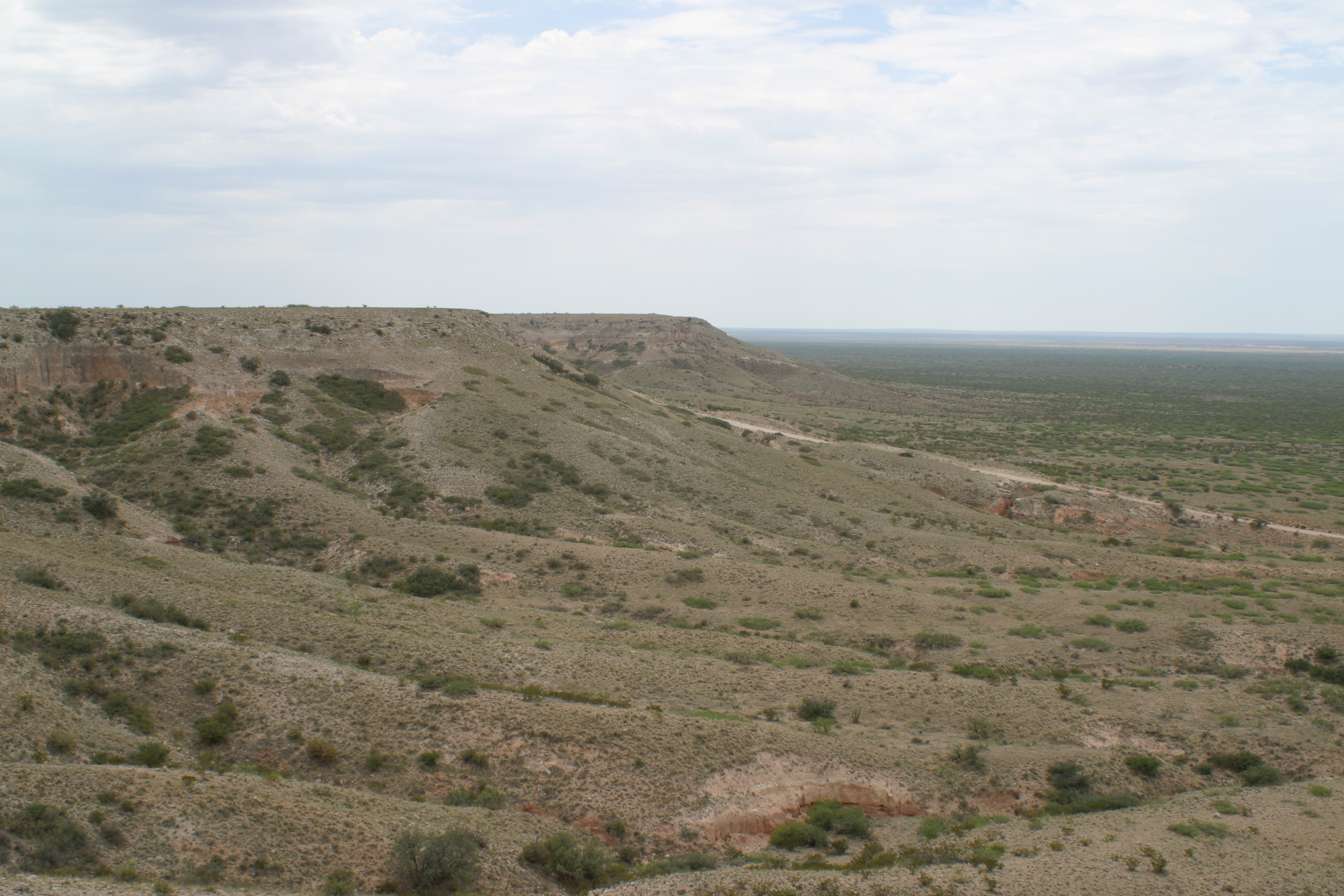
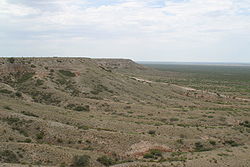 A portion of the Mescalero Escarpment between Caprock and Maljamar, New Mexico. (6 August 2003)
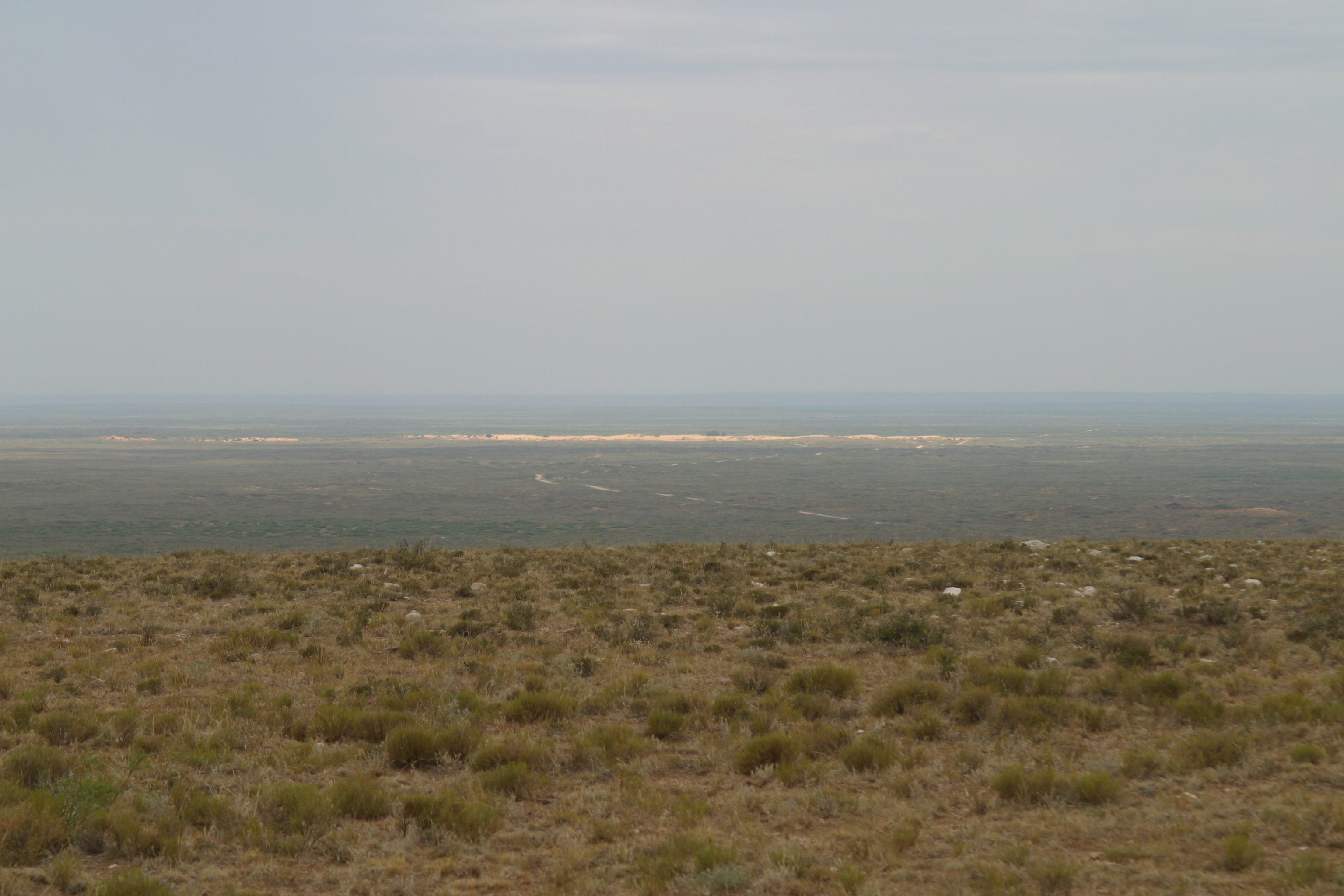
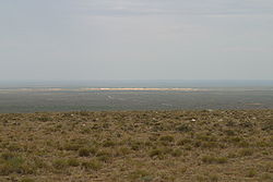 View of the Mescalero Sands looking west from the top of the Mescalero Escarpment. (6 August 2003)
The Mescalero Escarpment, also known as the Mescalero Ridge, forms the western edge of the great Llano Estacado, a vast plateau or tableland in the southwestern United States in New Mexico and Texas. [1][2] It is an extension of the Caprock Escarpment.
Mescalero Sands
Extending north south along the western edge of the Mescalero Escarpment lies a vast sand sheet called the Mescalero Sands, named for the Mescalero Apaches who once hunted in these sandhills.[3][4] In 1928, Nelson Horatio Darton of the United States Geological Survey observed: “On the east side of the Pecos Valley in southern New Mexico there are very extensive sand hills formed of deposits known as the ‘Mescalero Sands,’ which are doubtless of Quaternary age ...” [5] In places, these sands climb up and over the Mescalero Escarpment and spread out over portions of the Llano Estacado.
References
- ^ Price, A.P. 1977. Mescalero Sandhills of Cochran and Yoakum Counties, Texas. Master's thesis, Texas Tech University, Lubbock, 253 pp.
- ^ Henderson, D. 2006. An Introduction to the Mescalero Sands Ecosystem. Master's thesis, Texas A&M University, 42 pp.
- ^ Julyan, R. 1996. The Place Names of New Mexico. University of New Mexico Press, Albuquerque.
- ^ Hall, S.A. 2002. Field Guide to the Geoarchaeology of the Mescalero Sands, Southeastern New Mexico. State of New Mexico Historic Preservation Division and New Mexico Bureau of Land Management, Project No. 35-00-15334.11, 59 pp.
- ^ Darton, N.H. 1928. "Red Beds" and associated formations in New Mexico, with an outline of the geology of the state. United States Department of the Interior, U.S. Geological Survey, Bulletin 794, 356 pp. (Mescalero sands described on p. 59)
See also
- Llano Estacado
- Palo Duro Canyon
- Caprock Canyons
- Mount Blanco
- List of geographical regions in Texas
- Geology of Texas
Coordinates: 33°13′43″N 103°48′34″W / 33.22861°N 103.80944°W
Categories:- Landforms of Chaves County, New Mexico
- Landforms of Eddy County, New Mexico
- Landforms of New Mexico
- Geology of New Mexico
- Landforms of Texas
- Geology of Texas
- Landforms of Lea County, New Mexico
- New Mexico geography stubs
Wikimedia Foundation. 2010.