- Mińsk County
-
For the district (raion) of Belarus, see Minsk Raion.
Mińsk County
Powiat miński— County — 
Flag
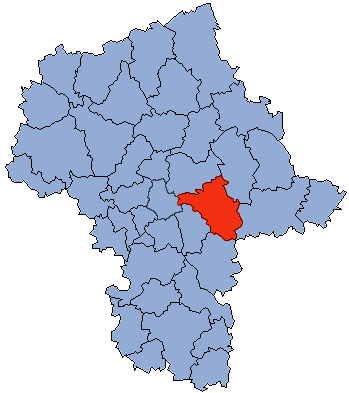
Coat of armsLocation within the voivodeship Division into gminas
Coordinates (Mińsk Mazowiecki): 52°11′N 21°34′E / 52.183°N 21.567°ECoordinates: 52°11′N 21°34′E / 52.183°N 21.567°E Country  Poland
Voivodeship Masovian Seat Mińsk Mazowiecki Gminas Area – Total 1,164.35 km2 (449.6 sq mi) Population (2006) – Total 141,048 – Density 121.1/km2 (313.7/sq mi) – Urban 62,758 – Rural 78,290 Car plates WM Website http://www.powiatminski.pl Mińsk County (Polish: powiat miński) is a unit of territorial administration and local government (powiat) in Masovian Voivodeship, east-central Poland. It was (re)created on January 1, 1999, as a result of the Polish local government reforms passed in 1998. Its administrative seat and largest town is Mińsk Mazowiecki, which lies 39 kilometres (24 mi) east of Warsaw. The county contains three other towns: Sulejówek, 21 km (13 mi) west of Mińsk Mazowiecki, Halinów, 16 km (10 mi) west of Mińsk Mazowiecki, and Kałuszyn, 17 km (11 mi) east of Mińsk Mazowiecki.
The county covers an area of 1,164.35 square kilometres (449.6 sq mi). As of 2006 its total population is 141,048, out of which the population of Mińsk Mazowiecki is 37,808, that of Sulejówek is 18,676, that of Halinów is 3,369, that of Kałuszyn is 2,905, and the rural population is 78,290.
Neighbouring counties
Mińsk County is bordered by Węgrów County to the north-east, Siedlce County to the east, Garwolin County to the south, Otwock County and the city of Warsaw to the west, and Wołomin County to the north-west.
Administrative division
The county is subdivided into 13 gminas (two urban, two urban-rural and nine rural). These are listed in the following table, in descending order of population.
Gmina Type Area
(km²)Population
(2006)Seat Mińsk Mazowiecki urban 13.1 37,808 Sulejówek urban 19.5 18,676 Gmina Mińsk Mazowiecki rural 112.3 12,876 Mińsk Mazowiecki * Gmina Halinów urban-rural 63.1 12,538 Halinów Gmina Mrozy rural 145.2 8,681 Mrozy Gmina Dębe Wielkie rural 77.9 8,299 Dębe Wielkie Gmina Cegłów rural 95.7 7,844 Cegłów Gmina Siennica rural 111.0 6,912 Siennica Gmina Stanisławów rural 106.0 6,240 Stanisławów Gmina Kałuszyn urban-rural 94.5 6,190 Kałuszyn Gmina Dobre rural 124.9 5,938 Dobre Gmina Latowicz rural 114.2 5,559 Latowicz Gmina Jakubów rural 87.2 4,962 Jakubów * seat not part of the gmina References
Urban gminas Mińsk Mazowiecki (seat) • Sulejówek
Urban-rural gminas Rural gminas Counties of Masovian Voivodeship City counties 
Land counties Białobrzegi • Ciechanów • Garwolin • Gostynin • Grodzisk Mazowiecki • Grójec • Kozienice • Legionowo • Lipsko • Łosice • Maków • Mińsk • Mława • Nowy Dwór Mazowiecki • Ostrołęka • Ostrów Mazowiecka • Otwock • Piaseczno • Płock • Płońsk • Pruszków • Przasnysz • Przysucha • Pułtusk • Radom • Siedlce • Sierpc • Sochaczew • Sokołów • Szydłowiec • Warsaw West • Węgrów • Wołomin • Wyszków • Żuromin • Zwoleń • ŻyrardówCategories:- Mińsk County
- Land counties of Masovian Voivodeship


Wikimedia Foundation. 2010.