Przysucha County

Przysucha County

Infobox Settlement
name = Przysucha County
native_name = Powiat przysuski
settlement_type = County
total_type = Total


image_shield = POL Przysucha COA.svg


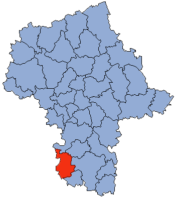
map_caption = Location within the voivodeship


map_caption1 = Division into gminas
subdivision_type = Country
subdivision_name = POL
subdivision_type1 = Voivodeship
subdivision_name1 = Masovian
area_total_km2 = 800.68
population_total = 43822
population_as_of = 2006
population_density_km2 = auto
population_urban = 6245
population_blank1_title = Rural
population_blank1 = 37577
coor_type = Przysucha
latd = 51
latm = 22
lats =
latNS = N
longd = 20
longm = 37
longs =
longEW = E
seat = Przysucha
parts_type = Gminas
parts = Total 8
p1 = Gmina Borkowice
p2 = Gmina Gielniów
p3 = Gmina Klwów
p4 = Gmina Odrzywół
p5 = Gmina Potworów
p6 = Gmina Przysucha
p7 = Gmina Rusinów
p8 = Gmina Wieniawa
blank_name = Car plates
blank_info = WPY
website = http://www.przysucha.pl
__NOTOC__Przysucha County ( _pl. powiat przysuski) is a unit of territorial administration and local government (powiat) in Masovian Voivodeship, east-central Poland. It was created on January 1, 1999 as a result of the Local Government Reorganization Act of 1998. Its administrative seat and only town is Przysucha, which lies convert|98|km|mi|0 south of Warsaw.

The county covers an area of convert|800.68|km2|sqmi|1. As of 2006 its total population is 43,822, out of which the population of Przysucha is 6,245 and the rural population is 37,577.

Neighbouring counties

Przysucha County is bordered by Grójec County to the north, Białobrzegi County to the north-east, Radom County to the east, Szydłowiec County to the south-east, Końskie County to the south-west, and Opoczno County and Tomaszów Mazowiecki County to the west.

Administrative division

The county is subdivided into eight gminas (one urban-rural and seven rural). These are listed in the following table, in descending order of population.

References

* [http://www.stat.gov.pl/gus/45_655_PLK_HTML.htm Polish official population figures 2006]


Wikimedia Foundation. 2010.

Игры ⚽ Нужно сделать НИР?

Look at other dictionaries:

  • Dębiny, Przysucha County — For other places with the same name, see Dębiny (disambiguation). Dębiny   Village   …   Wikipedia

  • Długie, Przysucha County — For other places with the same name, see Długie. Długie   Village   …   Wikipedia

  • Odrzywół, Przysucha County — For other places with the same name, see Odrzywół. Odrzywół   Village   …   Wikipedia

  • Dąbrowa, Przysucha County — For other places with the same name, see Dąbrowa (disambiguation). Dąbrowa   Village   Country Poland …   Wikipedia

  • Olszany, Przysucha County — For other places with the same name, see Olszany (disambiguation). Olszany   Settlement   Country Poland …   Wikipedia

  • Przysucha — Infobox Settlement name = Przysucha imagesize = 250px image caption = Monument on Main Square image shield = POL Przysucha COA.svg pushpin pushpin label position = bottom subdivision type = Country subdivision name = POL subdivision type1 =… …   Wikipedia

  • Gmina Przysucha — Infobox Settlement name = Gmina Przysucha other name = Przysucha Commune settlement type = Gmina total type = Total image shield = POL Przysucha COA.svg subdivision type = Country subdivision name = POL subdivision type1 = Voivodeship subdivision …   Wikipedia

  • Grójec County — Infobox Settlement name = Grójec County native name = Powiat grójecki settlement type = image shield = POL powiat grójecki COA.svg map caption = Location within the voivodeship map caption1 = Division into gminas subdivision type = Country… …   Wikipedia

  • Radom County — Infobox Settlement name = Radom County native name = Powiat radomski settlement type = County total type = Total image shield = POL powiat radomski COA.svg map caption = Location within the voivodeship map caption1 = Division into gminas… …   Wikipedia

  • Końskie County — Infobox Settlement name = Końskie County native name = Powiat konecki settlement type = image shield = POL powiat konecki flag.svg map caption = Location within the voivodeship subdivision type = Country subdivision name = POL subdivision type1 …   Wikipedia

Share the article and excerpts

Direct link
Do a right-click on the link above
and select “Copy Link”