- Warsaw West County
Infobox Settlement
name = Warsaw West County
native_name = Powiat warszawski zachodni
settlement_type = County
total_type = Total
image_shield = POL powiat warszawski zachodni COA.svg
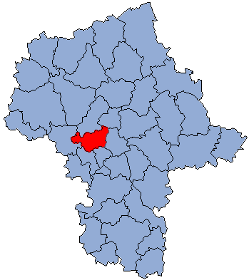
map_caption = Location within the voivodeship

map_caption1 = Division into gminas
subdivision_type = Country
subdivision_name = POL
subdivision_type1 = Voivodeship
subdivision_name1 = Masovian
area_total_km2 = 532.99
population_total = 100965
population_as_of = 2006
population_density_km2 = auto
population_urban = 36240
population_blank1_title = Rural
population_blank1 = 64725
coor_type = Ożarów Mazowiecki
latd = 52
latm = 13
lats =
latNS = N
longd = 20
longm = 48
longs =
longEW = E
seat =Ożarów Mazowiecki
parts_type =Gmina s
parts = Total 7
p1 =Gmina Błonie
p2 =Gmina Izabelin
p3 =Gmina Kampinos
p4 =Gmina Leszno
p5 =Gmina Łomianki
p6 =Gmina Ożarów Mazowiecki
p7 =Gmina Stare Babice
blank_name = Car plates
blank_info = WZ
website = http://www.pwz.pl __NOTOC__Warsaw West County ( _pl. powiat warszawski zachodni) is a unit of territorial administration and local government (powiat ) inMasovian Voivodeship , east-centralPoland . It was created onJanuary 1 ,1999 as a result of the Local Government Reorganization Act of 1998. In spite of its name, the county does not include any part of the city of Warsaw proper.The county originally had its admnistrative offices in Warsaw, but in 2006 its seat was moved to the town of
Ożarów Mazowiecki , which lies convert|14|km|mi|0 west ofWarsaw . The county also contains the towns ofŁomianki , lying convert|15|km|mi|0|abbr=on north-east of Ożarów, andBłonie , convert|13|km|mi|0|abbr=on west of Ożarów.The county covers an area of convert|532.99|km2|sqmi|1. As of 2006 its total population is 100,965, out of which the population of Łomianki is 15,744, that of Błonie is 12,259, that of Ożarów Mazowiecki is 8,237, and the rural population is 64,725.
Neighbouring counties
Warsaw West County is bordered by
Nowy Dwór Mazowiecki County andLegionowo County to the north, the city ofWarsaw to the east,Pruszków County to the south,Grodzisk Mazowiecki County to the south-west, andSochaczew County to the west.Administrative division
The county is subdivided into seven
gmina s (three urban-rural and four rural). These are listed in the following table, in descending order of population.References
* [http://www.stat.gov.pl/gus/45_655_PLK_HTML.htm Polish official population figures 2006]

Wikimedia Foundation. 2010.