- Grodzisk Mazowiecki County
Infobox Settlement
name = Grodzisk Mazowiecki County
native_name = Powiat grodziski
settlement_type = County
total_type = Total
image_shield = POL powiat Grodzisk Mazowiecki COA.svg
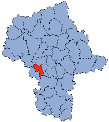
map_caption = Location within the voivodeship

map_caption1 = Division into gminas
subdivision_type = Country
subdivision_name = POL
subdivision_type1 = Voivodeship
subdivision_name1 = Masovian
area_total_km2 = 366.87
population_total = 78208
population_as_of = 2006
population_density_km2 = auto
population_urban = 46539
population_blank1_title = Rural
population_blank1 = 31669
coor_type = Grodzisk Mazowiecki
latd = 52
latm = 6
lats = 32
latNS = N
longd = 20
longm = 37
longs = 30
longEW = E
seat =Grodzisk Mazowiecki
parts_type =Gmina s
parts = Total 6 (incl. 2 urban)
p1 =Milanówek
p2 =Podkowa Leśna
p3 = Gmina Baranów
p4 =Gmina Grodzisk Mazowiecki
p5 =Gmina Jaktorów
p6 =Gmina Żabia Wola
blank_name = Car plates
blank_info = WGM
website = http://www.powiat-grodziski.pl __NOTOC__Grodzisk Mazowiecki County ( _pl. powiat grodziski) is a unit of territorial administration and local government (powiat ) inMasovian Voivodeship , east-centralPoland . It was created onJanuary 1 ,1999 as a result of the Local Government Reorganization Act of 1998. Its administrative seat and largest town isGrodzisk Mazowiecki , which lies convert|29|km|mi|0 south-west ofWarsaw . The county also contains the towns ofMilanówek , lying convert|2|km|mi|0|abbr=on north-east of Grodzisk Mazowiecki, andPodkowa Leśna , convert|8|km|mi|0|abbr=on east of Grodzisk Mazowiecki.The county covers an area of convert|366.87|km2|sqmi|1. As of 2006 its total population is 78,208, out of which the population of Grodzisk Mazowiecki is 27,055, that of Milanówek is 15,660, that of Podkowa Leśna is 3,824, and the rural population is 31,669.
Neighbouring counties
Grodzisk Mazowiecki County is bordered by
Warsaw West County to the north-east,Pruszków County andPiaseczno County to the east,Grójec County to the south, andŻyrardów County andSochaczew County to the west.Administrative division
The county is subdivided into six
gmina s (two urban, one urban-rural and three rural). These are listed in the following table, in descending order of population.References
* [http://www.stat.gov.pl/gus/45_655_PLK_HTML.htm Polish official population figures 2006]

Wikimedia Foundation. 2010.