- Wołomin County
Infobox Settlement
name = Wołomin County
native_name = Powiat wołomiński
settlement_type = County
total_type = Total
image_shield = POL powiat wołomiński COA.svg
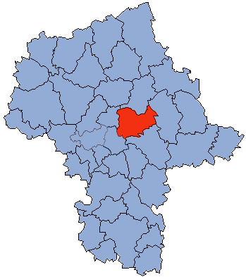
map_caption = Location within the voivodeship

map_caption1 = Division into gminas
subdivision_type = Country
subdivision_name = POL
subdivision_type1 = Voivodeship
subdivision_name1 = Masovian
area_total_km2 = 955.37
population_total = 202444
population_as_of = 2006
population_density_km2 = auto
population_urban = 134733
population_blank1_title = Rural
population_blank1 = 67711
coor_type = Wołomin
latd = 52
latm = 21
lats =
latNS = N
longd = 21
longm = 14
longs =
longEW = E
seat =Wołomin
parts_type =Gmina s
parts = Total 12 (incl. 4 urban)
p1 =Kobyłka
p2 =Marki
p3 =Ząbki
p4 =Zielonka
p5 =Gmina Dąbrówka
p6 =Gmina Jadów
p7 =Gmina Klembów
p8 = Gmina Poświętne
p9 =Gmina Radzymin
p10 =Gmina Strachówka
p11 =Gmina Tłuszcz
p12 =Gmina Wołomin
blank_name = Car plates
blank_info = WWL, WV
website = http://www.powiat-wolominski.pl __NOTOC__Wołomin County ( _pl. powiat wołomiński) is a unit of territorial administration and local government (powiat ) inMasovian Voivodeship , east-centralPoland . It was created onJanuary 1 ,1999 as a result of the Local Government Reorganization Act of 1998. Its administrative seat and largest town isWołomin , which lies convert|22|km|mi|0 north-east ofWarsaw . The county contains six other towns:Ząbki , convert|11|km|mi|0|abbr=on south-west of Wołomin,Marki , convert|10|km|mi|0|abbr=on west of Wołomin,Kobyłka , convert|3|km|mi|0|abbr=on south-west of Wołomin,Zielonka , convert|8|km|mi|0|abbr=on south-west of Wołomin,Radzymin , convert|9|km|mi|0|abbr=on north-west of Wołomin, andTłuszcz , convert|18|km|mi|0|abbr=on north-east of Wołomin.The county covers an area of convert|955.37|km2|sqmi|1. As of 2006 its total population is 202,444, out of which the population of Wołomin is 36,711, that of Ząbki is 24,422, that of Marki is 23,376, that of Kobyłka is 17,897, that of Zielonka is 17,180, that of Radzymin is 7,864, that of Tłuszcz is 7,283, and the rural population is 67,711.
Neighbouring counties
Wołomin County is bordered by
Wyszków County to the north,Węgrów County to the east,Mińsk County to the south-east, the city ofWarsaw to the south-west andLegionowo County to the west.Administrative division
The county is subdivided into 12
gmina s (four urban, three urban-rural and five rural). These are listed in the following table, in descending order of population.References
* [http://www.stat.gov.pl/gus/45_655_PLK_HTML.htm Polish official population figures 2006]

Wikimedia Foundation. 2010.