- Weimar, California
-
Weimar — Unincorporated community — Location in California
 Weimar
Coordinates: 39°02′15″N 120°58′21″W / 39.0375°N 120.9725°WCoordinates: 39°02′15″N 120°58′21″W / 39.0375°N 120.9725°W Country  United States
State  California
County Placer County Elevation[1] 2,257 ft (688 m) ZIP code 95739, 95713 Area code(s) 530 GNIS feature ID 237401[2] Weimar (formerly, New England Mills and Weimer) is an unincorporated community in Placer County, California,[1] located in the Sacramento area. Weimar is located 4.5 miles (7.2 km) south-southwest of Colfax.[3]
By car, Weimar is about one hour from Reno, Nevada and about one hour northeast of Sacramento, California on east I-80. It is directly adjacent to Interstate 80. Amtrak stops at Colfax, California which is about 3 miles east on I-80 past Weimar. Weimar, California was originally named New England Mills. The elevation is about 2300-2600 feet.
Weimar has a campground in it, and also has access to the North Fork of the American River. The former Weimar Sanitorium, a Tuberculosis treatment hospital, is now Weimar Institute, home to the NewStart health program. The Institute also includes Weimar College, and Weimar Academy, a boarding school for high school students, both run by the Seventh-day Adventist Church. It is also home to the Weimar Hills Charter School, which offers grades 4th through 8th.
The town was named Weimar after the German city by immigrants to the area.
The Weimar post office opened in 1866.[3] Its ZIP code is 95736 and its area code 530.
References
- ^ a b U.S. Geological Survey Geographic Names Information System: Weimar, California
- ^ "US Board on Geographic Names". United States Geological Survey. 2007-10-25. http://geonames.usgs.gov. Retrieved 2008-01-31.
- ^ a b Durham, David L. (1998). California's Geographic Names: A Gazetteer of Historic and Modern Names of the State. Quill Driver Books. p. 575. ISBN 9781884995149.
Municipalities and communities of Placer County, California Cities and towns 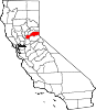
CDPs Alta | Carnelian Bay | Dollar Point | Dutch Flat | Foresthill | Granite Bay | Kings Beach | Kingvale‡ | Meadow Vista | Newcastle | North Auburn | Penryn | Sheridan | Sunnyside-Tahoe City | Tahoe Vista | Tahoma‡
Unincorporated
communitiesAlpine Meadows | Applegate | Baxter | Big Bend | Blue Canyon | Brockway | Cape Horn | Casa Loma | Chambers Lodge | Cisco | Cisco Grove | Clayton | Clipper Gap | Donner | Eder | Elders Corner | Emigrant Gap | Forebay | Four Acres | Gold Hill | Greekstore | Heather Glen | Hidden Valley | Homewood | Hughes Mill | Idlewild | Iowa Hill | Kilaga Springs | Lake Forest | Lander Crossing | Last Chance | Magra | McCulloh | Michigan Bluff | Midas | Monte Vista | Nielsburg | Ophir | Pinecroft | Rainbow | Rampart | Ramsey Crossing | Rawhide | Secret Town | Soda Springs | Squaw Valley | Sunnyside | Tahoe City | Tahoe Pines | The Cedars | Todd Valley | Towle | Troy | Virginiatown | Westville | Weimar | Whitney | Yankee Jims | Zuver
Ghost
townsAckerman | Andover | Arctic | Baltimore | Bath | Blue Bluffs | Bullion | Cairns | Ceres Flat | Chicago Park | Coon Creek | Deadwood | Drum | East Auburn | Flat Ravine | Florence Spring | Fort Trojan | Frytown | Fulda | Gilsons Station | Goggins | Gold Run | Indiana Hill | Knapp | Kulkumish | Leta | Little Rattlesnake Bar | Lone Star | Lost Camp | Mayflower | Millertown | Mineral Bar | Molma | Moss Hills | Oilville | Pine Grove | Pitsokut | Ralston | Red Point | Secret Canyon | Secret Ravine | Smiths | Spruce | Stanford | Stewarts Flat | Stonehill | Tamarack | Union Shed | Vantrent | Webster | Yorkville
Footnotes ‡This CDP also has portions in an adjacent county or counties
Categories:- Populated places in Placer County, California
- Unincorporated communities in California
- Sacramento metropolitan area


Wikimedia Foundation. 2010.