- Foresthill, California
Infobox Settlement
official_name = Foresthill, California
settlement_type = CDP
imagesize =
image_caption =
image_
imagesize =
image_caption =
image_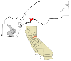
mapsize = 250x200px
map_caption = Location in Placer County and the state ofCalifornia
mapsize1 =
map_caption1 =
subdivision_type = Country
subdivision_type1 = State
subdivision_type2 = County
subdivision_name =United States
subdivision_name1 =California
subdivision_name2 = Placer
government_type =
leader_title = N/A
leader_name =
leader_title1 = State Senate
leader_name1 =Dave Cox (R)
leader_title2 = State Assembly
leader_name2 =Ted Gaines (R)
leader_title3 = U. S. Congress
leader_name3 =John Doolittle (R)
established_date =
area_magnitude =
area_total_km2 = 29
area_total_sq_mi = 11.2
area_land_km2 = 29
area_land_sq_mi = 11.2
area_water_km2 = 0
area_water_sq_mi = 0
elevation_ft = 3228
elevation_m = 984
population_as_of = 2000
population_footnotes =
population_total = 1791
population_metro =
population_density_km2 = 61.8
population_density_sq_mi = 159.9
timezone = PST
utc_offset = -8
latd = 39 |latm = 1 |lats = 10 |latNS = N
longd = 120 |longm = 50 |longs = 10 |longEW = W
timezone_DST = PDT
utc_offset_DST = -7
postal_code_type =ZIP code
postal_code = 95631
area_code = 530
blank_name = FIPS code
blank_info = 06-24834
blank1_name = GNIS feature ID
blank1_info = 0277518
footnotes =
website =Foresthill is a
census-designated place (CDP) in Placer County,California ,United States . It is part of the Sacramento–Arden-Arcade–Roseville Metropolitan Statistical Area. The population was 1,791 at the 2000 census.Geography
Foresthill is located at coor dms|39|1|10|N|120|50|10|W|city (39.019562, -120.836085)GR|1.
According to the
United States Census Bureau , the CDP has a total area of 11.2 square miles (29.0 km²), all of it land.Demographics
As of the
census GR|2 of 2000, there were 1,791 people, 673 households, and 465 families residing in the CDP. Thepopulation density was 159.9 people per square mile (61.7/km²). There were 717 housing units at an average density of 64.0/sq mi (24.7/km²). The racial makeup of the CDP was 90.34% White, 0.61% Black or African American, 2.68% Native American, 0.06% Asian, 0.45% Pacific Islander, 1.95% from other races, and 3.91% from two or more races. 5.75% of the population were Hispanic or Latino of any race.There were 673 households out of which 38.2% had children under the age of 18 living with them, 49.6% were married couples living together, 12.9% had a female householder with no husband present, and 30.8% were non-families. 22.3% of all households were made up of individuals and 7.4% had someone living alone who was 65 years of age or older. The average household size was 2.66 and the average family size was 3.14.
In the CDP the population was spread out with 30.2% under the age of 18, 6.4% from 18 to 24, 30.3% from 25 to 44, 23.1% from 45 to 64, and 10.1% who were 65 years of age or older. The median age was 36 years. For every 100 females there were 105.6 males. For every 100 females age 18 and over, there were 102.8 males.
The median income for a household in the CDP was $34,348, and the median income for a family was $41,161. Males had a median income of $41,438 versus $25,813 for females. The
per capita income for the CDP was $19,409. About 9.9% of families and 12.6% of the population were below thepoverty line , including 17.2% of those under age 18 and 4.8% of those age 65 or over.History
Foresthill is located on a broad ridge between the North and Middle Forks of the
American River on the gold-bearing gravel bed of an ancient river. In the spring of 1850, miners came to the Forest Hill Divide in large numbers. There was one route from Auburn through Yankee Jim's and one from Coloma. At the junction of these trails, the Forest House hotel and trading post was built. The height of mining activity in Forest Hill began in 1853 after a winter landslide at the head of Jenny Lind Canyon exposed numerous nuggets of gold. The Jenny Lind mine produced about $2,500 of gold a day for a while, up to a total output over $1 million by 1880. The combined production of all the mines in the Forest Hill area was estimated at $10 million by 1868 with gold selling for $16 an ounce. In the 1860s, there were about convert|125000|ft|m of hard-rock runnels dug into the hillsides in, around and under Forest Hill. By 1857, this area had become an important center for trade among the many gold camps on the divide. In 1862, the Hardy-Kennedy building was erected - the first fireproof store in Forest Hill. This building, now known as the Langstaff building, is still being used by the merchants of Foresthill. By 1880, Forest Hill was one of the largest towns in Placer County. The town had an convert|80|ft|m|sing=on wide main street befitting such an important place.References
External links
* [http://mmoffet.mystarband.net/ Foresthill Historical Society]
Wikimedia Foundation. 2010.