- Loomis, California
Infobox Settlement
official_name = Loomis, California
settlement_type =Town
imagesize =
image_caption =
image_
imagesize =
image_caption =
image_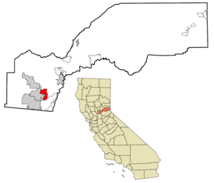
mapsize = 250x200px
map_caption = Location in Placer County and the state ofCalifornia
mapsize1 =
map_caption1 =
subdivision_type = Country
subdivision_type1 = State
subdivision_type2 = County
subdivision_name =United States
subdivision_name1 =California
subdivision_name2 = Placer
government_type =
leader_title = Mayor
leader_name =
leader_title1 = State Senate
leader_name1 =Sam Aanestad (R)
leader_title2 = State Assembly
leader_name2 =Ted Gaines (R)
leader_title3 = U. S. Congress
leader_name3 =John Doolittle (R)
established_date =
area_magnitude =
area_total_km2 = 19
area_total_sq_mi = 7.3
area_land_km2 = 19
area_land_sq_mi = 7.3
area_water_km2 = 0
area_water_sq_mi = 0
elevation_ft = 404
elevation_m = 123
population_as_of = 2000
population_footnotes =
population_total = 6260
population_metro =
population_density_km2 = 329.5
population_density_sq_mi = 857.5
timezone = PST
utc_offset = -8
latd = 38 |latm = 48 |lats = 59 |latNS = N
longd = 121 |longm = 11 |longs = 34 |longEW = W
timezone_DST = PDT
utc_offset_DST = -7
postal_code_type =ZIP code
postal_code = 95650
area_code = 916
blank_name = FIPS code
blank_info = 06-43140
blank1_name = GNIS feature ID
blank1_info = 0277546
footnotes =
website =Loomis is an incorporated town in Placer County,
California ,United States . It is part of the Sacramento–Arden-Arcade–Roseville Metropolitan Statistical Area. The population was 6,260 at the 2000 census. It is home toDel Oro High School .Geography
Loomis is located at coor dms|38|48|59|N|121|11|34|W|city (38.816436, -121.192778)GR|1.
According to the
United States Census Bureau , the town has a total area of 7.3square mile s (19.0km² ), all of it land. Stream drainages are Antelope Creek andSecret Ravine .Demographics
As of the
census GR|2 of 2000, there were 6,260 people, 2,206 households, and 1,729 families residing in the town. Thepopulation density was 851.9 people per square mile (328.8/km²). There were 2,273 housing units at an average density of 309.3/sq mi (119.4/km²). The racial makeup of the town was 89.06% White, 0.19% African American, 0.96% Native American, 3.23% Asian, 0.18% Pacific Islander, 2.01% from other races, and 4.38% from two or more races. Hispanic or Latino of any race were 6.87% of the population.There were 2,206 households out of which 39.1% had children under the age of 18 living with them, 62.3% were married couples living together, 11.1% had a female householder with no husband present, and 21.6% were non-families. 16.8% of all households were made up of individuals and 6.6% had someone living alone who was 65 years of age or older. The average household size was 2.82 and the average family size was 3.17.
In the town the population was spread out with 28.8% under the age of 18, 6.4% from 18 to 24, 27.6% from 25 to 44, 25.5% from 45 to 64, and 11.7% who were 65 years of age or older. The median age was 38 years. For every 100 females there were 98.7 males. For every 100 females age 18 and over, there were 94.3 males.
The median income for a household in the town was $60,444, and the median income for a family was $64,837. Males had a median income of $50,458 versus $31,140 for females. The
per capita income for the town was $30,384. About 2.5% of families and 3.4% of the population were below thepoverty line , including 3.4% of those under age 18 and 0.4% of those age 65 or over.History
Loomis takes its name from one the of town's pioneers, James Loomis. At one time, James Loomis was the whole town--saloon keeper, railroad agent, express agent, and postmaster.In the early part of the 20th century, Loomis was the second largest fruit-shipping station in Placer County.
Loomis remained part of unincorporated Placer County until
December 17 ,1984 , when the Town of Loomis officially incorporated. The town was in danger of being annexed by its neighbor Rocklin and the residents voted to incorporate to preserve local control, partly on the issue of preserving the "small town" character and historic structures such as the High Hand and Blue Goose fruit packing sheds which sit between Taylor Road (a segment of historic Highway 40, also known as theLincoln Highway ) and theUnion Pacific Railroad tracks.Loomis is South of I-80 and North of Highway 50.
Famous residents
*
Ron Artest ,Sacramento Kings small forward/shooting guardReferences
External links
* [http://www.loomis.ca.gov Town of Loomis]
* [http://www.soplacerheritage.org South Placer Heritage Society]
* [http://loomisfire.org/ Loomis Fire Protection District]
Wikimedia Foundation. 2010.