- Kings Beach, California
:"For the suburb & beach in
Queensland ,Australia , seeKings Beach, Queensland .Infobox Settlement
official_name = Kings Beach, California
settlement_type = CDP
imagesize =
image_caption =
image_
imagesize =
image_caption =
image_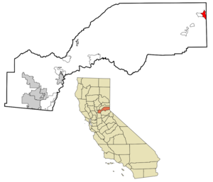
mapsize = 250x200px
map_caption = Location in Placer County and the state ofCalifornia
mapsize1 =
map_caption1 =
subdivision_type = Country
subdivision_type1 = State
subdivision_type2 = County
subdivision_name =United States
subdivision_name1 =California
subdivision_name2 = Placer
government_type =
leader_title = N/A
leader_name =
leader_title1 = State Senate
leader_name1 =Dave Cox (R)
leader_title2 = State Assembly
leader_name2 =Ted Gaines (R)
leader_title3 = U. S. Congress
leader_name3 =John Doolittle (R)
established_date =
area_magnitude =
area_total_km2 = 8.9
area_total_sq_mi = 3.4
area_land_km2 = 8.9
area_land_sq_mi = 3.4
area_water_km2 = 0
area_water_sq_mi = 0
elevation_ft = 6250
elevation_m = 1905
population_as_of = 2000
population_footnotes =
population_total = 4037
population_metro =
population_density_km2 = 453.6
population_density_sq_mi = 1187.4
timezone = PST
utc_offset = -8
latd = 39 |latm = 14 |lats = 28 |latNS = N
longd = 120 |longm = 1 |longs = 24 |longEW = W
timezone_DST = PDT
utc_offset_DST = -7
postal_code_type =ZIP code
postal_code = 96143
area_code = 530
blank_name = FIPS code
blank_info = 06-38548
blank1_name = GNIS feature ID
blank1_info = 1662302
footnotes =
website =Kings Beach is a
census-designated place (CDP) in Placer County,California ,United States . It is part of the Sacramento–Arden-Arcade–Roseville Metropolitan Statistical Area. The population was 4,037 at the 2000 census.Geography
Kings Beach is located at coor dms|39|14|28|N|120|1|24|W|city (39.241170, -120.023295)GR|1.
According to the
United States Census Bureau , the CDP has a total area of 3.4square mile s (8.9km² ), all of it land.Demographics
As of the censusGR2 of 2000, there were 4,037 people, 1,411 households, and 788 families residing in the CDP. The population density was 454.4/km² (1,176.4/sq mi). There were 2,284 housing units at an average density of 665.6/sq mi (257.1/km²). The racial makeup of the CDP was 70.03% White, 0.72% Black or African American, 1.88% Native American, 0.40% Asian, 0.02% Pacific Islander, 23.61% from other races, and 3.34% from two or more races. 48.43% of the population were Hispanic or Latino of any race.
There were 1,411 households out of which 34.8% had children under the age of 18 living with them, 39.4% were married couples living together, 8.9% had a female householder with no husband present, and 44.1% were non-families. 28.3% of all households were made up of individuals and 3.0% had someone living alone who was 65 years of age or older. The average household size was 2.86 and the average family size was 3.69.
In the CDP the population was spread out with 28.0% under the age of 18, 13.3% from 18 to 24, 38.0% from 25 to 44, 17.4% from 45 to 64, and 3.4% who were 65 years of age or older. The median age was 29 years. For every 100 females there were 122.9 males. For every 100 females age 18 and over, there were 133.2 males.
The median income for a household in the CDP was $35,507, and the median income for a family was $37,837. Males had a median income of $25,880 versus $21,571 for females. The per capita income for the CDP was $16,556. About 17.1% of families and 17.7% of the population were below the poverty line, including 20.3% of those under age 18 and 4.1% of those age 65 or over.
References
External links
Wikimedia Foundation. 2010.