- Drum, Placer County, California
-
Drum — Former settlement — Location in California
 Drum
DrumCoordinates: 39°14′57″N 120°45′13″W / 39.24917°N 120.75361°WCoordinates: 39°14′57″N 120°45′13″W / 39.24917°N 120.75361°W Country  United States
State  California
County Placer County Elevation[1] 4,655 ft (1,419 m) Drum is a former settlement in Placer County, California.[1] Drum is located 5 miles (8.0 km) east-northeast of Dutch Flat.[2] It lay at an elevation of 4655 feet (1419 m).[1]
The Drum post office operated from 1913 to 1915.[2]
References
Municipalities and communities of Placer County, California County seat: Auburn Cities and towns 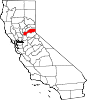
CDPs Alta | Carnelian Bay | Dollar Point | Dutch Flat | Foresthill | Granite Bay | Kings Beach | Kingvale‡ | Meadow Vista | Newcastle | North Auburn | Penryn | Sheridan | Sunnyside-Tahoe City | Tahoe Vista | Tahoma‡
Unincorporated
communitiesAlpine Meadows | Applegate | Baxter | Big Bend | Blue Canyon | Brockway | Cape Horn | Casa Loma | Chambers Lodge | Cisco | Cisco Grove | Clayton | Clipper Gap | Donner | Eder | Elders Corner | Emigrant Gap | Forebay | Four Acres | Gold Hill | Greekstore | Heather Glen | Hidden Valley | Homewood | Hughes Mill | Idlewild | Iowa Hill | Kilaga Springs | Lake Forest | Lander Crossing | Last Chance | Magra | McCulloh | Michigan Bluff | Midas | Monte Vista | Nielsburg | Ophir | Pinecroft | Rainbow | Rampart | Ramsey Crossing | Rawhide | Secret Town | Soda Springs | Squaw Valley | Sunnyside | Tahoe City | Tahoe Pines | The Cedars | Todd Valley | Towle | Troy | Virginiatown | Westville | Weimar | Whitney | Yankee Jims | Zuver
Ghost
townsAckerman | Andover | Arctic | Baltimore | Bath | Blue Bluffs | Bullion | Cairns | Ceres Flat | Chicago Park | Coon Creek | Deadwood | Drum | East Auburn | Flat Ravine | Florence Spring | Fort Trojan | Frytown | Fulda | Gilsons Station | Goggins | Gold Run | Indiana Hill | Knapp | Kulkumish | Leta | Little Rattlesnake Bar | Lone Star | Lost Camp | Mayflower | Millertown | Mineral Bar | Molma | Moss Hills | Oilville | Pine Grove | Pitsokut | Ralston | Red Point | Secret Canyon | Secret Ravine | Smiths | Spruce | Stanford | Stewarts Flat | Stonehill | Tamarack | Union Shed | Vantrent | Webster | Yorkville
Footnotes ‡This CDP also has portions in an adjacent county or counties
Categories:- Former settlements in Placer County, California
- Former populated places in California
- Sacramento Valley geography stubs


Wikimedia Foundation. 2010.