- Coastline of the United Kingdom
-
For the problem in fractal geometry, see How Long Is the Coast of Britain?.
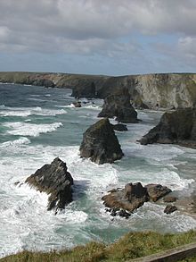 Bedruthan Steps, North Cornwall, A spectacular section of the UK coastline, managed by the National Trust.
The coastline of the United Kingdom is long in comparison to the coastline of similar sized countries;[1] it is accessible and very varied in geography and habitats.
The mapping authority for the United Kingdom, the Ordnance Survey, records the coastline of the main island, Great Britain, as 11,072.76 miles rounding to 11,073 miles (17,820 km). If the larger islands are added the coastline, as measured by the standard method at Mean High Water Mark, rises to about 19,491 miles (31,368 km).
According to the CIA Factbook, the length of the UK coastline is around 12,429 km or 7723 miles. For comparison the Factbook also shows the coastline of Italy (7,600 km), Spain (4,964 km) or France (3,427 km). The CIA Factbook figures may be useful comparatively but no detail is provided as to how they were calculated.
Note that the measurement of any coastline is subject to variation depending upon the scale of map used and is an approximation. The smaller the map scale and the smaller the ruler will result in more detail being revealed and thus a greater length. This is referred to as the coastline paradox. A coastline is also fractal — which roughly means that it is self similar, the same at every scale — the closer the observer looks, the more detail is revealed, leading to a greater overall length.)[citation needed]
Nowhere in the UK is more than 113 kilometres (70 mi) from the coast. It is estimated that around 3 million people (out of 60 million) live on the coast of the UK. The place furthest from the coast is Coton in the Elms in Derbyshire, which is equidistant from Fosdyke Wash in Lincolnshire; White Sands between Neston in Cheshire and Flint, Flintshire in Wales; and Westbury-on-Severn Gloucestershire.[2][3]
The geography of the UK coastline consists of a variety of natural features. These consist of islands, bays, headlands and peninsulas. Of the 1,000+ islands within the UK, only 290 are permanently inhabited. Of the remaining islands, some are used for farming and are occupied occasionally, some are nature reserves with restricted access and some are little more than sea-swept rocks. The main occupied islands and island groups in the UK are as follows.
- Great Britain
- Ireland (Northern Ireland to UK)
- Lewis and Harris
- Skye
- Shetland
- Mull
- The Uist archipeligo
- Islay
- Jura
- Orkney
- Yell
- Unst
- Barra
- Arran
- Bute
- Great Bernera
- Isle of Man
- Anglesey
- Hoy
- Isle of Wight
- (Note that the Channel Islands (including Jersey, Guernsey, Alderney and Sark) and the Isle of Man are not part of the UK. They are self-governing Crown dependencies. Their coastlines are not coastlines of the United Kingdom.)
Peninsulas around the UK coast include:
- Ards Peninsula
- Furness
- Fife
- The Black Isle
- Easter Ross
- Gower Peninsula
- Kintyre
- Llŷn Peninsula
- Penwith
- Pembrokeshire
- Rhins of Galloway
- The Wirral
Bays, sea lochs, (loughs) and large estuaries include:
- Loch Fyne
- Loch Long
- Loch Linnhe
- Lochs Torridon, Carron, Etive, Creran, Eriboll, Seaforth and about a hundred others
- Belfast Lough
- Bristol Channel
- Cardigan Bay
- Dee Estuary
- Firth of Clyde
- Firth of Forth
- Firth of Tay
- Humber Estuary
- Lough Foyle
- Luce Bay
- Lyme Bay
- Mersey Estuary
- Moray Firth
- Morecambe Bay
- Solway Firth
- Strangford Lough
- Swansea Bay
- Thames Estuary
- The Solent
- River Tamar
- The Wash
See also
- Heritage Coast
- Jurassic Coast
- Land's End to John o' Groats
- List of places on the British coastline
- List of places on the Jurassic Coast
References
- ^ Cartopics > How long is the UK coastline?, The British Cartographic Society.
- ^ BBC report centre of England
- ^ Ordnance Survey - MapZone
External links
Categories:- Coasts of the United Kingdom

Wikimedia Foundation. 2010.