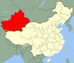
- Keriya Town
-
Coordinates: 36°53′N 81°36′E / 36.883°N 81.6°E Keriya Town or Mugala Town (Chinese: 木尕拉镇, Pinyin: Mùgǎlā Zhèn; Ugyhur: كېرىيە / Keriyə), is a town in Keriya County, Xinjiang Uygur Autonomous Region, China, on the old Southern Silk Road. As the commercial and administrative centre of Keriya County, it is about 166 km east of Khotan, 80 km east of Qira, and 120 km west of Niya. Yutian County has a population of about 160,000.
Contents
History
During the Former Han Dynasty the kingdom based on the Keriya Oasis was known as Wumi (扜彌) and that there were, "3340 households, 20040 individuals with 3540 persons able to bear arms".[1] These figures seem to be out of balance with too a high number of individuals per household. Perhaps to correct this, the Hou Hanshu - which records the kingdom as Jumi (拘彌) - states that, during the Later Han Dynasty (25-220 CE), there were, "2,173 households, 7,251 individuals, and 1,760 people able to bear arms."[2] The later Weilüe and the Tangshu refer to Keriya as Hanmi 扞彌.[3]
Both the Hanshu and the Hou Hanshu place this kingdom 390 li [162 km] east of Khotan. This is very close to the distance between Khotan and Keriya on modern maps, and confirms the identification of Wumi/Jumi with Keriya.[4]
The small modern town of Keriya is situated on the western bank of the Keriya River. Approximately 180 km north along the Keriya River is the ancient fortified site of Karadong where the world's oldest Buddhist murals have been found. It was abandoned in the 4th century CE. Another site, Yuan Sha, some 40 km north of Karadong, dates from the Iron Age but was abandoned by about 130 BCE.
There is a village about 75 km south of Keriya called Pulu. There are a number of peaks over 6,000 metres to the south of the oasis including Qong Muztag at 6,962 m (22,841 ft) in the upper Keriya River Valley. About 100 families of the distinctive Keriya Uyghurs, who are said to be quite distinct from other Uyghurs, live at Tangzubasti Village, about 170 km north of the town of Yutian. It is said to be on the ruins of the ancient city of Keladun where artifacts from the Han Dynasty (206 BCE-222 CE) have been found.
Marco Polo visited the oasis in the late 13th century. He described it as being five day's journey in extent, but with sandy deserts to both east and west. Both the Province and the "most splendid" capital city were called Pem. He notes that the people "all worship Mahomet" and that there were many towns and villages. "It is amply stocked with the means of life" with rich estates including orchards, vineyards, and lots of cotton. He also mentions that "jasper" (probably nephrite jade) and chalcedony were found in the rivers and the people "live by trade and industry" and were "not at all war-like."
Gold mines were reported near Keriya in the 19th century.[5]
Footnotes
References
- Baumer, Christoph. 2000. Southern Silk Road: In the Footsteps of Sir Aurel Stein and Sven Hedin. White Orchid Books. Bangkok.
- Bonavia, Judy 2004. The Silk Road From Xi’an to Kashgar. Revised by Chrisoph Baumer. 2004. Odyssey Publications. ISBN 962-217-741-7
- Hill, John E. (2009). Through the Jade Gate to Rome: A Study of the Silk Routes during the Later Han Dynasty, 1st to 2nd Centuries CE. BookSurge, Charleston, South Carolina. ISBN 978-1-4392-2134-1.
- Hulsewé, A. F. P. (1979). China in Central Asia: The Early Stage 125 BC – AD 23: an annotated translation of chapters 61 and 96 of the History of the Former Han Dynasty. E. J. Brill, Leiden.
- Latham, Ronald. 1958. The Travels of Marco Polo. Translated and Introduced by Ronald Latham. Reprint 1982 by Abaris Books, New York. ISBN 0-89835-058-1
- Mallory, J. P. and Mair, Victor H. (2000). The Tarim Mummies: Ancient China and the Mystery of the Earliest Peoples from the West. Thames & Hudson. London. ISBN 0-500-05101-1
- Skrine, C. P. 1926. Chinese Central Asia. Methuen, London. Reprint: Barnes & Noble, New York. 1971.
- Stein, M. Aurel 1907. Ancient Khotan: Detailed report of archaeological explorations in Chinese Turkestan, 2 vols. Oxford. Clarendon Press.
- Stein, M. Aurel 1912. Ruins of Desert Cathay: Personal narrative of explorations in Central Asia and westernmost China, 2 vols. Reprint: Delhi. Low Price Publications. 1990.
- Stein, M. Aurel 1921. Serindia: Detailed report of explorations in Central Asia and westernmost China, 5 vols. London. Oxford. Clarendon Press. Reprint: Delhi. Motilal Banarsidass. 1980.
- Yu, Taishan. 2004. A History of the Relationships between the Western and Eastern Han, Wei, Jin, Northern and Southern Dynasties and the Western Regions. Sino-Platonic Papers No. 131 March, 2004. Dept. of East Asian Languages and Civilizations, University of Pennsylvania.
External links
- Slideshow of archaeological sites along the Keriya River [1]
- 3000 year old archaeological finds at Liushui Village, Yutian County [2]
- Archaeological GIS and Oasis Geography in the Tarim Basin [3]
- Description of the Keriya Uyghur people by a Christian evangelical group. [4]
- Site showing photos of the mosque and a statue in Keriya town. [5]
Categories:- Populated places along the Silk Road
- Central Asian Buddhist kingdoms
- Central Asian Buddhist sites
- Uyghurs
- Populated places in Xinjiang
- Ancient peoples of China
- Former countries in Chinese history
- Oases of China
Wikimedia Foundation. 2010.

