- Oxford Township, Erie County, Ohio
-
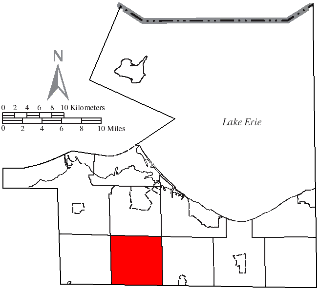
Oxford Township, Erie County, Ohio — Township — Along the West Branch of the Huron River in southeastern Oxford Township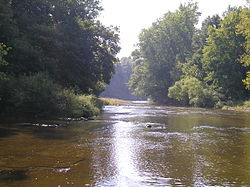 Location of Oxford Township in Erie County
Coordinates: 41°19′43″N 82°41′16″W / 41.32861°N 82.68778°WCoordinates: 41°19′43″N 82°41′16″W / 41.32861°N 82.68778°W Country United States State Ohio County Erie Area – Total 26.1 sq mi (67.6 km2) – Land 26.0 sq mi (67.4 km2) – Water 0.1 sq mi (0.3 km2) Elevation[1] 696 ft (212 m) Population (2000) – Total 1,096 – Density 42.1/sq mi (16.3/km2) Time zone Eastern (EST) (UTC-5) – Summer (DST) EDT (UTC-4) FIPS code 39-59276[2] GNIS feature ID 1086068[1] Website http://www.oxfordtownshipohio.com/ Oxford Township is one of the nine townships of Erie County, Ohio, United States. It is part of the Sandusky, Ohio metropolitan statistical area. The 2000 census found 1,096 people in the township, fewer than any other township in the county.[3]
Contents
Geography
Located in the southwestern part of Erie County, it borders the following townships:
- Perkins Township - north
- Huron Township - northeast
- Milan Township - east
- Norwalk Township, Huron County - southeast
- Ridgefield Township, Huron County - south
- Lyme Township, Huron County - southwest
- Groton Township - west
- Margaretta Township - northwest
No municipalities are located in Oxford Township, although the unincorporated community of Bloomingville lies in the township's north.
Oxford Township is part of the Firelands, which in turn is part of the Connecticut Western Reserve.
Topography
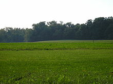 Farm fields and woodlots are a common scene across Oxford Township.
Oxford Township lies within two river watersheds, both flowing into Lake Erie. The majority of the township is within the Huron River watershed while the northwestern area of the township is within the Sandusky Bay watershed. [4]
The majority of the topography of the township includes extremely flat to slightly rolling land; farm fields and small woodlots are in abundance. In the far southeast portion of the township, however, the topography becomes rugged with steep cliffs and dense woods near the west branch of the Huron River. Some of the cliffs are over 100 feet (30 m) high. There are even some small waterfalls near Peru Center Road and Schaffer Road that are approximately 75 feet (23 m) high.
Two state natural areas are located within this township. Erie Sand Barrens State Nature Preserve, a 32-acre (130,000 m2) park in the northwest part of the township, can be accessed from Mason Road and Taylor Road.[5] The 296-acre (1.20 km2) Milan State Wildlife Area in the southeast part of the township can be accessed from State Route 113 and Lovers Lane.[6]
Name and history
Oxford Township is one of only thirty townships located in a unique subregion of the Connecticut Western Reserve, known as the Firelands. Established in 1792, this half-million-acre tract of land (originally known as the Fire Sufferers Land) was given by the Connecticut Legislature to the citizens of towns which were invaded and damaged by British troops during the American Revolutionary War.[7]
It is one of six Oxford Townships statewide.[8]
Government
Regional and national government
- All of Oxford Township is located within the Ohio 9th District of the US House of Representatives. Marcy Kaptur (D-Toledo) is the elected official for this district, which spans the Lake Erie shoreline from Toledo to the western suburbs of Cleveland.
- All of Oxford Township is located within the Ohio State 2nd Senate District. Mark Wagoner (R-Ottawa Hills) is the elected official for this district (and also serves as the Senate Majority Whip).
- All of Oxford Township is located within the Ohio State 80th House District. Dennis Murray (D-Sandusky) is the representative for this district.
Local government
The township is governed by a three-member board of trustees, who are elected in November of odd-numbered years to a four-year term beginning on the following January 1. Two are elected in the year after the presidential election and one is elected in the year before it. There is also an elected township fiscal officer,[9] who serves a four-year term beginning on April 1 of the year after the election, which is held in November of the year before the presidential election. Vacancies in the fiscal officership or on the board of trustees are filled by the remaining trustees.
Public services
Transportation
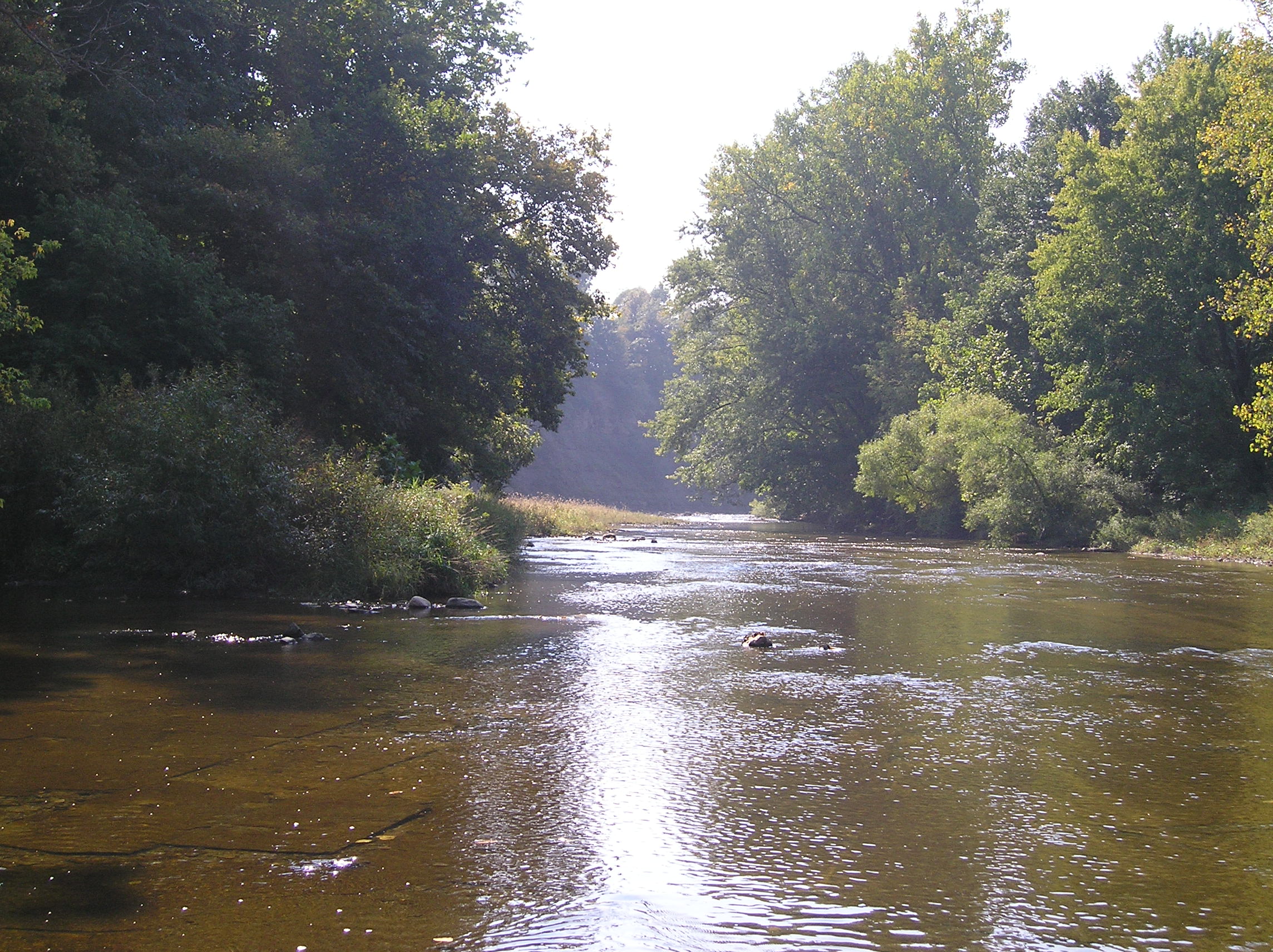
 An early winter view from Ransom Road just south of NASA Plum Brook Station in Oxford Township.
The Ohio Turnpike passes through Oxford Township, as does Ohio State Routes 99 and 113. Other important county and township highways include Mason Road, Patten Tract Road, Ransom Road, Strecker Road, and Thomas Road.
Communication
Addresses in Oxford Township have several different ZIP codes:
- 44846 (Milan), in the east
- 44847 (Monroeville), in the southwest
- 44857 (Norwalk), in the far southeast
- 44870 (Sandusky), in the north
Telephone numbers in Oxford Townships have one of two area codes, either 419 or 567.
Education
Children from Oxford Townships attend one of three different public school districts:
- The Berlin-Milan Local School District, in the east
- The Monroeville Local School District, in the south
- The Perkins Local School District, in the northwest
Parochial schools are located in the nearby towns of Monroeville, Norwalk, and Sandusky.
Safety
Residents are protected by the Erie County Sheriff's Department, North Central EMS, and one of two volunteer fire departments: the Groton Township fire department, for residents in the western part of the township[10]; and the Milan Township fire department, for residents in the eastern part of the township.
References
- ^ a b "US Board on Geographic Names". United States Geological Survey. 2007-10-25. http://geonames.usgs.gov. Retrieved 2008-01-31.
- ^ "American FactFinder". United States Census Bureau. http://factfinder.census.gov. Retrieved 2008-01-31.
- ^ Erie County, Ohio — Population by Places Estimates Ohio State University, 2007. Accessed 15 May 2007.
- ^ http://www.ohiodnr.com/LinkClick.aspx?fileticket=U51T82PmwVw%3d&tabid=21661. Accessed 15 December 2009
- ^ http://www.dnr.state.oh.us/location/eriebarrens/tabid/938/Default.aspx. Accessed 15 December 2009
- ^ http://www.dnr.state.oh.us/Home/wild_resourcessubhomepage/WildlifeAreaMaps/NorthwestOhioWildlifeAreaMaps/MilanWildlifeArea/tabid/20011/Default.aspx. Accessed 15 December 2009
- ^ http://firelandsmuseum.org/History/. Accessed 15 December 2009
- ^ "Detailed map of Ohio" (PDF). United States Census Bureau. 2000. http://www2.census.gov/geo/maps/general_ref/cousub_outline/cen2k_pgsz/oh_cosub.pdf. Retrieved 2007-02-16.
- ^ §503.24, §505.01, and §507.01 of the Ohio Revised Code. Accessed 4/30/2009.
- ^ Groton Township Volunteer Fire Department - History Page Accessed 04 December 2009.
External links
Municipalities and communities of Erie County, Ohio Cities 
Villages Bay View | Berlin Heights | Castalia | Kelleys Island | Milan‡
Townships CDPs Unincorporated
communitiesAvery | Birmingham | Bloomingville | Bogart
Footnotes ‡This populated place also has portions in an adjacent county or counties
Categories:- Townships in Erie County, Ohio


Wikimedia Foundation. 2010.