- Fairview Lanes, Ohio
Infobox Settlement
official_name = Fairview Lanes, Ohio
settlement_type = CDP
nickname =
motto =
imagesize =
image_caption =
image_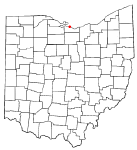
mapsize = 250px
map_caption = Location of Fairview Lanes, Ohio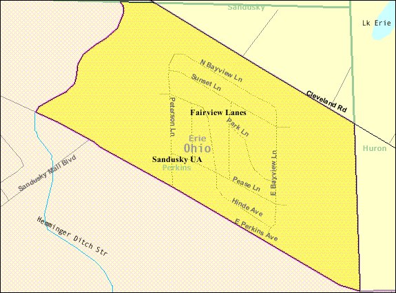
mapsize1 = 250px
map_caption1 = Detailed map of Fairview Lanessubdivision_type = Country
subdivision_name =United States
subdivision_type1 = State
subdivision_name1 =Ohio
subdivision_type2 = County
subdivision_name2 = Eriegovernment_footnotes =
government_type =
leader_title =
leader_name =
leader_title1 =
leader_name1 =
established_title =
established_date =unit_pref = Imperial
area_footnotes =area_magnitude =
area_total_km2 = 0.9
area_land_km2 = 0.9
area_water_km2 = 0.0
area_total_sq_mi = 0.4
area_land_sq_mi = 0.4
area_water_sq_mi = 0.0population_as_of = 2000
population_footnotes =
population_total = 1015
population_density_km2 = 1073.1
population_density_sq_mi = 2779.2timezone = Eastern (EST)
utc_offset = -5
timezone_DST = EDT
utc_offset_DST = -4
elevation_footnotes = GR|3
elevation_m = 178
elevation_ft = 584
latd = 41 |latm = 25 |lats = 34 |latNS = N
longd = 82 |longm = 39 |longs = 20 |longEW = Wpostal_code_type =
postal_code =
area_code =
blank_name = FIPS code
blank_info = 39-26432GR|2
blank1_name = GNIS feature ID
blank1_info = 1061264GR|3
website =
footnotes =Fairview Lanes is a
census-designated place (CDP) in Perkins Township, Erie County,Ohio ,United States . The population was 1,015 at the 2000 census. It is part of theSandusky, Ohio metropolitan statistical area .Geography
Fairview Lanes is located at coor dms|41|25|34|N|82|39|20|W|city (41.426218, -82.655440)GR|1.
According to the
United States Census Bureau , the CDP has a total area of 0.4square mile s (1.0km² ), all of it land.Demographics
As of the
census GR|2 of 2000, there were 1,015 people, 394 households, and 306 families residing in the CDP. Thepopulation density was 2,779.2 people per square mile (1,059.2/km²). There were 399 housing units at an average density of 1,092.5/sq mi (416.4/km²). The racial makeup of the CDP was 99.01% White, 0.59% African American, 0.20% Asian, 0.10% from other races, and 0.10% from two or more races. Hispanic or Latino of any race were 1.18% of the population.There were 394 households out of which 34.3% had children under the age of 18 living with them, 69.0% were married couples living together, 7.4% had a female householder with no husband present, and 22.1% were non-families. 19.8% of all households were made up of individuals and 8.9% had someone living alone who was 65 years of age or older. The average household size was 2.58 and the average family size was 2.96.
In the CDP the population was spread out with 26.2% under the age of 18, 5.3% from 18 to 24, 25.4% from 25 to 44, 25.1% from 45 to 64, and 17.9% who were 65 years of age or older. The median age was 41 years. For every 100 females there were 95.6 males. For every 100 females age 18 and over, there were 90.1 males.
The median income for a household in the CDP was $52,891, and the median income for a family was $57,250. Males had a median income of $39,375 versus $26,541 for females. The
per capita income for the CDP was $23,864. None of the population or families were below thepoverty line .References
External links
Wikimedia Foundation. 2010.