- Monroeville, Ohio
-
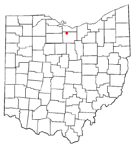
Monroeville, Ohio — Village — Downtown Monroeville, Ohio on Main Street. Location of Monroeville, Ohio
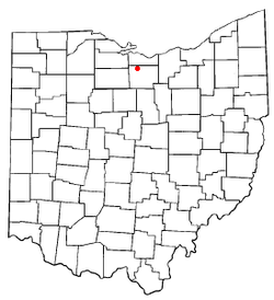
Coordinates: 41°14′38″N 82°41′53″W / 41.24389°N 82.69806°WCoordinates: 41°14′38″N 82°41′53″W / 41.24389°N 82.69806°W Country United States State Ohio County Huron Government – Mayor Sharon Miller Area – Total 1.4 sq mi (3.7 km2) – Land 1.4 sq mi (3.7 km2) – Water 0.0 sq mi (0.0 km2) Elevation[1] 709 ft (216 m) Population (2000) – Total 1,433 – Density 1,001.3/sq mi (386.6/km2) Time zone Eastern (EST) (UTC-5) – Summer (DST) EDT (UTC-4) ZIP code 44847 Area code(s) 419 FIPS code 39-51618[2] GNIS feature ID 1065046[1] Website http://www.monroevilleohio.com/ Monroeville is a village in Huron County, Ohio, United States. The population was 1,433 at the 2000 census.
Monroeville High School sports teams are known as the "Eagles".
Geography
Monroeville is located at 41°14′38″N 82°41′53″W / 41.24389°N 82.69806°W (41.243795, -82.698165)[3].
According to the United States Census Bureau, the village has a total area of 1.4 square miles (3.6 km2), all of it land.
Demographics
As of the census[2] of 2000, there were 1,433 people, 523 households, and 384 families residing in the village. The population density was 1,001.3 people per square mile (386.9/km²). There were 553 housing units at an average density of 386.4 per square mile (149.3/km²). The racial makeup of the village was 98.53% White, 0.07% African American, 0.21% Native American, 0.28% from other races, and 0.91% from two or more races. Hispanic or Latino of any race were 0.63% of the population.
There were 523 households out of which 43.2% had children under the age of 18 living with them, 57.9% were married couples living together, 13.2% had a female householder with no husband present, and 26.4% were non-families. 23.3% of all households were made up of individuals and 10.1% had someone living alone who was 65 years of age or older. The average household size was 2.73 and the average family size was 3.23.
In the village the population was spread out with 31.1% under the age of 18, 8.6% from 18 to 24, 31.1% from 25 to 44, 19.1% from 45 to 64, and 10.2% who were 65 years of age or older. The median age was 31 years. For every 100 females there were 96.6 males. For every 100 females age 18 and over, there were 92.0 males.
The median income for a household in the village was $43,558, and the median income for a family was $49,669. Males had a median income of $32,708 versus $21,042 for females. The per capita income for the village was $17,651. About 4.2% of families and 3.8% of the population were below the poverty line, including 5.0% of those under age 18 and 4.5% of those age 65 or over.
References
- ^ a b "US Board on Geographic Names". United States Geological Survey. 2007-10-25. http://geonames.usgs.gov. Retrieved 2008-01-31.
- ^ a b "American FactFinder". United States Census Bureau. http://factfinder.census.gov. Retrieved 2008-01-31.
- ^ "US Gazetteer files: 2010, 2000, and 1990". United States Census Bureau. 2011-02-12. http://www.census.gov/geo/www/gazetteer/gazette.html. Retrieved 2011-04-23.
Municipalities and communities of Huron County, Ohio Cities 
Villages Greenwich | Milan‡ | Monroeville | New London | North Fairfield | Plymouth‡ | Wakeman
Townships Bronson | Clarksfield | Fairfield | Fitchville | Greenfield | Greenwich | Hartland | Lyme | New Haven | New London | Norwalk | Norwich | Peru | Richmond | Ridgefield | Ripley | Sherman | Townsend | Wakeman
Unincorporated
communitiesCeleryville | Clarksfield | Collins | Fitchville | Hunts Corners | New Haven | Steuben
Footnotes ‡This populated place also has portions in an adjacent county or counties
Categories:- Villages in Ohio
- Populated places in Huron County, Ohio


Wikimedia Foundation. 2010.