- Narita, Chiba
-
Narita
成田市— City — [[File:|border|100px|border|alt=|Flag of Narita]]
FlagLocation of Narita in Chiba

 Narita
Coordinates: 35°47′N 140°19′E / 35.783°N 140.317°ECoordinates: 35°47′N 140°19′E / 35.783°N 140.317°E Country Japan Region Kantō Prefecture Chiba Government - Mayor Kazunari Koizumi Area - Total 213.84 km2 (82.6 sq mi) Population (March 31, 2011) - Total 126,235 - Density 590.33/km2 (1,528.9/sq mi) Time zone Japan Standard Time (UTC+9) City symbols - Tree Ume - Flower Hydrangea Phone number 0476-22-1111 Address 760 Hanasaki-cho, Narita-shi, Chiba-ken
286-8585Website city.narita.chiba.jp Narita (成田市 Narita-shi) is a city located in Chiba Prefecture, Japan. It is the site of Narita International Airport, the main international airport serving the Greater Tokyo Area.
As of March 31, 2011, the city has an estimated population of 126,235, with 54,021 households and a population density of 590.33 persons per km². Its total area was 213.84 km².
Contents
History
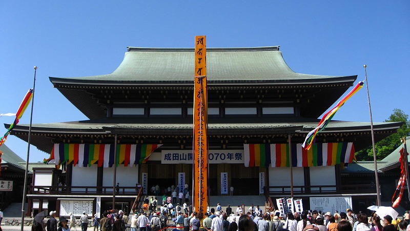
 Main Hall of Narita-san temple
The area around present-day Narita has been inhabited since the Japanese Paleolithic period. Archaeologists have found stone tools dating to some 30,000 years ago on the site of Narita Airport. Numerous shell middens from the Jōmon period, and hundreds of burial tumuli from the Kofun period have been found in numerous locations around Narita. Place names in the vicinity of Narita appear in the Nara period Man'yōshū (although the name “Narita” does not appear in written records until 1408). As Narita is located roughly equidistant from the Pacific Ocean and Tokyo Bay, around a number of small rivers, it was a natural political and commercial center for the region, and gained importance as a pilgrimage destination with the foundation of the noted Buddhist temple of Shinsho-ji in 940 AD. During the Heian period, the area was a center for the revolt of Taira Masakado. During the Edo period, the area continued to prosper as part of the tenryō within Shimōsa Province under direct control of the Tokugawa shogunate.
After the Meiji Restoration, the area was organized as a town under Inba District on April 1, 1889. Portions of the town were destroyed by Allied air raids in February and May, 1945. On March 31, 1954, Narita gained city status through merger with the neighboring villages of Habu, Nakago, Kuzumi, Toyosumi, Toyama, and Kozu. Growth in the area began in earnest in 1966, when Prime Minister Eisaku Sato laid out the plan for Narita International Airport. The development of the airport and accompanying access to central Tokyo led to widespread residential, commercial and industrial development in the city. However, construction of the airport was widely opposed, and violent demonstrations occurred through the end of the 1960s and early 1970s, which delayed the opening of the airport until May 20, 1978. The city annexed the towns of Taiei and Shimofusa from Katori District on March 27, 2006.
Areas
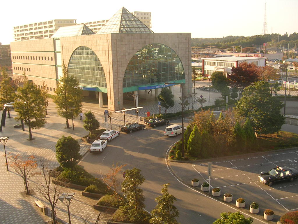
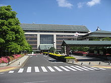 City Office
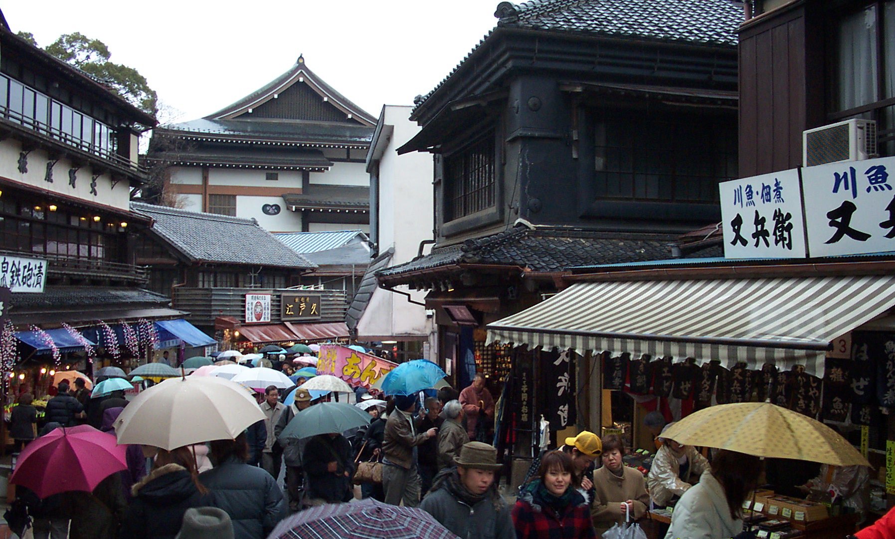
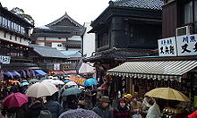 The street of Narita-san temple
Central Narita
Central Narita is roughly defined as the area between Narita Station, Keisei Narita Station and the Narita-san Temple. The main road in central Narita is Omotesandō (表参道), which is lined with about 150 small shops and has been extensively renovated in recent years.
Narita New Town
Narita New Town is a planned residential area to the west of Narita Station. It has 16,000 homes with a total population of 60,000. The area was designed in 1968 based on the new towns surrounding London in the UK, and now houses most of the city's population.
Kōzunomori
Kōzunomori (公津の杜) is a suburban area of Narita located south of the New Town, about 4 minutes by train from Keisei Narita Station. It has a population of about 12,000. The Kōzunomori Station is flanked by a large Ito-Yokado department store.
Airport and farm areas
Narita International Airport is located on the east side of Narita in an historically agricultural area called Sanrizuka (三里塚). The construction and later expansion of the airport led to intense civil unrest among Sanrizuka residents (see Narita International Airport's history). Although land expropriation and poorer farming conditions due to the airport's construction have caused Narita's farming population to drop two-thirds from pre-airport levels, the area immediately surrounding the airport remains lightly populated by farmers. Some abandoned farmland is now used for golf courses, while other plots of land have become unofficial dumping grounds for garbage.
Industrial areas
There are two main industrial zones in Narita: Nogedaira (野毛平) and Toyosumi (豊住). Both zones were laid out in the 1960s to take advantage of Narita Airport and the ability to quickly import and export goods by air. An aircraft part repair plant operated by JAL (Japan Airlines) and Pratt & Whitney, called Japan Turbine Technologies, is located in the Taiei industrial estate.
Tourist attractions
- Narita-san Shinsho Temple
- Shiseki Park
- Chiba Prefectural Boso Fudoki-no-oka Museum
Economy
JALways, a subsidiary of Japan Airlines, has its headquarters on the grounds of Narita International Airport.[1]
Education
Schools
Public elementary and junior high schools are operated by the city of Narita.
The following public high schools are operated by the Chiba Prefectural Board of Education.
- Narita North High School
- Narita Seiryo High School
- Shimofusa High School
- Narita International High School
Public libraries
The City of Narita operates the Narita Public Library. In addition each community center includes a library branch.[2]
Community centers
Narita operates several community centers, including the Central Community Center and various others.[2]
Transportation
Airport
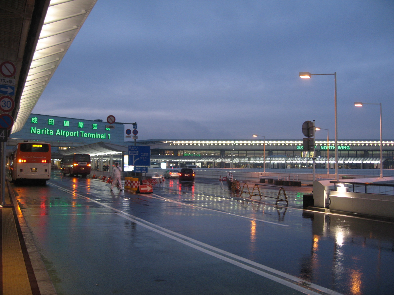
 Narita International Airport Terminal One
- Narita International Airport provides domestic and international services.
Rail
Narita Express trains and Keisei Skyliner trains connect Narita to central Tokyo.
- JR East: Narita Main Line
- JR East: Narita Abiko Line
- Narita–Shimōsa-Manzaki
- JR East: Narita Airport Line
 Keisei Kozunomori Station
- Keisei Electric Railway: Keisei Main Line
- Keisei Electric Railway: Keisei Higashi-Narita Line
Highway
The Higashi-Kanto Expressway connects Narita to Tokyo and Chiba City. Chiba Kotsu and Narita Kuko Kotsu provide bus service through the city. The Narita City Loop Bus, operated by both companies, operates on two circular routes around the city, stopping in major commercial areas and at all major hotels.
- Higashi-Kantō Expressway
- Shin-Kūkō Expressway
- Ken-Ō Expressway
- Japan National Route 51
- Japan National Route 295
- Japan National Route 296
- Japan National Route 356
- Japan National Route 408
- Japan National Route 409
- Japan National Route 464
Sister cities
 Xianyang, Shaanxi, China, since September 14, 1988
 Incheon, South Korea, since September 21, 1998
- Jeongeup, South Korea, since January 29, 2002
 San Bruno, California, USA,[3] since October 6, 1990
 Næstved, Denmark, since March 14, 2003
 Foxton, New Zealand, since January 1, 1995
Noted people from Narita
- Yuji Funayama – professional soccer player
- Yusuke Igawa – professional soccer player
- Yoshio Inaba – actor
- Manabu Iwadate – professional baseball player
- Yuki Karakawa – professional baseball player
- Takeharu Kunimoto – musician
- Yōko Oginome – singer
- Sakura Sōgorō – Edo period folk hero
See also
References
- ^ "Company Profile." JALways. Retrieved on December 12, 2009.[dead link]
- ^ a b "Libraries and Community Centers". City Narita, Chiba, Japan. http://www.city.narita.chiba.jp/english/information/c6_04.html. Retrieved 29 June 2011.
- ^ "Consolidation of Local Governments in Japan and Effects on Sister City Relationships", Consulate General of Japan, San Francisco
External links
 Media related to Narita, Chiba at Wikimedia Commons
- Narita official website (in English)
- Narita Layover Page (in English)
- Narita travel guide from Wikitravel
 Chiba Prefecture
Chiba (capital city) 
Other cities Chōshi | Ichikawa | Funabashi | Tateyama | Kisarazu | Matsudo | Noda | Mobara | Narita | Sakura | Tōgane | Asahi | Narashino | Kashiwa | Katsuura | Ichihara | Nagareyama | Yachiyo | Abiko | Kamogawa | Kamagaya | Kimitsu | Futtsu | Urayasu | Yotsukaidō | Sodegaura | Yachimata | Inzai | Shiroi | Tomisato | Minamibōsō | Sōsa | Katori | Sanmu | IsumiInba District Katori District Sanbu District Chōsei District Isumi District Awa District Categories:- Cities in Chiba Prefecture


Wikimedia Foundation. 2010.