- Chōnan, Chiba
-
Chōnan
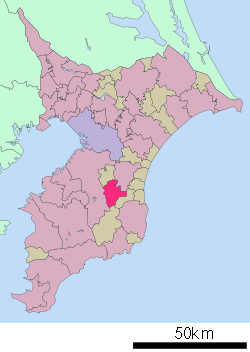
長南町— Town — Location of Chōnan in Chiba Prefecture Coordinates: 35°23′N 140°14′E / 35.383°N 140.233°ECoordinates: 35°23′N 140°14′E / 35.383°N 140.233°E Country Japan Region Kantō Prefecture Chiba Prefecture District Chōsei District Area – Total 65.38 km2 (25.2 sq mi) Population (March 1, 2010 est.) – Total 9,154 – Density 140/km2 (362.6/sq mi) Time zone Japan Standard Time (UTC+9) City Symbols - Tree Japanese cypress - Flower Cherry Blossom, Safflower - Bird Japanese Bush-warbler Phone number 0475-46-2111 Address 2110 Chōnan, Chōnan-machi, Chōsei-gun, Chiba-ken
297-0121Website Town of Chōnan Chōnan (長南町 Chōnan-machi) is a town located in Chōsei District, Chiba, Japan.
As of 2010 estimates, the town had a population of 9,154 and a density of 140 persons per km². The total area was 65.38 square kilometres (25.24 sq mi).
Contents
Geography
Located in the mountainous terrains that divides the Bōsō Peninsula, Chōnan has relatively little flat land. Like other municipalities in the region, the town maintains agricultural reservoirs. Several golf courses dot the landscape.
Neighboring municipalities
History
The modern town of Chōnan was created on February 11, 1955 from the merger of the former town of Chōnan with neighboring villages of Nishimura, Higashimura and Toyosaka.
Transportation
Railway
Chōnan is not serviced by train.
Highway
Visitor attractions
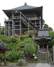
- Kasamori-ji
- Kasamori Temple Forest Nature Area
- Hōon-ji
- Shōen-ji
- Shōtoku-ji
- Chōfukuju-ji
External links
- Chonan official website in Japanese
 Chiba Prefecture
Chiba (capital city) 
Other cities Inba District Katori District Sanbu District Chōsei District - Ichinomiya
- Mutsuzawa
- Chōsei
- Shirako
- Nagara
- Chōnan
Isumi District Awa District 
This Chiba Prefecture location article is a stub. You can help Wikipedia by expanding it.


