- Creegbrawse
-
Coordinates: 50°14′53″N 5°09′50″W / 50.248°N 5.164°W
Coordinates: 50°14′53″N 5°09′50″W / 50.248°N 5.164°W
Creegbrawse Cornish: Creegbraws
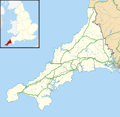
 Creegbrawse shown within Cornwall
OS grid reference SW7450943496 Parish Kenwyn Unitary authority Cornwall Ceremonial county Cornwall Region South West Country England Sovereign state United Kingdom Post town TRURO Postcode district TR4 Dialling code 01209 Police Devon and Cornwall Fire Cornwall Ambulance South Western EU Parliament South West England UK Parliament Truro and Falmouth List of places: UK • England • Cornwall Creegbrawse is a hamlet in west Cornwall, United Kingdom. It is situated between the villages of Chacewater and Todpool approximately three miles (5 km) east of Redruth.[1]
Creegbrawse was a busy mining area in the 19th century. Remains of the mining activity are still present including numerous mineshafts. Since the decline of the industry, the village has become a rural community centred around a crossroads; the roads lead to Chacewater, Twelveheads, Todpool and St Day via Little Beside.
- ^ Ordnance Survey: Landranger map sheet 204 Truro & Falmouth ISBN 9780319231494
External links
 Media related to Creegbrawse at Wikimedia Commons
Geography of Cornwall Unitary authorities Major settlements Bodmin • Bude • Callington • Camborne • Camelford • Falmouth • Fowey • Hayle • Helston • Launceston • Liskeard • Looe • Lostwithiel • Marazion • Newlyn • Newquay • Padstow • Par • Penryn • Penzance • Porthleven • Redruth • Saltash • St Austell • St Blazey • St Columb Major • St Ives • St Just-in-Penwith • St Mawes • Stratton • Torpoint • Truro • Wadebridge
See also: Civil parishes in CornwallRivers Topics History • Status debate • Flag • Culture • Places • People • The Duchy • Diocese • Politics • Hundreds/shires • Places of interest • full list...Categories:- Villages in Cornwall
- Cornwall geography stubs
Wikimedia Foundation. 2010.

