- Oklahoma State Highway 270
-
State Highway 270
Route information Maintained by ODOT Length: 14.4 mi (23.2 km) Existed: 1979[1] (March 5?[2]) – present Major junctions West end:  US-62 in Harrah
East end:  US-177 north of Shawnee
Highway system Oklahoma State Highways
Oklahoma turnpike system←  US-270
US-271  →
→State Highway 270, abbreviated as SH-270, is a highway maintained by the U.S. state of Oklahoma. It runs on a former alignment of US-270 between US-62 in Harrah and US-177 north of Shawnee. (US-270 is now concurrent with Interstate 40 through the area.) The highway is 14.4 miles[3] (23.1 km) long. SH-270 has no lettered spur routes.
Contents
Route description
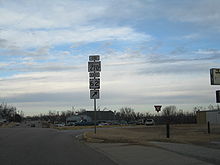 SH-270's western terminus at US-62
State Highway 270 begins at US-62 in Harrah, in Oklahoma County. The road runs through town on a southeast course, paralleling a rail line. As it leaves town, the highway gradually curves to the south. SH-270 runs along Harrah Road to S.E. 29th Street, where it makes a hard left, turning to the east.[4]
SH-270 continues east for one mile (1.6 km) until it crosses into Pottawatomie County, where the name of the road changes to Oklahoma Street. SH-270 then enters McLoud, where it has a brief concurrency with State Highway 102. After leaving McLoud, it then turns back to the southeast, parallel to the same railroad it ran alongside in Harrah. SH-270 turns east upon reaching the small town of Dale. It then crosses over the railroad and the North Canadian River. After passing through Dale, it ends at US-177.[4]
History
Prior to 1979, US-270 ran through Oklahoma City on surface streets. It left the city and ran through Choctaw concurrent with US-62. US-270 split away from in Harrah, and continued on to Shawnee on what is now SH-270.[5]
On March 5, 1979, US-270 was rerouted to run concurrent with Interstate 40 from south of Calumet in Canadian County through the Oklahoma City metro, exiting the Interstate onto a surface alignment in Shawnee.[2] Presumably, SH-270 was commissioned the same date. The realignment of US-270, with SH-270 on the old alignment between Harrah and Shawnee, appears on the 1979 state map. SH-270 followed the same path in 1979 as it does today.[1]
Junction list
County Location Mile[3] Destinations Notes Oklahoma Harrah 0.0  US-62
US-62Western terminus Pottawatomie McLoud 7.7  SH-102
Western end of SH-102 concurrency 7.9 SH-102Eastern end of SH-102 concurrency 14.4 US-177Eastern terminus 1.000 mi = 1.609 km; 1.000 km = 0.621 mi
Concurrency terminus • Closed/Former • Incomplete access • UnopenedReferences
- ^ a b Oklahoma Department of Transportation. Official State Map (Map) (1979 ed.). http://www.odot.org/hqdiv/p-r-div/maps/state-maps/pdfs/1979.pdf. Retrieved 2009-01-14.
- ^ a b Oklahoma Department of Transportation, Planning & Research Division. "Memorial Dedication & Revision History - US-270". http://www.okladot.state.ok.us/memorial/legal/sh51.htm. Retrieved 2009-01-14.
- ^ a b Stuve, Eric. "OK-270". OKHighways. http://www.okhighways.com/ok270.html. Retrieved 2006-04-13.
- ^ a b DeLorme (2006). Oklahoma Atlas and Gazetteer (Map). 1:200,000. p. 43.
- ^ Oklahoma Department of Transportation. Official State Map (Map) (1978 ed.). http://www.odot.org/hqdiv/p-r-div/maps/state-maps/pdfs/1978.pdf. Retrieved 2009-01-14.
External links
Categories:- State highways in Oklahoma


Wikimedia Foundation. 2010.