- Newton St Cyres
-
Coordinates: 50°46′05″N 3°35′31″W / 50.768°N 3.592°W
Newton St Cyres 
Newton St Cyres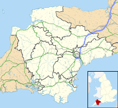
 Newton St Cyres
Newton St Cyres shown within DevonPopulation 867 (2001) OS grid reference SX8897 Parish Newton St Cyres District Mid Devon Shire county Devon Region South West Country England Sovereign state United Kingdom Post town EXETER Postcode district EX5 Dialling code 01392 Police Devon and Cornwall Fire Devon and Somerset Ambulance South Western EU Parliament South West England UK Parliament Tiverton and Honiton List of places: UK • England • Devon Newton St Cyres is a village and civil parish in Mid Devon in the English county of Devon, located between Crediton and Exeter. It has a population of 867.[1] Almost destroyed by fire in the early 1960s,[citation needed] its main interest is the Parish Church dedicated to the martyr Saint Cyres: it was built in the 15th century. There is a railway station here, Newton St Cyres railway station, which is on the Exeter to Barnstaple line.
Newton St Cyres is home to two public houses, the Crown and Sceptre and the Beer Engine and traditional cheeses can be bought from the Quickes Farm shop. The village also has a recreation ground with 2 football pitches, a cricket pitch and 2 tennis courts.[2]
References
External links
 Media related to Newton St Cyres at Wikimedia CommonsCategories:
- Villages in Devon
- Devon geography stubs


Wikimedia Foundation. 2010.