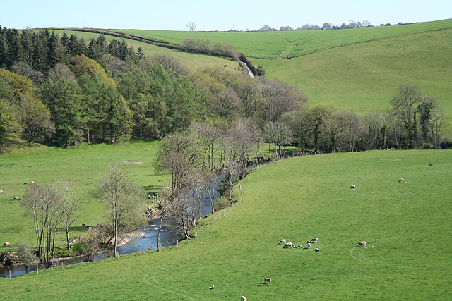
- River Mole, Devon
Geobox|River
name = Mole
native_name =
other_name =
other_name1 =

image_size =
image_caption = The River Mole below its confluence with the River Yeo.
etymology =
country_
country = England
country1 =
state =
state1 =
region_type = Counties
region =Devon
region1 =
region2 =
district_type = District
district =North Devon
city_type = Towns
city = North Molton
city1 = South Molton
landmark =Exmoor
length =
watershed =
discharge_location =
discharge =
discharge_max =
discharge_max_note =
discharge_min =
discharge_min_note =
discharge1_location =
discharge1_average =
source_name =
source_location =
source_district =
source_region =Devon
source_state =
source_country =
source_lat_d =
source_lat_m =
source_lat_s =
source_lat_NS =
source_long_d =
source_long_m =
source_long_s =
source_long_EW =
source_elevation =
source_length_imperial =
mouth_name =River Taw
mouth_location = Junction Pool
mouth_district =
mouth_region =Devon
mouth_state =
mouth_country =
mouth_lat_d = 50
mouth_lat_m = 56
mouth_lat_s = 30
mouth_lat_NS = N
mouth_long_d = 03
mouth_long_m = 54
mouth_long_s = 24
mouth_long_EW =W
mouth_elevation = 6
tributary_left =
tributary_left1 =
tributary_left2 =
tributary_left3 =
tributary_left4 =
tributary_right =
tributary_right1 =
tributary_right2 =
tributary_right3 =
tributary_right4 =
free_name =
free_value =
map_size =
map_caption =The River Mole is a tributary of the
River Taw inDevon which rises on the southwestern border ofExmoor . The river takes its name from the market towns of North andSouth Molton . The river was previously known as the Nymet. [http://www.ndas.org.uk/place_names.htm]Tributaries
River Yeo
Crooked Oak
River BrayReferences
ee also
*
List of rivers in England External Links
Wikimedia Foundation. 2010.

