- Clair, New Brunswick
-
Clair — Village — 
FlagMotto: "Quousque Possumus" Location of Clair, New Brunswick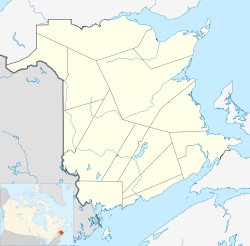

Coordinates: 47°15′09″N 68°36′18″W / 47.2525°N 68.605°W Country  Canada
Province  New Brunswick
County Madawaska Parish Clair Village Status 1966 Electoral Districts
Federal
Madawaska—RestigoucheProvincial Madawaska-les-Lacs Government[1] – Type Village Council – Mayor Ludger Lang – Councillors List of Members- Patrick P. Long
- Marcel Réal Michaud
- Pierre Michaud
- Jacques Ouelette
Area[2] – Total 10.46 km2 (4 sq mi) Population (2006)[2][3] – Total 848 – Density 81.1/km2 (210/sq mi) – Change 2001-06  1.7%
1.7%– Census Ranking 2,280 of 5,008 Time zone AST (UTC-4) – Summer (DST) ADT (UTC-3) Area code(s) 506 Dwellings 400 Median Income* $37,352 CDN Access Routes  Route 161
 Route 205
*Median household income, 2005 (all households) Clair (2006 population: 848) is a Canadian village in Madawaska County, New Brunswick.[4]
Situated on the Saint John River opposite Fort Kent, Maine. The name Clair finds its roots in the community named for County Clare in Ireland. The name of the village is the result of the railroad station being located near the General store of James T. Clair. The station was called Clair's and was a regular stop of the Temiscouata Railway on its way up to the Connors station. Over time, the name stuck and was shortened to the family name of Clair. The original name of the location was actually "La Petite Décharge" named after the discharge of the small "ruisseau des Lang" into the Saint John River.
Forestry is the basis of the local economy.
The Clair-Fort Kent Bridge crosses the International Boundary to link both communities.
Contents
Demographics
Population trend[5]
Census Population Change (%) 2006 848 1.7%2001 863 4.6%1996 905  0.2%
0.2%1991 903 N/A Mother tongue language (2006)[2]
Language Population Pct (%) French only 715 86.14% English only 80 9.64% Other languages 20 2.41% Both English and French 15 1.81% Attractions
The local Roman Catholic church, houses noted religious artwork, including stained-glass windows from the workshop of Belgian artist José Gaterrath and the Stations of the Cross by the famous Spanish ceramist Jordi Bonet.
See also
References
- ^ Government of New Brunswick website: Clair
- ^ a b c 2006 Statistics Canada Community Profile: Clair, New Brunswick
- ^ Statistics Canada Population and dwelling counts, for Canada and census subdivisions (municipalities), 2006 and 2001 censuses - 100% data
- ^ New Brunswick Provincial Archives - Clair
- ^ Statistics Canada: 1996, 2001, 2006 census
External links

Lac-Baker Saint-François-de-Madawaska 
Baker Brook  Clair
Clair 

Fort Kent, Maine
 United StatesCategories:
- Communities in Madawaska County, New Brunswick
- Villages in New Brunswick

Wikimedia Foundation. 2010.