- Charlo, New Brunswick
-
Charlo — Village — 
SealLocation of Charlo, New Brunswick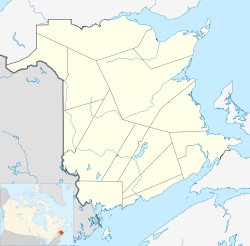

Coordinates: 47°59′36″N 66°18′18″W / 47.99343°N 66.30489°W Country  Canada
Province  New Brunswick
County Restigouche Parish Colborne Settled 1799 Village Status 1966 Electoral Districts
Federal
Madawaska—RestigoucheProvincial Dalhousie-Restigouche East Government[1] - Type Charlo Village Council - Mayor André J. C. Carrier - Councillors List of Members- Roger Joseph LeClair
- Éric Perry
- Denis McIntyre
- Douglas W. Petersen
- Édith M. Morris
- MLA Donald Arseneault (L) - MP Jean-Claude D'Amours (L) Area[2] - Land 30.75 km2 (11.9 sq mi) Population (2006)[2] - Total 1,376 - Density 44.7/km2 (115.8/sq mi) - Change 2001-06  6.4%
6.4%- Census Ranking 1,689 of 5,008 Time zone AST (UTC-4) - Summer (DST) ADT (UTC-3) Postal code(s) E8E Area code(s) 506 Access Routes
 Route 11
 Route 134
 Route 280
Dwellings 739 Median Income* $55,211 CDN Website www.villagecharlo.com *Median household income, 2005 (all households) Charlo (2006 population: 1,376) is a Canadian village in Restigouche County, New Brunswick.[3]
Situated on the south shore of Chaleur Bay, the community was first settled by Acadians in 1799 and incorporated in 1966.
The Charlo Airport, the only airport in the region, offered scheduled air service between 1963-2001. It is currently only used for general aviation.
Contents
Demographics
Population
Population trend[4]
Census Population Change (%) 2006 1,376 5.0%2001 1,449 10.0%1996 1,610  0.8%
0.8%1991 1,597 N/A Language
Mother tongue language (2006)[2]
Language Population Pct (%) French only 860 62.77% English only 470 34.31% Both English and French 30 2.19% Other languages 10 0.73% See also
References
External links

Upper Charlo Chaleur Bay 
 Charlo

Mountain Brook River Charlo Coordinates: 47°59′50.5″N 66°19′6.4″W / 47.997361°N 66.318444°W
Categories:- Communities in Restigouche County, New Brunswick
- Villages in New Brunswick

Wikimedia Foundation. 2010.