- Oromocto, New Brunswick
-
Oromocto
Welamooktook (Great River)— Town — 
Flag
Coat of armsNickname(s): Canada's Model town Motto: "Succesus Per Operam" (Latin)
"Effort Brings Success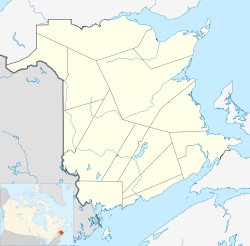
 Oromocto
Coordinates: 45°50′56″N 66°28′44″W / 45.84878°N 66.47879°W Country Canada Province New Brunswick County Sunbury County Founded March 16, 1693 Incorporated 1956 Electoral Districts
Federal
FrederictonProvincial Oromocto Government - Type Town Council - Mayor Fay Tidd - Deputy Mayor Shelley Comeau - Councillor Michael Comeau, Allison Mockler, Dianne Buchanan, Melvin Vance, Kelly Murdock. - CAO Richard Isabelle - Assist Town Clerk Cynthia Abbott Area[1] - Total 22.37 km2 (8.6 sq mi) Elevation Sea level to 51 m (0 to 167.3 ft) Population (2006)[1] - Total 8,412 - Density 375.5/km2 (972.5/sq mi) - Change (2001-06)  5.0%
5.0%- Dwellings 3,484 Time zone AST (UTC−4) - Summer (DST) ADT (UTC−3) Postal code(s) E2V Area code(s) 506 Access Routes
Route 2 (TCH)
 Route 7
 Route 102
Telephone Exchange 357-440 NTS Map 021G16 GNBC Code DATWJ Website http://www.oromocto.ca Oromocto (2006 population: 8,412) is a Canadian town in Sunbury County, New Brunswick.
The town is located on the west bank of the St. John River at the mouth of the Oromocto River, approximately 20 kilometres southeast of Fredericton. The town's name is derived from the name of the Oromocto River; "oromocto" is thought to have originated from the Maliseet word wel-a-mook-took which means "deep water".
Contents
History
The village was initially an Acadian village. During the Expulsion of the Acadians, the village was burned in the St. John River Campaign (1758). During the American Revolution, Fort Hughes was built in the community after the rebellion at Maugerville, New Brunswick. (A replica of Fort Hughes was built at Sir Douglas Hazen Park.)
There are various burial grounds throughout the town. Oromocto was originally a shipbuilding town in the 19th century, but went into decline after the industry closed. It remained a small hamlet until it was selected as the headquarters for a large military training area, in the early 1950s. The Gagetown Military Camp (Camp Gagetown) opened in 1955 as the largest military reservation in the Commonwealth of Nations at the time.Oromocto underwent a major transformation during this time as it was designed to be a "model town". It was considered to be at the forefront of such efforts in Canada, along with locations such as Richmond Hill, Ontario and Nepean, Ontario. Today, Oromocto's entire economy is dominated by CFB Gagetown.
Census Population 1871 400 1956 661 1961 12,170 1971 11,427 1981 9,064 1991 9,325 2001 8,843 2006 8,402 The town's location in the Saint John River valley provides lush vegetation and an attractive waterfront on both rivers. A small park and marina occupy an area on the Oromocto River waterfront near the downtown. Nightlife attractions include the former Club Camelot, no longer in operation, as well as Griffon's Pub and Eatery (formerly Bleachers, Crocodile Dundee's) the Oromocto Hotel. The town's shopping mall features Pizza Delight, A&W, Bluenotes, Reitman's, Tim Hortons as well as an Atlantic Superstore location. A business district in the area of Restigouche Road and has become moderately successful, and the town features a small hospital, track and field facilities, and a multitude of churches. The town is home to a distribution centre for Sobeys grocery stores, a funeral home, library and recreation centre. Where the town borders on CFB Gagetown there is also a Canex with a salon and barbershop, lounge, hockey/squash arenas, swimming pool, and a credit union, along with military vehicles and aircraft on outdoor display.
Adjacent to the town on the eastern limits is the Oromocto First Nations reservation, a small Mi'qmaq/Maliseet community.
Canadian National Railway abandoned its railway line, which ran through the town to CFB Gagetown, in March 1996. Today, this railway right-of-way has been developed as a recreational trail and is part of the "Sentier NB Trail" network. This particular portion of the Sentier NB Trail between Fredericton-Oromocto-Burton also hosts the Trans-Canada Trail.
Education
- Oromocto High School
- Ridgeview Middle School
- Hubbard Ave. Elementary
- Summerhill Elementary
References
Harold Peterson middle school
External links
- Town of Oromocto - official website
- Oromocto Watershed Association Inc.
Subdivisions of New Brunswick 
Subdivisions Cities Towns Beresford · Bouctouche · Caraquet · Dalhousie · Florenceville-Bristol · Grand Bay-Westfield · Grand Falls · Hampton · Hartland · Lamèque · Nackawic · Oromocto · Quispamsis · Richibucto · Riverview · Rothesay · Sackville · Shediac · Shippagan · St. Andrews · St. George · St-Léonard · St-Quentin · St. Stephen · Sussex · Tracadie-Sheila · Woodstock Category:New Brunswick ·
  Portal:New Brunswick ·
  WikiProject:New BrunswickCategories:
- Communities in Sunbury County, New Brunswick
- Towns in New Brunswick
- Planned cities in Canada

Wikimedia Foundation. 2010.