- Chakwal District
-
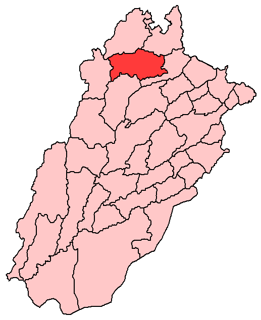
Chakwal District — District — View from top of the temple Chakwal is located in the north of Punjab
Country Pakistan Province Punjab Capital Chakwal Established Government - District Nazim Sardar Saqib Maqsood Malik - District Naib Nazim Sardar Wajid Chishti Area - Total 6,524 km2 (2,518.9 sq mi) Population (1998) - Total 1,083,725 Time zone PST (UTC+5) District Council {{{seats}}} seats Number of Tehsils 4 Chakwal (Urdu: ضلع چکوال) is a district in the Punjab province of Pakistan. Chakwal district was created in 1985; until the year 2000 when divisions were abolished, it was part of Rawalpindi Division.
Contents
Administration
The district of Chakwal, which covers an area of 6,524,[1] is subdivided into 4 tehsils,[2] these tehsils were formerly part of neighbouring districts:
- Chakwal of Jhelum District
- Talagang of Attock District and police station Choa Saidan Shah, carved out of subdivision Pind Dadan Khan, Jhelum District, and amalgamating it with sub-division Chakwal. Choa Saidan Shah was upgraded to the level of a sub-division in 1993.
At present district Chakwal consists of 4 subdivisions - Chakwal, Talagang , Choa Saidan Shah,and Kallar Kahar, 23 qanungois and 198 patwar circles. The police subdivisions correspond with those of the district administration and there are 11 police stations- Chakwal City, Saddar, Kallar Kahar, Dhumman, Nila, Dhudhial, Talagang City, Saddar, Tamman, Lawa and Choa Saidan Shah.
The district is administratively subdivided into four tehsils and 68 Union Councils[3]
Name of Tehsil No of Unions Chakwal Tehsil 30 Kallar Kahar Tehsil 8 Choa Saidan Shah Tehsil 7 Talagang Tehsil 23 Total 68 Constituencies
There is one district council, two municipal committees- Chakwal and Talagang and two town committees- Choa Saidan Shah and Kaller Kahar.
The district is represented in the National Assembly by two constituencies NA-60 and NA-61. The district is represented in the provincial assembly by four elected MPAs who represent the following constituencies:[4]
Constituency MPA Party PP-20 Mrs Iffat Liaqat Ali Khan Pakistan Muslim League (N) PP-21 Malik Tanveer Aslam Sehti PML (N)
PP-22 Khurram Nawab of Dullah PP-23 Malik Zahoor Anwar Awan PML(N)
Qazi kashif Abrar President (Ehsas welfare Trust of Padshahan ) Distt Chakwal Topography
Chakwal district borders the districts of Rawalpindi and Attock in the north, Jhelum in the east, Khushab in the south and Mianwali in the west. The total area of Chakwal district is 6,609 square kilometres, which is equivalent to 1,652,443 acres (6,687.20 km2).
The southern portion runs up into the Salt Range, and includes the Chail peak, 3,701 feet (1,128 m) above the sea, the highest point in the District. Between this and the Sohan river, which follows more or less the northern boundary, the country consists of what was once a fairly level plain, sloping down from 2,000 feet (610 m) at the foot of the hills to 1,400 feet (430 m) in the neighbourhood of the Sohan ; but the surface is now much cut up by ravines and is very difficult to travel over.[5]
Lying at the beginning of the Potohar plateau and the Salt Range, Chakwal is a barani district and the terrain is mainly hilly, covered with scrub forest in the southwest, and levelled plains interspaced with dry rocky patches in the north and northeast.
Social Welfare Organizations
Saviours Trust Islamabad based NGO is working for emergency relief and long-term development projects in Pakistan. For more details please visit www.savioursngo.org or call at +92315-SAVIOUR (7284687)
Demography
According to the 1998 census of Pakistan, the total population is 1,083,725 of which 12.01% only were urban making Chakwal the most rural district in Punjab.[6]
During the Partition of Punjab in 1947 The Chakwal Area had a Big Hindu Population and also Sikhs But During the Chaos and Riots and Killings The Hindus and Sikhs of this Area They fled the Newly Created Pakistan to India The majority of them settled in New Delhi the Capital of India.
Languages
Punjabi is the native language of majority of the people of district.Other languages spoken are Hindko, Potohari and Urdu.
Major tribes
The tribes, clans and castes that inhabit this area are the Kahuts, Kassar, and Mair-Minhas in the east of the district, the Awans, in the Salt Range, the [Khokhar] in villages such as Dab, Khokhar Zer, Khokhar Bala and Bhatti Gujjar,[Qazis] most of them resident in Nachindi. The Jats (the main clans being the Bhutta, Khoti, Khingar, Gondal and Mekan) are found mainly in Chakwal tehsil, along the borders with Jhelum and Khushab district. The district is also home to Rajputs, such as the Chauhans of Ghazial, Janjua, Khokhar, Mair Minhas, Bhatti, Jalap and Khiwa tribes. There are also small numbers of Pathans, Gujars, Syeds of Chak Misri, Maliars, Kashmiris and the Punjabi Sheikhs (including the famous Sahgal family).
The physical features of the district, its tribes, its society and its economy all combine to make Chakwal one of the main recruiting areas for the Pakistan Army and the Pakistan Air Force. Main occupation of the people are Mining. Transport and poultry business also contributes imperatively towards the revenues of the district.History
During British rule, Chakwal was a tehsil of Jhelum district, the population according to the 1891 census of India was 164,912 which had fallen to 160,316 in 1901. It contained the towns of Chakwal and Bhaun and 248 villages. The land revenue and cesses amounted in 1903-4 to 3-3 lakhs.[5]
The boundaries and area of the tehsil were described by the Imperial Gazetteer of India as follows the tehsil "lies between 28° 45' and 30°05' N. and 72°32' and 73° 13' E., with an area of 1,004 square miles"[5]
Historical sites
Quite a number of historical sites lie in the undulations of Chakwal, the more important of which are:
Katas Raj
Katas Raj is a 3000-year-old town sacred to the Hindus and lies about 5 kilometres west of Choa Saidan Shah on the Choa-Kallar Kahar road. Its importance is derived from the fact that it contains over 100 temples built over a period of more than 1000 years by its Hindu Rajas. Some of these temples are dilapidated but a large number of them have been well maintained. Hindu pilgrims from all over Pakistan and India frequently visit this town to worship. Katas Raj at its peak time was the well renowned university; a famous mathematician Alberuni measured the circumference of the earth while he was studying the Sanskrit in that university.
Dulmial
Dulmial is located just 3 km from Katas Raj, a town which is very famous for the services rendered from its residents to all walks of life for Pakistan and also in British Army.[7]. Dulmial is one of the two towns on Earth which was awarded with the Victoria Gun After WWI in 1920. The gun was received by Cap. Ghulam Mohammad Malik and other WWI veterans. Since the creation of Pakistan Dulmial has kept its reputaion in the Pakistan Army as well, apart from the military services this town is also known for the reputation of its people working in high ranks in almost every important governmental and non governmental organisations.
Economy
Most people of the district prefer to join armed forces like Pakistan Army, Pakistan Navy and Pakistan Air Force. Chakwal has the highest proportion of it population serving in the Armed forces of Pakistan.
A handsome percentage of the population is employed in the mining, industrial and trading sector with a very small fraction employed in technical fields like health, education, banking and engineering.
Food and health
The food which the people of Chakwal consume is very modernized.biryani,halwa, sweets are most widely used.people are mostly interested in junk food from different and good restaurants of chakwal like Nisar Sweets & Bakers,Pehlwan juice,Corner sweets,Makkah restaurant,Pizza time etc.
The most well known and favourite food product coming from Chakwal is a sweet called Riyori (pronounced ree-o-ree) (Pehlwan de Riyori, Zafar de Riyaori are famous brands) As well as Dhodha and Burfi of Nisar Sweets & Bakers are also well known and liked products.TAJ MAHAL SWEET & BAKERS, WAQAS SWEETS and WAQAR SWEETS are famous for "MITHAIE" including Manpassand AMBALA SWEETS brand of sweets by Taj Mahal Sweets are very famous and trusted sweet sites.
Notable places
- Buchal Kalan is the largest union council of Tehsil Kalar Kahar located at the top of Wanhar. Malik Shahbaz (Late) was a prominent figure of this village. This village is also famous for being the place of birth of a number of Generals of Pakistan army.
- Ghazial is a small village of union council Mulhal Mughlan.Most of its population is in Education Department.It has high Literacy rate as compared with nearest villages and towns.There is road which is Gernally Road which was made by Sher Shah Suri.This road connects Jhelum and Chakwal.Ghazial is situated on boarder of Jhelum and Chakwal.Dil Jabba mountains are near from it.Of course it has high literacy rate but unfortunately it has no commessioned officer.[Added by Muhammad Haris Baidar Raja].
- Sarkalan is a small village but an important one being in hold of the major mineral resources of the wanhar region. Malik Lal khan (late) being the coal lease owner of this village was considered to be a mentor and authoritative chieftain of his phulial and jhurwal clans of Awan tribe. Stories of his dictates with his 11 nephews are still of stimulus interest in the Wanhar region.
- Noorpur sethi is one of the largest viallges of kalar kahar tehsil. Another hub of mineral resources, this village is considered a place of consensus in Cakwal. Nobles of the village are respected all over the district and enjoy a respectable place in the Awan tribe.
- Bilalabad (Kufri) is one of the oldest towns of Tehsil Talagang. Its population is over eight thousand, before partition its dominant population were wealthy Hindus, whose businesses were spread up to Peshawar. The houses built by them are still master pieces of architecture. Most of the population are from the Awan. Beside farming the clan is noted for performing a distinguished role in Pakistan Defence Services and business.Malik Falak Sher well known businessman belongs to this town (THE AWAN GROUP)
- SAGHAR** is one of the best town in District Chakwal. It is famous due to Army Air Force, Navey Officers, and also Air force academy which is located in ceneter of town. where as students after matric joine this academy of preparation of Air force test. It is very lodest town have more than 20,000 papulation.
- SADWAL: Sadwal is an important village of Kahutani area and is located in south of Chakwal. Dr Muhammad Iqbal Kahut, grand son of Ch. Dost Muhammad Kahut, from Sadwal was first person from District Chakwal who served as Medical Superintendent DHQ Hospital Chakwal(1999–2003) and as Executive District Officer Health chakwal (2004–2007). He up graded DHQ Hosp[ital Chakwal, THQ Hospital Talagang and THQ Hospital Choa Saiden Shah during his tenure.
- Budhial is a village located about 25 kilometres from Talagang. This a beautiful village, and has many places worth seeing. Ghazi Mureed Hussain Shaheed, a son of Kahut Family killed a Hindu who insulted the Islamic prophet Muhammad.
- Choa Saidanshah village and tehsil of Chakwal are named after a famous Sufi Sakhi Saidan Sherazi Choa Saidan Shah. It is a beautiful valley of Chakwal
- Dhruggi Rajgan is a village situated on Jhelum Chakwal road.It is 36 km awasy from Chakwal.
- Dharyala Kahun is a beautiful village situated at a hill top in the Kahoon valley, 13 km away from the centre of Choa Saiden Shah. Majority of the population are Awans and serving in the Armed Forces and other businesses. Lt Gen Muhammad Afsar,a proud son of the village earned laurals for Dharyala Kahoon when he passed out as number one from Pakistan Military Academy Kakul in April 1963. He rose to be Engineer In Chief of the Army and retired as Quarter Master General. After his retirement he served as Managing Director Army Welfare Trust also.
- Dhoular is a village of Tehsil Talagang, it is one of the oldest, largest and culturally rich village of the area.
- Dullah is a beautiful village of Tehsil Chakwal, it is one of the oldest villages, most of people are serving in the Pakistan army, but unfortunately a lot of work is still needed to promote literacy, some people are living without electricity.
- Lawa is one of the largest villages in Asia[citation needed], it is a village of Talagang Tehsil, it has a population of over 115,000.
- Munara is a village and union council, an administrative subdivision, of Chakwal District in the Punjab Province of Pakistan, it is part of Chakwal Tehsil.[3]
- Piera Fatehial is a village of Talagang, it is located about 15 km from Talagand. Its population is more than 10000, it is one of the most educated village in the area.
- Rupwal is one of the oldest and historic towns of Chakwal.
- Munday is one of the most historic village in chakwal locatded 25 km in east of chakwal with some old cultural values and tradations.
- Tamman is a medium sized village, located 30 km towards west from Talagang it is one of the oldest town with more than 10,000 population.
- Dhulli is a beautiful village[Awais Masood Dhulli]
- Latifal is a beautiful village of district Chakwal.it is 40 km away from the city of Chakwal.
- Khairpur is a village and union council,located in Kahoun valley, at latitude 32 43'56.53", longitude 72 47'27.21", mid of the Salt Range at about 2600 feet elevation, with a moderate climate. Now village Khairpur is a part of Kallar Kahar Tehsil. Located on the road leading to Choa Saiden Shah 10 Kilometres eastward of Kallar Kahar motorway interchange, this is a typical Awankari village: Bravest of soldiers, toughest of cultivators and having inexorable lust for revenge and vendetta in family feuds.The soil is thin and stony and cultivation depends upon the capricious rainfall in these blue serrated hills. Agriculture and Army Service are the main profession of the dwellers. Though now the residents of the village are in other governmental jobs like teaching, medical, business and other professions. The old name Khardare was changed to Khairpur in 1947,but still it is famous for its old name "Khardher" and the inhabitants of the village are proud of and love to be called as "Khardehr".
References
- ^ Official Website of Chakwal District
- ^ List to tehsils and districts
- ^ a b Tehsils & Unions in the District of Chakwal
- ^ CHAKWAL (PP-20 to PP-23) - Website of the Provincial Assembly of the Punjab
- ^ a b c Imperial Gazetteer of India, v. 10, p. 126
- ^ 1998 Census figures - Urban Resource Centre
- ^ Wisdom and Waste In The Punjab Village, by M.L.Darling 1934,Page 51,"the Awan village of Dulmial close by produced more recruits in the war than any other village in India : 460 served out of a population (in 1921) of only 879 males"
Union councils Arra · Balkassar · Balokassar · Basharat · Begal · Bharpur · Bheen · Bhilomar · Bhoun · Bidher · Buchal Kalan · Budhial · Chak Malook · Chak Umra · Chakwal City-I · Chakwal City-Ii · Chakwal City-Iii · Chakwal City-Iv · Chakwal City-V · Choa Ganj Ali Shah · Choa Saidanshah · Dab · Dalwal · Dandot · Dhoular · Dhudial · Dhurnal · Dullah · Dulmial · Dumman · Jabbi Shah Dilawar · Jand · Jand Khanzada · Jassial · Jaswal · Jhatla · Kallar Kahar · Karsal · Karyala · Khairpur · Khotian · Kot Choudrain · Kot Gullah · Kot Qazi · Kot Sarang · Lawa · Lehr Sultanpur · Leti · Mangwal · Miani · Mulhal Mughlan · Multan Khurd · Munara · Mureed · Naka Kahoot · Noorpur · Odherwal · Padshahan · Pichnand · Piera Fatehial · Saghar · Saral · Talagang City-I · Talagang City-Ii · Tamman · Tehi · Thoa Mehram Khan · WarwalDivisions of Pakistan Balochistan KP Punjab Bahawalpur · Dera Ghazi Khan · Faisalabad · Gujranwala · Lahore · Multan · Rawalpindi · Sahiwal · SargodhaSindh Coordinates: 33°40′38″N 72°51′21″E / 33.67722°N 72.85583°E
Categories:

Wikimedia Foundation. 2010.