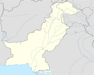
- Dandot
-

Dandot District Chakwal Location in Pakistan Coordinates: 32°39′0″N 72°58′0″E / 32.65°N 72.966667°ECoordinates: 32°39′0″N 72°58′0″E / 32.65°N 72.966667°E Country Pakistan Province Punjab District Chakwal District Time zone PST (UTC+5) – Summer (DST) +6 (UTC) Dandot ڈنڈوت is a village, union council, and administrative subdivision of Chakwal District in the Punjab Province of Pakistan. It is part of Choa Saidan Shah Tehsil[1] and is located at 32°39'0N 72°58'0E.[2] Dandot village has a population of more than 15000 people and most are Janjua Rajputs. There is a pre partition Dalmia cement factory now known as Dandot Cement Company Ltd. (DCCL).
Dandot is also one of the Fort of janjua rajputs like Malot fort,Makhila,Dalwal etc. Raja Ajmal Mal khan was the first janjua who embraced Islam in the 12th century due to his love for Sufi art, poetry and teachings followed the Islamic tradition of change of name after conversion and was then known as Raja Ajmal Khan. He was among the first Muslim Rajputs. This conversion was done before the armies of Shahabudin Ghauri entered into the Indian Plateau to conquer whilst he was very young in his teens and inclined towards Islamic philosophy of the Sufis,whose missionary efforts were gaining popularity in Northern India.
External links
References
Capital Union councils Arra · Balkassar · Balokassar · Basharat · Begal · Bharpur · Bheen · Bhilomar · Bhoun · Bidher · Buchal Kalan · Budhial · Chak Malook · Chak Umra · Chakwal City-I · Chakwal City-Ii · Chakwal City-Iii · Chakwal City-Iv · Chakwal City-V · Choa Ganj Ali Shah · Choa Saidanshah · Dab · Dalwal · Dandot · Dhoular · Dhudial · Dhurnal · Dullah · Dulmial · Dumman · Jabbi Shah Dilawar · Jand · Jand Khanzada · Jassial · Jaswal · Jhatla · Kallar Kahar · Karsal · Karyala · Khairpur · Khotian · Kot Choudrain · Kot Gullah · Kot Qazi · Kot Sarang · Lawa · Lehr Sultanpur · Leti · Mangwal · Miani · Mulhal Mughlan · Multan Khurd · Munara · Mureed · Naka Kahoot · Noorpur · Odherwal · Padshahan · Pichnand · Piera Fatehial · Saghar · Saral · Talagang City-I · Talagang City-Ii · Tamman · Tehi · Thoa Mehram Khan · WarwalCategories:- Union councils of Chakwal District
- Populated places in Chakwal District
- Chakwal District geography stubs
Wikimedia Foundation. 2010.

