- Coventry Canal
-
Coventry Canal Route map legend


Fradley Junction - Trent and Mersey Canal 
-- Coventry Canal (detached section) 
Fradley Swingbridge 
New Bridge Fradley Estate Access Bridge Fradley Bridge 
Bell Bridge/A38 road 
Brookhay Pumping Station Fradley Bridge Bears Hay Bridge 
Streethay Bridge 
Streethay Wharf 
Cross-City Line King's Orchard Bridge Stoney Step Bridge Plough Bridge Trent Valley Line 


Huddlesford Junction - Lichfield Canal 
Huddlesford Foot Bridge Bowmans Bridge Cheadles Bridge Burton Road Bridge -- Coventry Canal (detached) above 
Whittington Brook -- Birmingham and Fazeley-built canal below Whittington Bridge Minor Road Bridges Hademore House Bridge Hademore Farm Bridge Tamhorn Farm Bridge Tamhorn House Bridge Tamhorn Park Bridge Hopwas Wood Bridge Hopwas School Bridge Hopwas Hill Bridge/A51 road 
Hopwas Minor Road Bridges Dixon's Bridge Balls Bridge Dunstall Bridge Hopwas Wood Bridge Bonehill Road Bridge A5 road Peel's Wharf 
Fazeley Junction - Birmingham and Fazeley Canal -- Coventry Main Line Canal below Junction Footbridge Tamworth Road Bridge 
Tame Aqueduct A5 road Kettlebrook Bridge Cross Country Route 
Glascote Locks x2 Anchor Bridge/Glascote Road Amington Road Bridge Gate Inn Bridge Hodge Lane Bridge Alvecote Marina Hodge Lane Bridge 
M42 motorway Polesworth Bridge Polesworth (Mill Bridge) Trent Valley Line Limekiln Bridge Bradley Green Bridge Atherstone Bottom Locks 10-11 Whitley Bridge Locks 8-9 Baddesley Bridge (Whittington Lane) Trent Valley Line 
Lock 7 Baddesley Basin Holly Lane Bridge Lock 6 A5 road Watling Street Bridge Atherstone Top Locks 1-5 Minor Road Bridges Coleshill Road Bridge Outwoods Bridge Rawn Hill Bridge Mancetter Bridge Worthington Farm Bridge Glebe Farm Bridge Cherrytree Farm Bridge Atherstone Road Apple Pie Lane Bridge Hartshill Wharf Minor Road Bridges Grange Road Anchor Bridge/Nuneaton Road White House Bridge Wood Bridge Tuttle Hill Bridge Birmingham to Peterborough Line Vernons Lane Wash Lane Bridge Boot Bridge A444 Coventry to Nuneaton Line Wharf Inn Bridge/Coventry Road Donnithorne Ave 
Griff Arm Gipsy Lane 
Marston Junction/Ashby Canal 
Charity Dock Marston Lane Bedworth/Bulkington Roads Bedworth Hill Bridge 
Junction Footbridge 

Hawkesbury Junction/Oxford Canal Exhall Footbridge Exhall Basin Coney Lane Bridge M6 motorway 
Longford Junction Longford Bridge Longford Footbridge Judds Lane Bridge 
Ricoh Arena New Inn Bridge/Longford Road Little Heath Factory Footbridge Old Church Road Bridge Phoenix Way (A444) Navigation Bridge/Stoney Stanton Road 
Heath Crescent Tunnel (334 yrds) Red Lane Old Bridge Red Lane New Bridge 
Stoke Heath Basin Priestley's Bridge/Stoney Stanton Road William Henry Bridge/Foleshill Road Cash's Lane Bridge Cash's Hundred Houses 
Canal Basin, Coventry
The Coventry Canal is a navigable narrow canal in the Midlands of England.It starts in Coventry and ends 38 miles (65 km) north at Fradley Junction, just north of Lichfield, where it joins the Trent and Mersey Canal.[1] It also has connections with the Oxford Canal, the Ashby Canal, and the Birmingham and Fazeley Canal.
Some maps show the canal as a northern and a southern section, connected by a stretch of the Birmingham and Fazeley Canal, but others show the through route all as the Coventry Canal. This reflects a complicated period of ownership and re-leasing when the Coventry Canal company was in financial difficulties during construction.
It runs through or past the towns of Bedworth, Nuneaton, Atherstone, Polesworth and Tamworth. It is navigable for boats up to 21.9 m (72 ft) length, 2.1 m (7 ft) beam and 1.98 m (6 ft 6) headroom. It forms part of the Warwickshire ring.
Contents
Route in Detail
The canal starts at Coventry Canal Basin. The basin was opened in 1769 and expanded in 1788. It is situated just north of Coventry City Centre and just outside the city's inner ring road. Many of the buildings and the site were restored between 1993 and 1995. The Canal Bridge, Canal House and the warehouses are grade II listed buildings. All boats going in and out of Coventry Canal Basin have to pass through the Canal Bridge.
From the canal basin, the canal meanders north through Coventry passing under many road bridges including prominent hump-back bridges under the Foleshill Road, Foleshill through Little Heath and the Longford Road, Longford. Five miles north of Coventry, at Hawkesbury Junction, a superbly preserved iron bridge crosses the start of the Oxford Canal, which journeys southwards to join the River Thames at Oxford. At Hawkesbury Junction there are some fascinating buildings from the working days of the canal, and the Greyhound pub is a traditional stop for boaters. Hawkesbury Junction is also known to regular boaters as Sutton Stop, though strictly this refers to the stop lock, a short distance along the Oxford Canal.
A few miles north of Hawkesbury, just outside Bedworth, is Marston Junction, where the Ashby-de-la-Zouch Canal starts its meandering, rural and lock-free journey towards the former coal mines at Moira; although it is now navigable only for 22 miles to Snarestone.
From Marston Junction, the Coventry canal runs north-west through Nuneaton, Atherstone and Polesworth, to Tamworth.
In a suburb of Tamworth, at Fazeley Junction, boaters can turn west towards Birmingham along the Birmingham & Fazeley Canal.
The Coventry canal continues northwards to end at Fradley Junction where it joins the Trent and Mersey Canal. From Fazeley to a point halfway to Fradley, maps show the canal as the "Birmingam, and Fazeley canal" (see History).
History
The Coventry Canal Company was formed in 1768. James Brindley was commissioned to build the canal, and work started on it in December that year. Due to the high standards of construction demanded by Brindley, the canal company ran out of money by the time the canal had reached Atherstone in 1769, and Brindley was replaced by Thomas Yeoman.
Thomas Dadford advised on the Canal's aqueduct over the River Tame (now known as Tame Aqueduct) in 1784 and in June 1785, Thomas Sheasby was awarded the contract to connect the Coventry Canal to the Trent and Mersey Canal.
Although the canal reached the Birmingham and Fazeley Canal at Fazeley, the final Parliament-approved stretch to the Trent and Mersey at Fradley was not finished until 1789.
The Trent and Mersey company, and the Birmingham and Fazeley company, anxious to allow through traffic from Birmingham to the Trent and Mersey canal, gained permission to complete and operate the approved but unbuilt section from Fazeley to Fradley. The B&F worked North from Fazeley, and the T&M worked south from Fradley. The full length from Coventry to Fradley was opened in 1789.
The middle section remained part of the Birmingham and Fazeley Canal, but the Coventry Canal company later bought the northern section, nowadays sometimes referred to as Coventry Canal (detached portion).
Operation
The Coventry canal was a vital trade artery for many years. In particular, it was part of the Birmingham-London route via the B&F Canal, Coventry Canal, Oxford Canal, and River Thames.
When the Grand Junction Canal and some smaller companies (which much later merged to form the Grand Union Canal company) opened a direct rival route from Birmingham to London, via Warwick, Napton, Braunston, and Bletchley, trade still remained high on the Coventry. This was partly because of the work done by the Oxford company to shorten its route north of Braunston, and because Grand Junction traffic using the Braunston/Fazeley route avoided the high tolls charged by the Oxford canal company on its Braunston-Napton section (which was also part of the new route).
The Coventry paid a dividend right up to 1947, and remained navigable to the present day.
It was nationalised in 1948 being operated first by the British Transport Board and then by the British Waterways Board, the forerunners of British Waterways.
In 1957, Coventry Canal Society was established to promote the proper use and maintenance of the canal, and to protect its interests. The canal acts as a base to Mercia Canoe Club, which is part of Coventry Canal Society.
Features
Point Coordinates Fradley Junction 52°43′25″N 1°47′36″W / 52.7236°N 1.7934°W Bell bridge (A38/Ryknild Street) 52°42′41″N 1°45′57″W / 52.7113°N 1.7658°W Huddlesford Junction 52°40′59″N 1°46′37″W / 52.6831°N 1.7769°W Fazeley Junction 52°36′55″N 1°42′04″W / 52.6154°N 1.7010°W Tame Aqueduct 52°37′03″N 1°41′31″W / 52.6176°N 1.6920°W Glascote Basin 52°38′10″N 1°38′08″W / 52.6362°N 1.6356°W Baddesley Basin 52°35′00″N 1°33′40″W / 52.5832°N 1.5612°W Mill Bridge (Polesworth) 52°36′57″N 1°37′00″W / 52.6158°N 1.6167°W Atherstone Top Lock 52°34′29″N 1°33′03″W / 52.5748°N 1.5509°W Marston Junction 52°29′25″N 1°27′33″W / 52.4902°N 1.4592°W Hawkesbury Junction 52°27′28″N 1°28′08″W / 52.4578°N 1.4690°W Coventry Canal Basin 52°24′48″N 1°30′43″W / 52.4134°N 1.5120°W See also
Gallery
Photos On The Route  Coventry Canal near Fradley
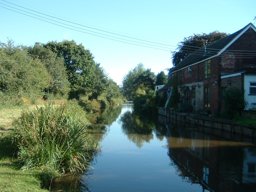
 Viewed looking west from Foleshill Rd, near Matlock Rd.
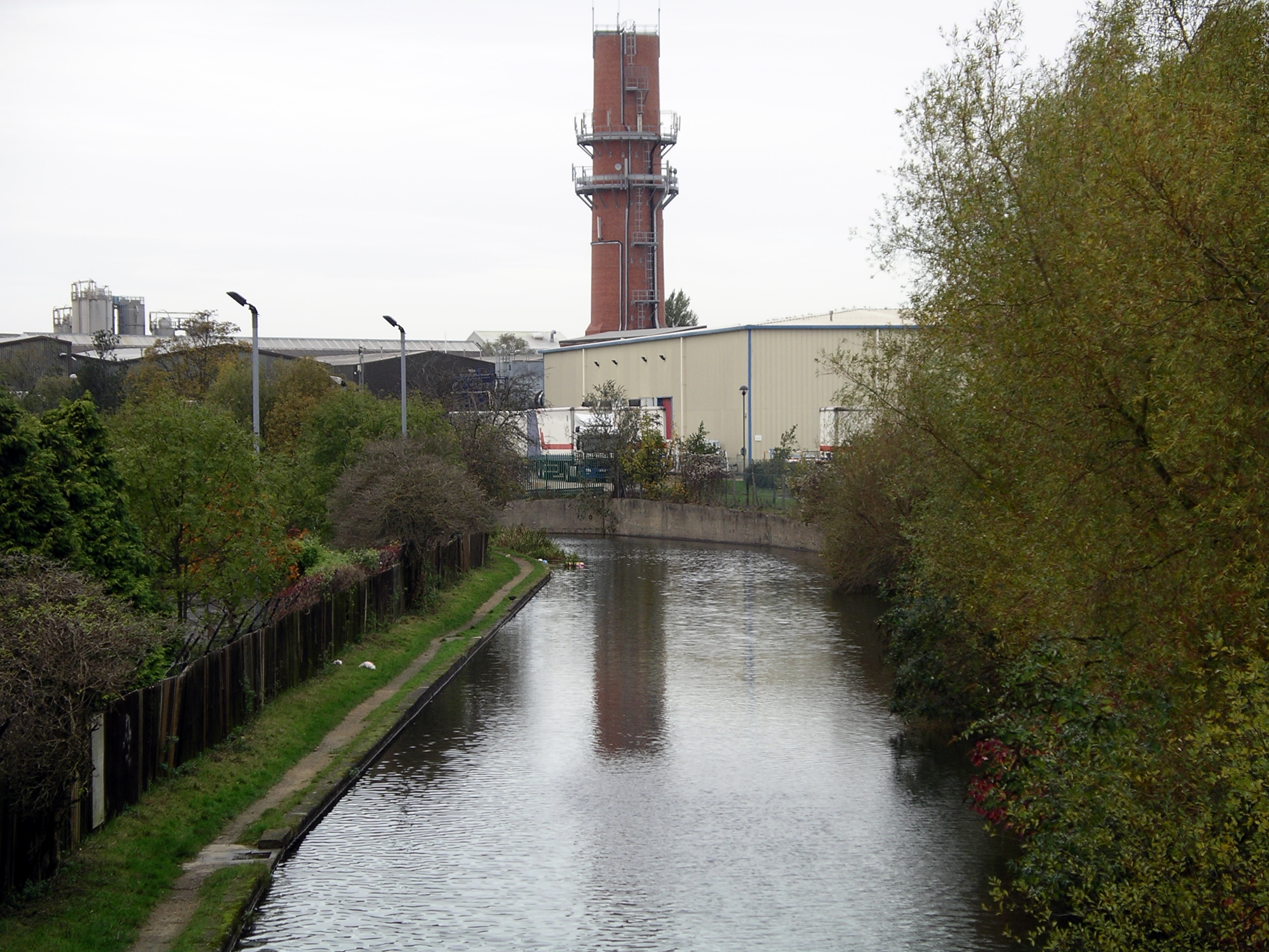
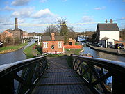 Hawkesbury Junction
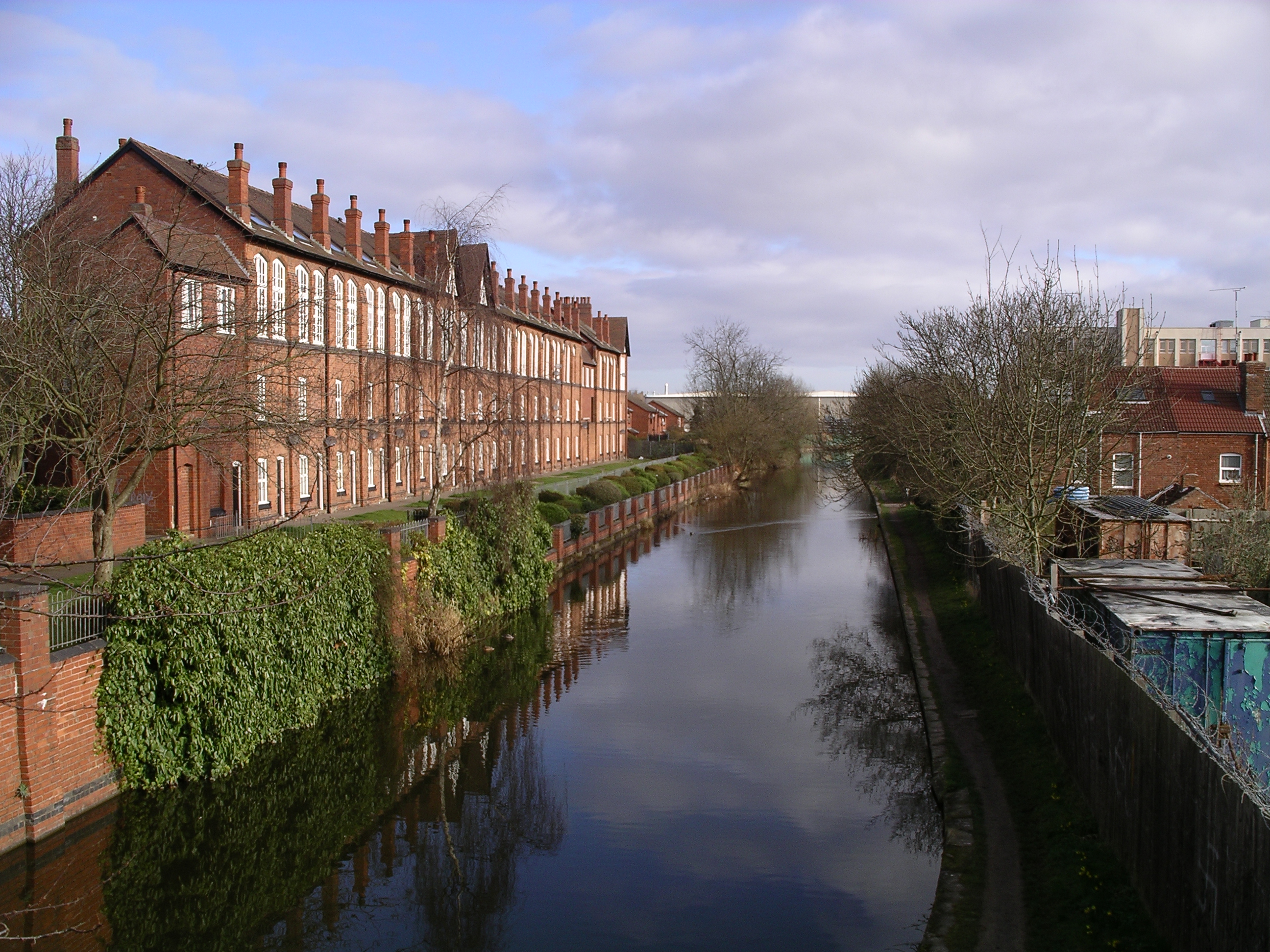
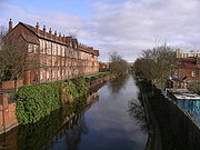 View to the north from Cash's Lane Bridge, Coventry.
References
External links
- Coventry Canal Society
- Mercia Canoe Club
- Guide to Coventry Canal from waterscape.com
- Panorama of Coventry Canal Basin - Virtual Midlands
Categories:- Canals in England
- Transport in Staffordshire
- Visitor attractions in Staffordshire
- Transport in Warwickshire
- Visitor attractions in Warwickshire
- Coventry
- Buildings and structures in Coventry

Wikimedia Foundation. 2010.