- Chichester Canal
-
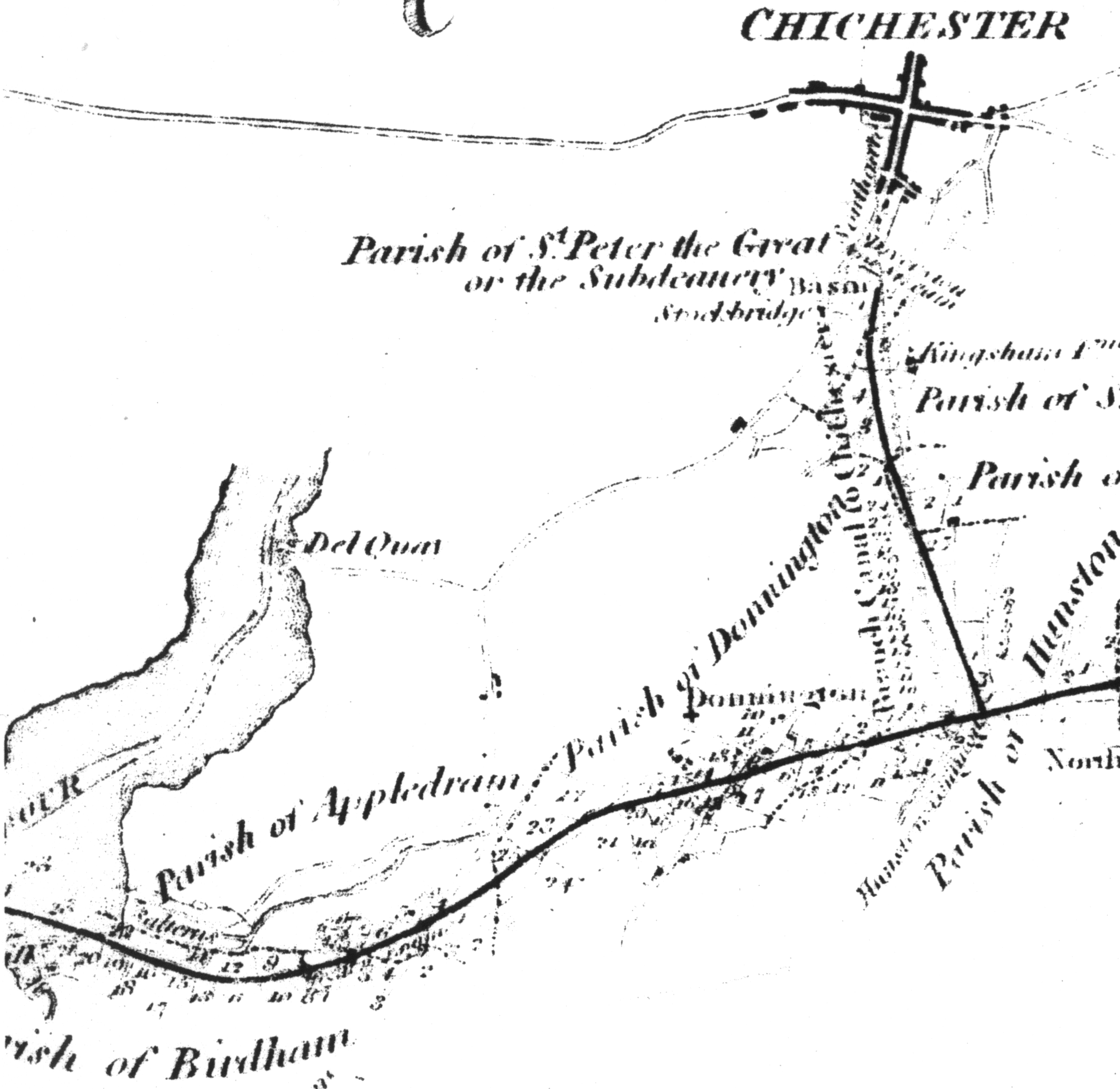
Chichester Canal A map of the planned route of the canal from 1815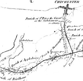
Date of act 1819 Date of first use 1922 Date closed 1928 Date restored 1984 Maximum boat length 85 ft 0 in (25.91 m) Maximum boat beam 18 ft 0 in (5.49 m) Start point Chichester End point Chichester Harbour Locks 2 Status part navigable Navigation authority West Sussex County Council The Chichester Canal is a navigable canal in England. It runs 4.5 miles (7.2 km) from the sea at Birdham Chichester Harbour to Chichester through two locks. The canal (originally part of the Portsmouth and Arundel Canal) was opened in 1822 having taken three years to build. When completed the canal could take ships of up to 100 tons. Dimensions were limited to 85 feet (26 m) long 18 feet (5.5 m) wide and a draft of up to 7 feet (2.1 m).[1]
Contents
History
Planning, construction and early operation
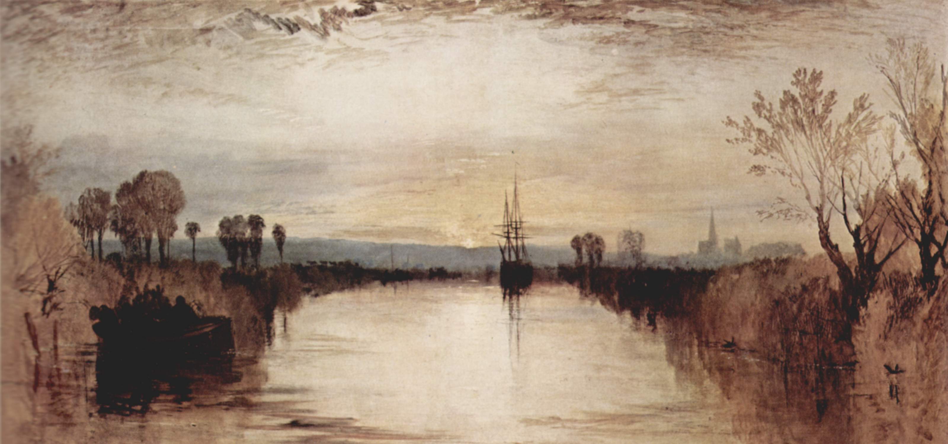
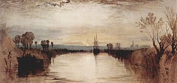 Chichester Canal by J.M.W. Turner
Chichester Canal Legend

Chichester Basin 
A27 Chichester Bypass 


Portsmouth and Arundel Canal 
End of navigable section 
B2201 Crosbie causeway 
A286 Birdham causeway 
Weir (was Casher lock) 
End of un-navigable section Moorings 
Salterns sea lock 
Chichester Harbour Proposals for a canal linking Chichester directly to the sea go back as least as far as 1585 when an act of parliament was passed allowing a cut linking Chichester with the sea.[2] Further proposals were made in the early 19th century, with schemes being proposed in 1801, 1802, 1803 and 1811, but none of these came to pass and as a result the first link to the sea was via a branch of the Portsmouth and Arundel Canal opened in 1822.[2] In 1817 it had been decided that the section between Chichester and Chichester Harbour, unlike the rest of the canal, would be built large enough to carry boats of 100 tons.[2] Putting this into practice required a new act of parliament which was obtained in 1819.[3] In the same year the construction of the Chichester branch began.[4] During the construction of the basin a hoard of 300 Denarii was found.[5] The section of the canal that would become the Chichester Canal was formally opened on the 9 April 1822[6]
The Portsmouth and Arundel Canal was conceived as part of a bigger plan to provide a secure inland canal route from London to Portsmouth, but by the time the route was completed, the war with France had ended. With the reason for its construction removed, the canal was not a commercial success, and apart from the Chichester section, it had fallen into disuse by 1847.[7]
Under the ownership of the Corporation of Chichester
The canal was transferred to the Corporation of Chichester in 1892.[8] In November of that year the City Surveyor gave a figure of £1000 to put the canal back into full working order. Work required included the repair of locks bridges and the removal of weeds and mud from the channel.[9] By 1898 only 704 tons of goods were carried and tolls for the year stood at £18.[10] The last recorded commercial traffic was in 1906 when a load of shingle was carried from Chichester Harbour to the basin at Southgate.[11] In the same year it was found that the swing bridges at Donnington and Birdham needed to be repaired or replaced. Westhampnett Rural District Council wanted to replace them with fixed bridges (which would have blocked the canal) but the Corporation of Chichester wanted to keep the canal open to traffic. By 1923 the Corporation appears to have accepted that there would be no further traffic and allowed the swing bridges to be replaced by fixed bridges.[9]
The canal survived until June 1928 before being formally abandoned.[11]
In 1932 the section of the canal between Cutfield Bridge and Salterns lock was reopened to allow yachts to be berthed there.[12] The open section was initially leased by Mr D S Vernon but in 1934 he transferred it to the Chichester Yacht Company.[13]
World War two
During World War 2 the canal was converted into an anti tank obstacle by the 4th infantry division as part of the preparations against a German invasion. These conversions included dismantling 4 swing bridges and building a dam above Cutfield bridge to raise the water level by 3 feet (0.91 m).[14] The level of the canal was raised using water diverted from the River Lavant.[13] The level of the canal proved hard to control and the changes in level caused some damage to the canal and a houseboat.[13] The arguments over who should pay for the damage lasted until June 1947.[15]
Post war
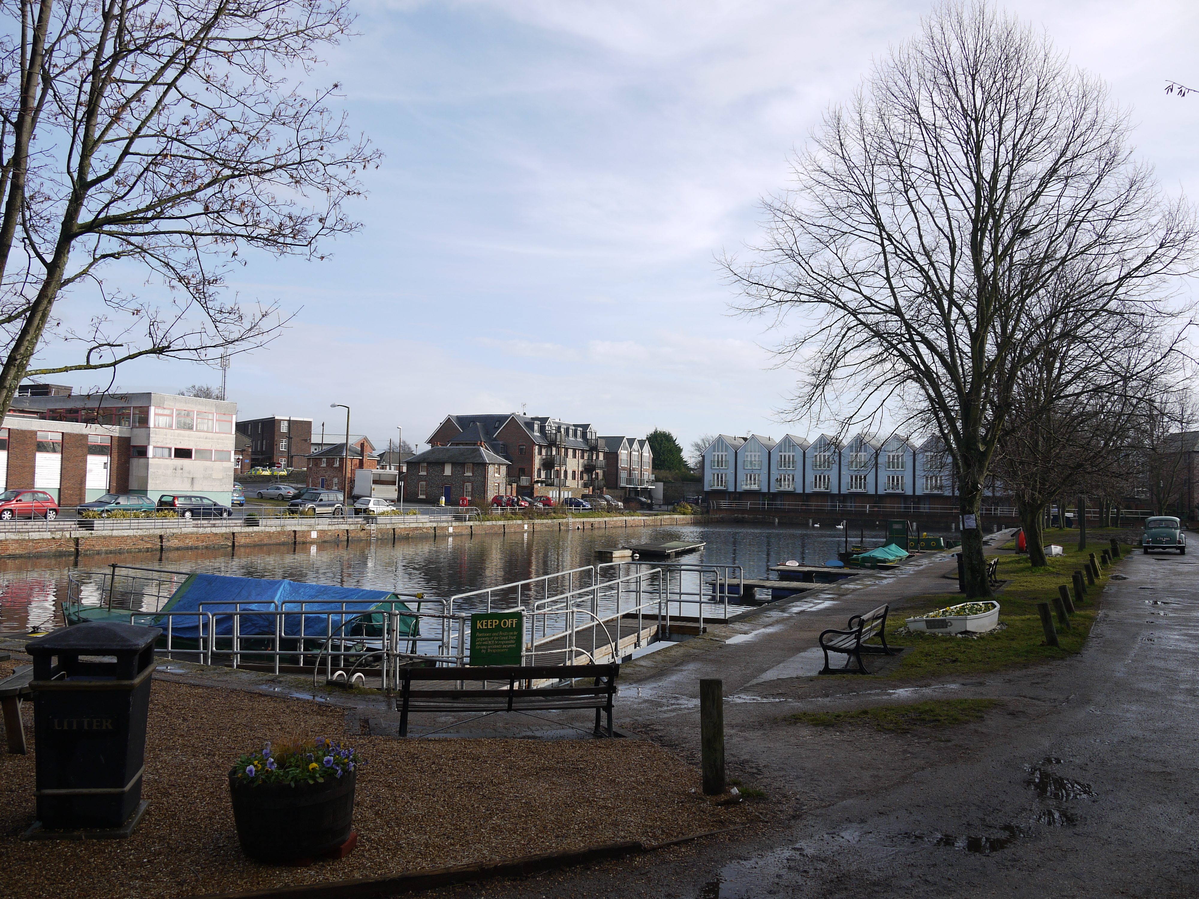
 Southgate basin at the Chichester end of the canal in 2011
In 1953 the canal and surrounding lands were sold to west Sussex County Council for £7,500.[16] The County Council planned to use part of the canal land for road improvements but these never took place.[16] The section below Cutfield Bridge continued to be leased to the Chichester Yacht Company while the upper part of the canal was leased to Chichester Canal Angling Association.[16]
In 1994 the canal was used in an attempt to keep floodwaters away from Chichester.[17]
The canal is now undergoing restoration. As of 2009 the sea lock is in working order but the other lock is not.
In 2009 the restoration was halted due to the presence of water voles.[18]
Points of interest
Point Coordinates
(Links to map resources)OS Grid Ref Notes Chichester Basin 50°49′49″N 0°46′54″W / 50.8304°N 0.7817°W SU859041 Jn with Portsmouth and Arundel Canal 50°48′47″N 0°46′29″W / 50.8131°N 0.7746°W SU864022 Site of Casher Lock 50°48′12″N 0°48′45″W / 50.8033°N 0.8126°W SU837010 Salterns Lock 50°48′14″N 0°49′41″W / 50.8040°N 0.8281°W SU826011 Chichester Channel See also
Bibliography
- Green, Alan H.J (2006). The History of Chichester’s Canal. Sussex Industrial Archaeology Society. ISBN 0951203614.
- Hadfield, Charles (1969). The Canals of South and South East England. David and Charles. ISBN 0-7153-4693-8.
- Heneghan, F. D. (1958). The Chichester Canal. Chichester City Council. ASIN B000XCT5Z6.
- Vine, P.A.L (1985). West Sussex waterways. Middleton Press. ISBN 0-906520-24-X.
- Vine, P.A.L (2005). London's Lost Route to Portsmouth. Phillimore & Co. ISBN 1-86007-283-8.
References
- ^ Heneghan 1958, p. 15
- ^ a b c Henegan 1958, pp. 1-2
- ^ Green 2006, p. 12
- ^ Green 2006, p. 24
- ^ Green 2006, p. 26
- ^ Green 2006, p. 30
- ^ Vine 1985
- ^ Vine 2005, p. 153
- ^ a b Henegan 1958, p. 19
- ^ Vine 2005, p. 155
- ^ a b Vine 2005, p. 161
- ^ Hadfield 1969, p. 146
- ^ a b c Green 2006, p. 65
- ^ Vine 2005, p. 163
- ^ Green 2006, pp. 65-70
- ^ a b c Green 2006, pp. 73-74
- ^ Chaudhary, Vivek (Jan 11, 1994). "Sales boom helps trader overcome that sinking feeling". The Guardian (Manchester).
- ^ "Voles Halt Chichester Restoration". Waterways (226): 32. winter 2009.
External links
Coordinates: 50°48′47.58″N 0°46′27.71″W / 50.8132167°N 0.7743639°W
Categories:- Canals in England
- Canals in West Sussex
- History of West Sussex
- Transport in West Sussex
- Chichester
Wikimedia Foundation. 2010.