- Mount Narodnaya
-
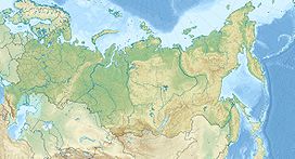
Mount Narodnaya Khanty-Mansi Autonomous Okrug in Tyumen Oblast, Russia Elevation 1,895 m (6,217 ft) Prominence 1,772 m (5,814 ft) Listing Ultra Location Range Ural Mountains Coordinates 65°02′N 60°07′E / 65.033°N 60.117°ECoordinates: 65°02′N 60°07′E / 65.033°N 60.117°E Climbing Easiest route Hike Mount Narodnaya (also known as Naroda and Poznurr; Russian: Гора Наро'дная, Гора На'родная, На'рода-Из[1], meaning People's Mountain), located in the Research Range, is the highest peak of the Urals in Russia. Its elevation is 1,895 metres (6,217 ft). It is in Khanty-Mansi Autonomous Okrug in Tyumen Oblast, 0.5 km to east from the border of Komi Republic.
It is the highest point in European Russia outside the Caucasus. This leads to its large topographic prominence of 1,772 metres (5,814 ft), with its key saddle being in Kazakhstan.[2]
Narodnaya is located in the Ural mountains water divide, and therefore on the border between Europe and Asia: the Naroda river flows south-east from the summit into the Ob river in Siberia, and the Kos'yu river flows north-west from the summit into the Pechora river in Europe.
The mountain is formed with quartzites and metamorphosed slates of the Proterozoic and Cambrian eras. There are some glaciers on the mountain. Also, there are sparse forests of larch and birch in the deep valleys at the foot of the mountain. The slopes of the mountain are covered with highland tundra.
The easiest route to the summit is a technically easy hike on the moderate north-west slope. Depending on snow and ice conditions, crampons may be required. The south wall of Narodnaya is steep and has not been climbed.[3]
References
Ultra prominent peaks of Europe Scandinavia Galdhøpiggen • Kebnekaise • Jiehkkevárri • Snøhetta • Store Lenangstind • Sarektjåhkkå — On islands: Beerenberg • Hvannadalshnúkur • Newtontoppen • Novaya Zemlya HPWestern Europe Atlantic islands Alps Mont Blanc • Grossglockner • Finsteraarhorn • Wildspitze • Bernina • Hochkönig • Monte Rosa • Hoher Dachstein • Marmolada • Viso • Triglav • Barre des Écrins • Säntis • Ortler • Baldo • Gran Paradiso • Coca • Cima Dodici • Dents du Midi • Chamechaude • Zugspitze • Antelao • Arcalod • Grintovec • Großer Priel • Grigna Settentrionale • Bondone • Presanella • Birnhorn • Col Nudo • Pointe Percée • Montasch • Polinik • Tödi • Birkkarspitze • Wilder Kaiser • Grande Tête de l'Obiou • Cima Tosa • Hochtor • Grimming • Grand Combin • Tournette • Zirbitzkogel • KeschItaly Eastern Europe Carpathians: Gerlachovský štít • Parângu Mare • Moldoveanu • Peleaga — Crimea: Roman-Kosh — Urals: NarodnayaBalkans Mediterranean islands Caucasus Elbrus • Bazardüzü • Kazbek • Tebulosmta • Aragats • Dykh-Tau • Dyultydag • Kapudzhukh • Gora Addala Shukgelmezr • Shani • ShahdaghExternal links
- [1] Photos from a trek to Narodnaya
Categories:- Mountains of Russia
- Khanty-Mansi Autonomous Okrug
- Komi Republic
- Urals Federal District geography stubs
- Northwestern Russia geography stubs
Wikimedia Foundation. 2010.

