- Moldoveanu Peak
-
Moldoveanu Peak 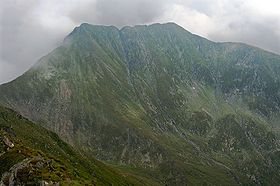
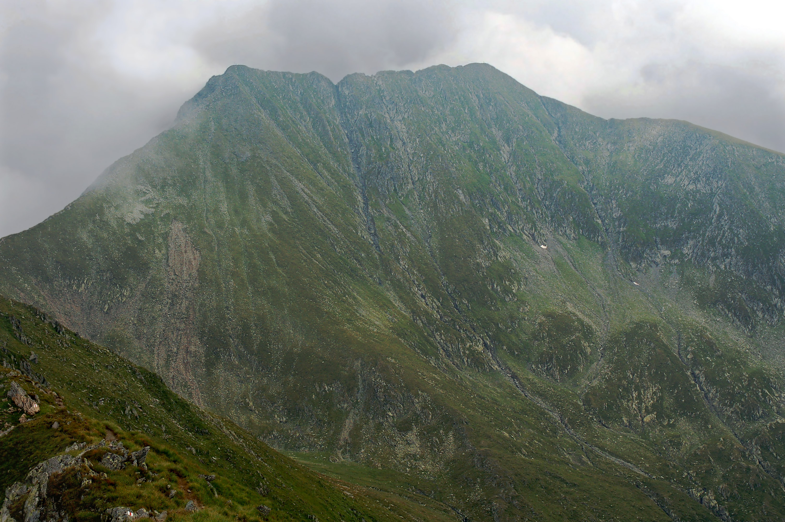
Moldoveanu (right) and Viştea Mare (left)Elevation 2,544 m (8,346 ft) Prominence 2,046 m (6,713 ft) Listing Country high point
UltraLocation Argeş County,
 Moldoveanu Peak
 Romania
Range Făgăraş Mountains, Southern Carpathians Coordinates 45°35′57.98″N 24°44′10.36″E / 45.5994389°N 24.7362111°ECoordinates: 45°35′57.98″N 24°44′10.36″E / 45.5994389°N 24.7362111°E Climbing Easiest route Scramble Moldoveanu Peak (Romanian: Vârful Moldoveanu pronounced [moldoˈve̯anu]), at 2544 m, is the highest mountain in Romania, located in Argeş County, in the Făgăraş Mountains of the Southern Carpathians.
The most used paths to reach Moldoveanu are over the Viştea Mare (2527m), by paths coming from Podragu, Sambata, or by the Vistea Valley.
The closest locality is Victoria, on the north side. On the south side it is accessible from northwest of Câmpulung.
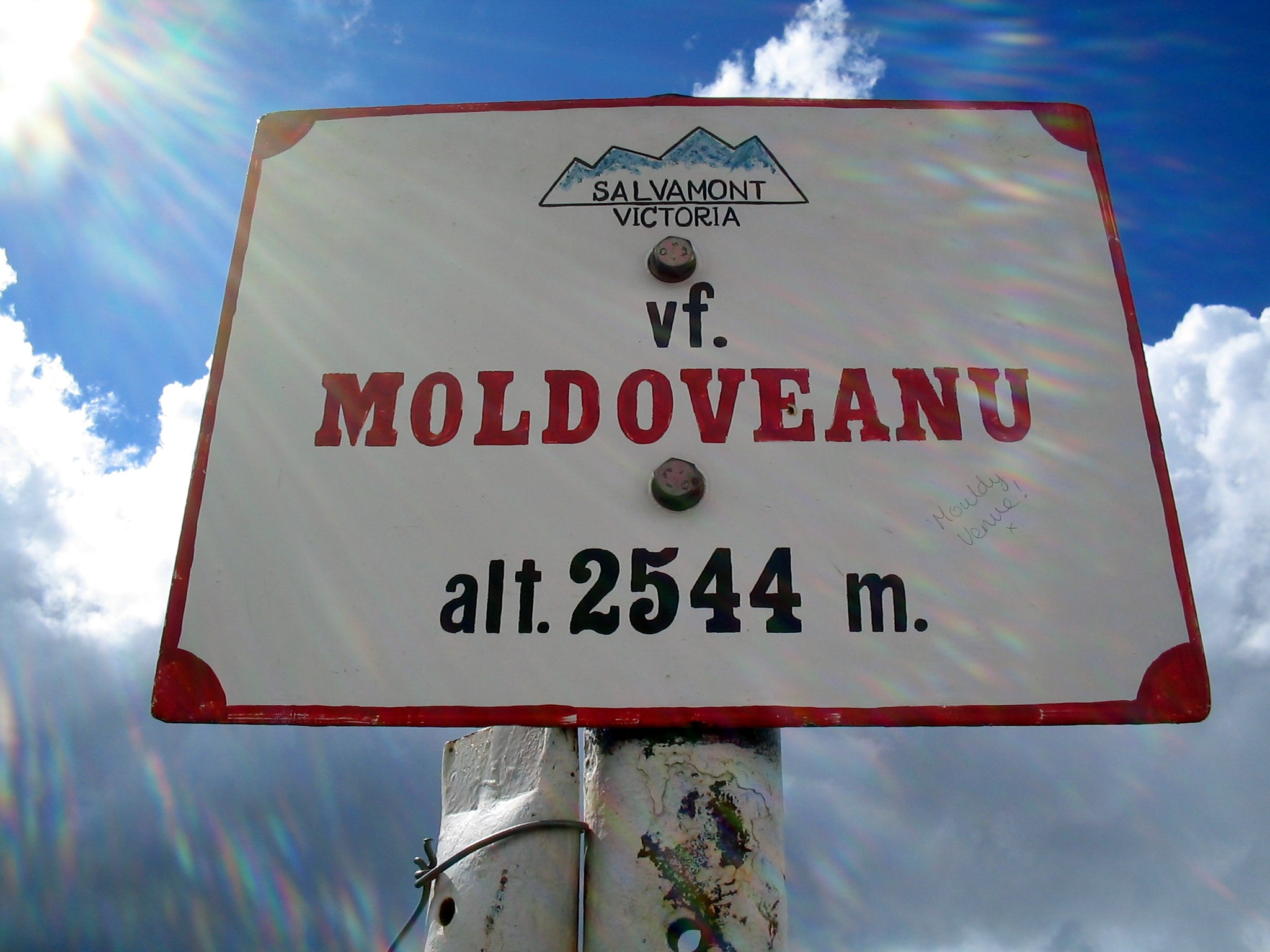
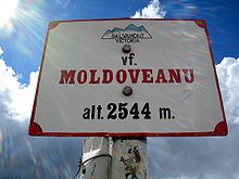 Height marker on top
External links
Ultra prominent peaks of Europe Scandinavia Galdhøpiggen • Kebnekaise • Jiehkkevárri • Snøhetta • Store Lenangstind • Sarektjåhkkå — On islands: Beerenberg • Hvannadalshnúkur • Newtontoppen • Novaya Zemlya HPWestern Europe Atlantic islands Alps Mont Blanc • Grossglockner • Finsteraarhorn • Wildspitze • Bernina • Hochkönig • Monte Rosa • Hoher Dachstein • Marmolada • Viso • Triglav • Barre des Écrins • Säntis • Ortler • Baldo • Gran Paradiso • Coca • Cima Dodici • Dents du Midi • Chamechaude • Zugspitze • Antelao • Arcalod • Grintovec • Großer Priel • Grigna Settentrionale • Bondone • Presanella • Birnhorn • Col Nudo • Pointe Percée • Montasch • Polinik • Tödi • Birkkarspitze • Wilder Kaiser • Grande Tête de l'Obiou • Cima Tosa • Hochtor • Grimming • Grand Combin • Tournette • Zirbitzkogel • KeschItaly Eastern Europe Carpathians: Gerlachovský štít • Parângu Mare • Moldoveanu • Peleaga — Crimea: Roman-Kosh — Urals: NarodnayaBalkans Mediterranean islands Caucasus Elbrus • Bazardüzü • Kazbek • Tebulosmta • Aragats • Dykh-Tau • Dyultydag • Kapudzhukh • Gora Addala Shukgelmezr • Shani • ShahdaghCategories:- Mountains of Romania
- Mountains of the Southern Carpathians
- Braşov County
- Braşov County geography stubs

Wikimedia Foundation. 2010.