- Tierra del Fuego Province, Argentina
-
Tierra del Fuego,
Antarctica and
South Atlantic Islands— Province — 
Flag
Coat of armsLocation of Tierra del Fuego Province within Argentina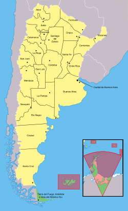
Country Argentina Capital Ushuaia Departments 4 Local Governments 5 Government – Governor Fabiana Rios (ARI) – Deputies 5 – Senators 3 Area
Ranked 22nd– Total 22,524 km2 (8,696.6 sq mi) Population (2010[1]) – Total 126.190 (Ranked 24th) – Density 5.8/km2 (15/sq mi) Demonym fueguino Time zone ART (UTC−3) ISO 3166 code AR-V Website tierradelfuego.gov.ar Tierra del Fuego (Spanish pronunciation: [ˈtjera ðel ˈfweɣo]; officially Provincia de Tierra del Fuego, Antártida e Islas del Atlántico Sur) is an Argentine province entirely separated from mainland Argentina by the Strait of Magellan. It includes:
- The eastern part of the Isla Grande of Tierra del Fuego archipelago (the western part is the Chilean province of Tierra del Fuego) and the Staten Island.
- Argentina's claims to the Falkland Islands (under their Spanish-language name, Malvinas) and to South Georgia and the South Sandwich Islands; these are self-governing overseas territories of the United Kingdom.
- Argentina's claims to Antarctica. All claims to Antarctica are effectively subject to the Antarctic Treaty. Argentina's claim overlaps with both the British claim and the Chilean claim.
Contents
History
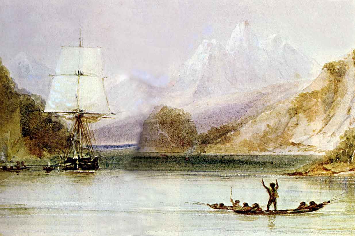
 Period impression of the HMS Beagle navigating along Tierra del Fuego, 1833.
The youngest of the Argentine provinces was first inhabited around 12,000 years ago. When the first Europeans arrived, they encountered a population of about 10,000 indigenous people belonging to four tribes: Yamana, Alakaluf, Selk'nam and Manek'enk (Haush).[2] Within fifty years after discovery, only about 350 natives remained due to the diseases such as smallpox and measles that had ravaged these tribes.[3][4] The provincial capital city is Ushuaia, from a native word meaning "bay towards the end".
The territory was first seen by Europeans in 1520 during Ferdinand Magellan's expedition. He named the area Land of Smokes (later changed to Land of Fire) as he saw what were probably the fires produced by the local peoples for heat.
Juan de Alderete in 1555 and later Pedro Sarmiento de Gamboa intended to found settlements in the area, but the inclemency of the weather and the constant attacks of British pirates, who took Sarmiento de Gamboa prisoner, frustrated their ambitions.[citation needed]
Spanish, Dutch, British and French explorers ventured on Tierra del Fuego island and the nearby seas. Gabriel de Castilla passed through before exploring the Antarctic islands, while Robert FitzRoy, and Charles Darwin explored this land and other parts of Patagonia.
In 1828 Argentina established a penal colony at Puerto Luis on the Falkland Islands, but in 1833 the British sent a naval task force to request that the Argentine representative of the islands, José María Pinedo, and Argentine forces leave the islands.
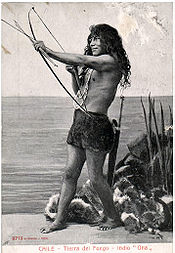 A inhabitant of the Selknam people, 1904. The Selknams, or, Onas, who place great value on amiability, were the island's most numerous native people.
Luis Piedrabuena installed a base in San Juan de Salvamento on Isla de los Estados island. The British Patagonia Mission, under its superintendent Waite Stirling, founded Ushuaia as an Anglican mission in 1869,[5] and shortly thereafter Salesian missionaries founded Río Grande.
In the 1880s the Argentine government took a more active interest in Tierra del Fuego. In 1881, the meridian 68°36'38 W was defined as the boundary between the Chilean and the Argentine sides of the island. In 1884 the Government of Tierra del Fuego was created, and a subprefecture was established at Ushuaia.
The southern part of the Beagle Channel was an issue of conflict between both states, specially regarding three small islands, Picton, Lennox and Nueva, which were given to Chile by decision of the mediating British Crown in 1977, revised by Pope John Paul II and ratified by treaty in 1985.
When the crews of sailing-ships told of the notoriously dangerous voyage round the tip of South America, Tierra del Fuego became a byword in Europe for an inhospitable land, where life would be impossibly harsh for settlers. In reality however, it is by no means the most sparsely populated province of Argentina. Its population density of 4.75/ km² is in fact higher than five other provinces, due to various waves of immigration.
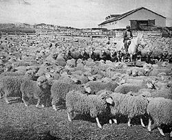 Local sheep ranch, 1942. The island's sole important activity at one time, sheep have been eclipsed by the decline in the global wool market as much as by petroleum and gas extraction.
Gold fever started in Tierra del Fuego around 1883. Many Croatians from the Dalmatian coast arrived in search of gold. The gold rush brought with it some innovations such as the telegraph in addition to a wave of immigrants. Although by 1910 the gold had run out, most of the pioneers stayed. The inauspicious-looking northern plains proved ideal sheep-farming country, and vast ranches sprang up. Croatian, Scottish, Basque, Italian, Galician and Chilean immigrants arrived to work on the estancias and build up their own landholdings.
With the creation of the Gobernación Marítima de Tierra del Fuego[explain in English] in 1943, construction of naval bases began in Ushuaia and Río Grande, as well as an airport and other infrastructure. This brought immigrants from other countries as well as other parts of Argentina.
It was not until 1990 that the "National Territory of Tierra del Fuego, the Antarctic and the South Atlantic Islands" was declared a province, and its first governor was appointed two years later.
As a result of killings and disease, by 1920 the Amerindian population of the island had dropped to only 200. News of the atrocities responsible for this reached the Federal Congress, in Buenos Aires, which tried to help the Salesian mission, the only institution working in the island to protect them.[citation needed]
Geography and climate
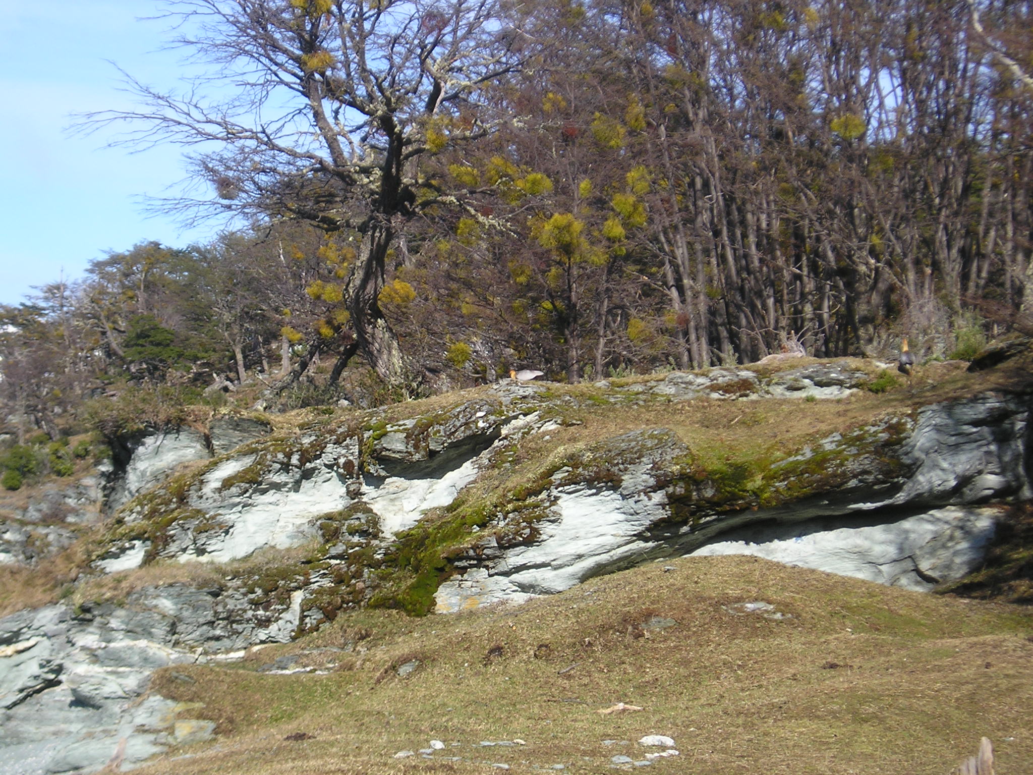
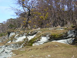 Mossy landscape, Tierra del Fuego.
The province can be geographically divided into 3 distinct areas: the Tierra del Fuego islands, Argentine Antarctica, and the South Atlantic Islands.
Tierra del Fuego Island
For more information, see Isla Grande de Tierra del Fuego.There are low mountains and sandy beaches at the north of the island, ascending to the south. The north is somewhat similar to the steppe of Santa Cruz Province. In the middle of the island, the end of the Andes mountain system becomes flattened, and its highest peak, Mount Cornú, rises only 1,490 meters (4,890 ft). There are a number of short rivers (the Grande, Moneta, Ona, Lasifashaj, etc.), and as a result of the low temperature there are many small glaciers that flow to the sea. The annual average temperature of the island is 5.3 °C (41.5 °F), with precipitation of 300 millimeters (12 in) in the north and 550 millimeters (22 in) in the south. Much of this island can be classified as within the Magellanic subpolar forests ecoregion.[6]
Argentine Antarctica
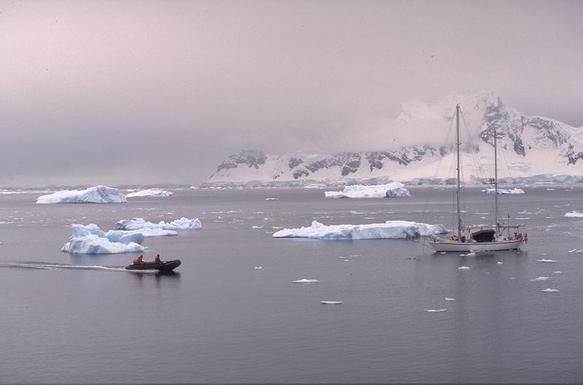
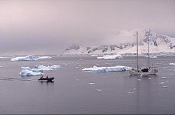 Watercraft in Esperanza Bay, Antarctica.See also: Argentine Antarctica
The part of Antarctica claimed by Argentina is formed by Palmer Land and the Weddell Sea, of which half remains frozen all year round. The highest peak of this section of the continent is Mt. Chiriguano, at 3,360 meters (11,020 ft). The weather is normally cold and windy.
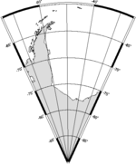 Antarctic portion between meridians 25º West and 74º West
South Atlantic Islands
See also: Falkland Islands, Sovereignty of the Falkland Islands, and Sovereignty of South Georgia and the South Sandwich IslandsMost of the islands of the Southern Atlantic have a more humid climate, except for the Falkland Islands: for instance, the Año Nuevo and Isla de los Estados islands have a dense vegetation of low forests of lenga beech and antarctic beech.
The Falklands are covered in moorland, receive less precipitation than islands closer to the continent, and are constantly swept by strong winds. The South Orkney Islands, South Georgia and the South Sandwich Islands are also considered to be part of the South Atlantic Islands, and they are colder than the others, because they are so far from continental land masses.
Economy
Tierra del Fuego has since the 1970s benefited from government subsidies to local industry and from its natural wealth. Its estimated 2006 output of US$2.6 billion gave the province a per capita income of US$25,700, second in Argentina only to the city of Buenos Aires itself and almost three times the national average.[7]
Manufacturing, despite the province's remoteness, contributes about 20% to output owing partly to generous certain tax incentives to local industry, a policy Buenos Aires has pursued to encourage immigration to less populated areas. A number of sizable factories have opened on Tierra del Fuego Island to take advantage of the tax benefits legislated in 1972, mainly home appliance and electronics manufacturers.
Recently, in the city of Río Grande, many international and Argentine companies, most notably the Korean company Samsung and the Argentine company Teltron, have set up factories that produce high-definition televisions (HDTV), CD-ROM-related articles, and low-cost GSM cell phones built mainly from Argentine components.
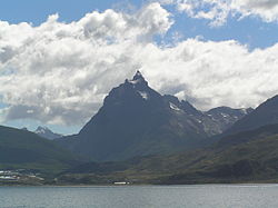 Mount Olivia, a popular tourist destination near Ushuaia.
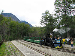 "Train to the End of the World". Operated by the province, it is the world's southernmost active railway.
Sheep ranching, is the leading source of the province's modest agricultural income (5% of output). It still serves as an important source of wool, mutton and hides throughout the province and the wider Argentine market, whose taste for these products has been growing strongly.
As with its neighbors in Patagonia to the north, petroleum and natural gas extraction contributes generously to Tierra del Fuego's economy, lately over 20% of total output. Exploration efforts continue, not only along the island's shores themselves, but, also near the Falkland Islands, where exploration under licences issued by the Falkland Islands government has caused anger in Argentina. This has also intruded onto the area's lucrative crab and shrimp fishing industry.
Tourism is gaining importance on Tierra del Fuego island. The region offers mountains, glaciers, forests, fast rivers, waterfalls, a ski centre, and the sea, all within short distances. Both Jules Verne and Darwin were fascinated by the beauties of the island.
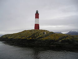
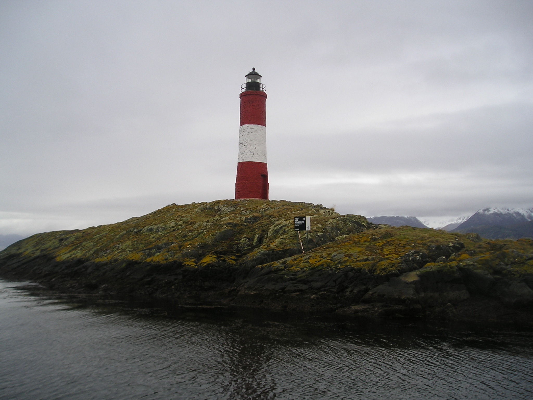
The most visited destinations include Ushuaia, the Tierra del Fuego National Park and the Tren del Fin del Mundo, Fagnano Lake, the Museum of the End of the World, the Beagle Channel, the Les Eclaireurs lighthouse, the old jail, and South Staten Island.
The Argentine Antarctic started receiving tourists a short time ago. Tourists can see wildlife at the Argentine Marambio Base during the summer.
The Falkland Islands gained publicity as a result of the Falklands War, and a modest number of tourists venture to the islands. Argentine nationals have been free to do so again since the 1989 restoration of diplomatic relations between the two former adversaries.
Political division
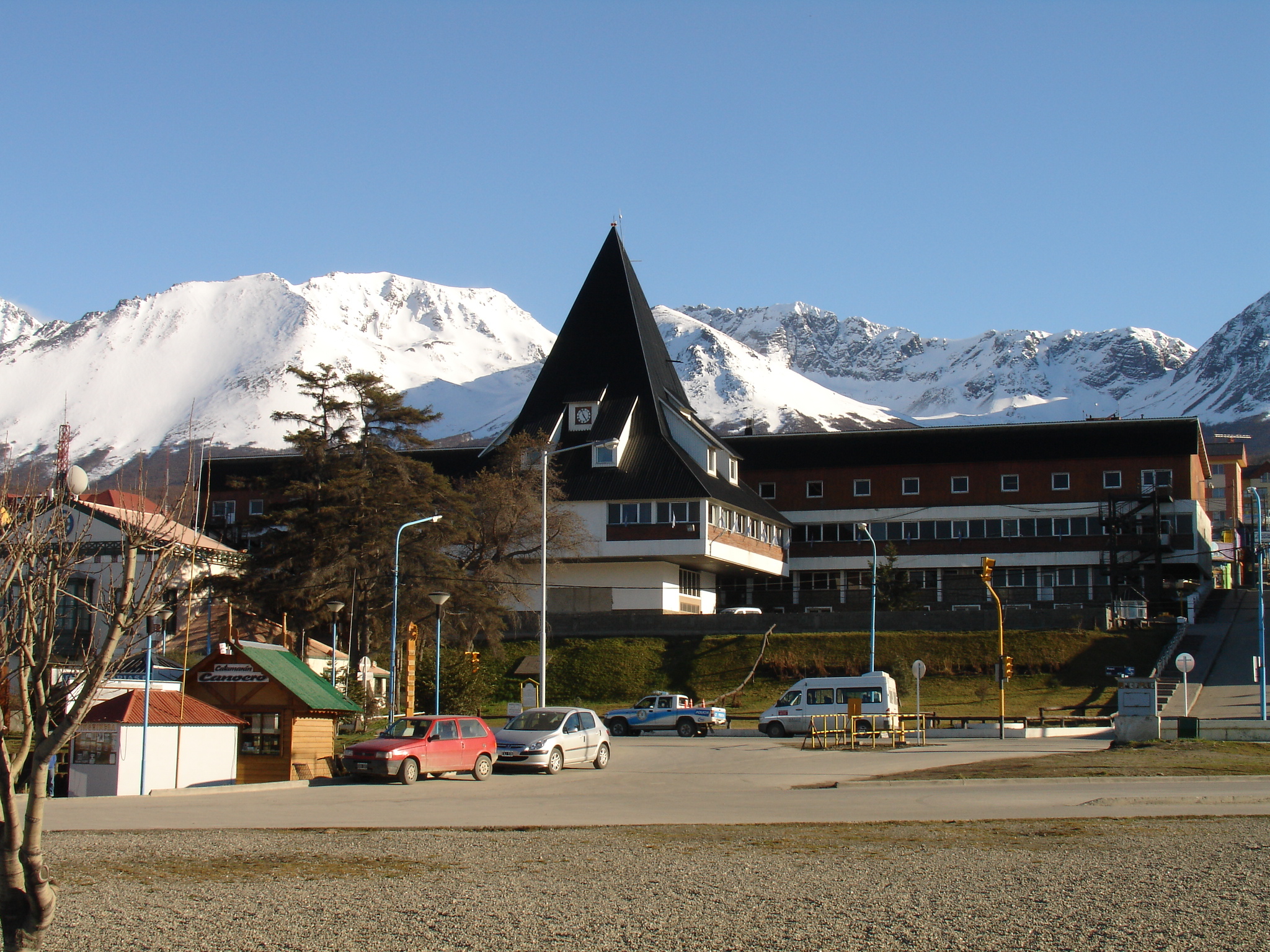
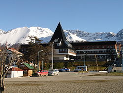 Governor's offices, Ushuaia.
The province is divided into 4 departments (Spanish: departamentos), only the first two of which are under the effective control of Argentina:
- Ushuaia (capital Ushuaia)
- Río Grande (capital Río Grande)
- Antártida Argentina: the Argentine claim to Antarctica, which lies between 25°W and 74°W (overlapping both Chilean and British claims) and which is uninhabited apart from the staff of scientific bases. Being south of 60°S, the Argentine claim to the entire department is suspended under the Antarctic Treaty. The South Orkney Islands and South Shetland Islands, which also lie south of 60°S, are considered by Argentina to be part of the department of Islas del Atlántico Sur.
- Islas del Atlántico Sur: consists of the Argentine claim to the Falkland Islands (Malvinas in Spanish) and South Georgia and the South Sandwich Islands, both of which are self-governing overseas territories of the United Kingdom. The department also includes the South Orkney Islands and South Shetland Islands, though these lie south of 60°S and thus the Argentine claim is again suspended under the Antarctic Treaty.
See also
- Tierra del Fuego Island
- Tierra del Fuego Province, Chile
- Treaty of Peace and Friendship of 1984 between Chile and Argentina
- Same-sex marriage in Argentina
References
- ^ Censo 2010 Argentina resultados provisionales: mapas
- ^ Tierra Del Fuego
- ^ Yahgan & Ona - The Road to Extinction
- ^ "La Patagonia Trágica"
- ^ Bridges, E. L. (1948) Uttermost Part of the Earth : Patagonia & Tierra del Fuego. London: Hodder & Stoughton, 1948; republished 2008, Overlook Press ISBN 978-1585679560
- ^ World Wildlife Fund; C.Michael Hogan. 2010. Magellanic subpolar forests. Encyclopedia of Earth, National Council for Science and the Environment. Washington DC
- ^ I.A.D.E.R
External links
- Tierra del Fuego provincial government homepage (Spanish)
- Tierra del Fuego tourist information (English) (Spanish)
Provinces of Argentina Provinces Buenos Aires · Catamarca · Chaco · Chubut · Córdoba · Corrientes · Entre Ríos · Formosa · Jujuy · La Pampa · La Rioja · Mendoza · Misiones · Neuquén · Río Negro · Salta · San Juan · San Luis · Santa Cruz · Santa Fe · Santiago del Estero · Tierra del Fuego · Tucumán

Autonomous city Categories:- Provinces of Argentina
- Tierra del Fuego Province (Argentina)
- Divided regions
- States and territories established in 1990


Wikimedia Foundation. 2010.