- Portal:Atlantic Archipelagoes
-
- Wikipedia portals:
- Culture
- Geography
- Health
- History
- Mathematics
- Natural sciences
- People
- Philosophy
- Religion
- Society
- Technology
Atlantic Archipelagoes
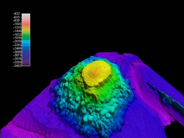
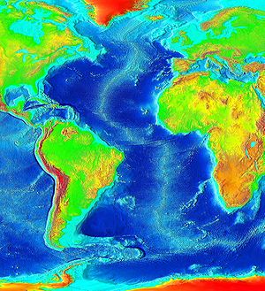 Atlantic bathymetry
 Pangaea separation animation, which formed the Atlantic Ocean known today.
The Atlantic Ocean is the second-largest of the world's oceanic divisions; with a total area of about 106.4 million square kilometres (41.1 million square miles). It covers approximately one-fifth of the Earth's surface. The first part of its name refers to the Atlas of Greek mythology, making the Atlantic the "Sea of Atlas". The oldest known mention of this name is contained in The Histories of Herodotus around 450 BC (I 202); see also: Atlas Mountains. Another name historically used was the ancient term Ethiopic Ocean, derived from Ethiopia, whose name was sometimes used as a synonym for all of Africa and thus for the ocean. Before Europeans discovered other oceans, the term "ocean" itself was to them synonymous with the waters beyond Western Europe that we now know as the Atlantic and which the Greeks had believed to be a gigantic river encircling the world; see Oceanus.
Selected panorama

Selected article
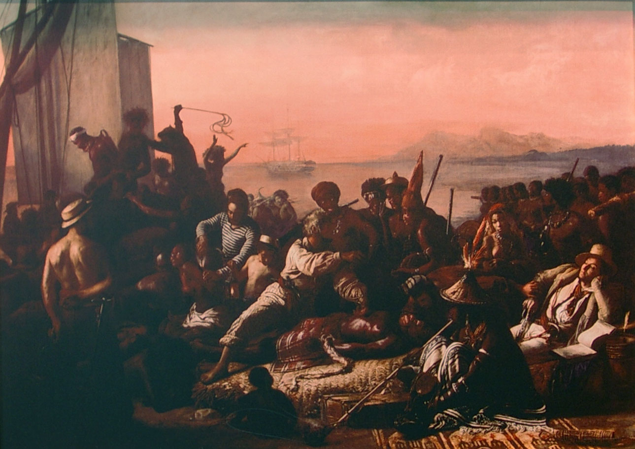
 "The Slave Trade" by Auguste Francois Biard, 1840
The Atlantic slave trade, also known as the transatlantic slave trade, was the trade of primarily African people supplied to the colonies of the New World that occurred in and around the Atlantic Ocean. It lasted from the 16th century to the 19th century. Most slaves were shipped from West Africa and Central Africa and taken to the New World (primarily Brazil[1]). Generally slaves were obtained through coastal trading with Africans, though some were captured by European slave traders through raids and kidnapping.[2][3] Most contemporary historians estimate that between 9.4 and 12 million[4][5] Africans arrived in the New World,[6][7] although the number of people taken from their homestead is considerably higher.[8][9]
The slave-trade is sometimes called the Maafa by African and African-American scholars, meaning "holocaust" or "great disaster" in Swahili. The slaves were one element of a three-part economic cycle—the Triangular Trade and its Middle Passage—which ultimately involved four continents, four centuries and millions of people.
Selected archipelago
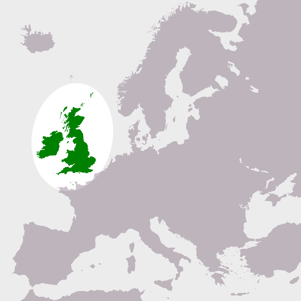
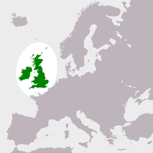 The British Isles in relation to Europe
The British Isles are a group of islands off the northwest coast of continental Europe that include Great Britain and Ireland, and numerous smaller islands.[10] There are two sovereign states located on the islands: the United Kingdom of Great Britain and Northern Ireland, and Ireland.[11] The British Isles also includes the Crown Dependencies of the Isle of Man and, by tradition, the Channel Islands, although the latter are not physically a part of the island group.[12]
The term "British Isles" is controversial in relation to Ireland, where there are objections to the use of the phrase and the government of Ireland discourages its use.[13][14][15] "Britain and Ireland" is a frequently used alternative name for the group.[16][17]
There are more than 6,000 islands in the group, the largest two being Great Britain and Ireland.
Great Britain is to the east and covers 216,777 km2 (83,698 square miles), over half of the total landmass of the group.
Ireland is to the west and covers 84,406 km2 (32,589 square miles).
The largest of the other islands are to be found in the Hebrides, Orkney and Shetland to the north, Anglesey and the Isle of Man between Great Britain and Ireland, and the Channel Islands near the coast of France.
In the news

Did you know?
Portal:Atlantic Archipelagoes/Did you know
Selected biography
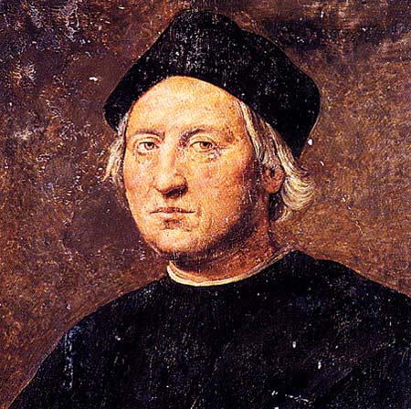
 Posthumous portrait of Christopher Columbus, Admiral of the Ocean Sea, Viceroy and Governor of the Indies, by Ridolfo Ghirlandaio.
Christopher Columbus (between August 25 and October 31, 1451 – May 20, 1506) was a Genoese navigator, colonizer and explorer whose voyages across the Atlantic Ocean—funded by Queen Isabella of Spain—led to general European awareness of the American continents in the Western Hemisphere. Although not the first to reach the Americas from Europe—he was preceded by the Norse, led by Leif Ericsson, who built a temporary settlement 500 years earlier at L'Anse aux Meadows[18]— Columbus initiated widespread contact between Europeans and indigenous Americans. With his several hapless attempts at establishing a settlement on the island of Hispaniola, he initiated the process of Spanish colonization which foreshadowed general European colonization of the "New World." (The term "pre-Columbian" is usually used to refer to the peoples and cultures of the Americas before the arrival of Columbus and his European successors.)
Selected picture
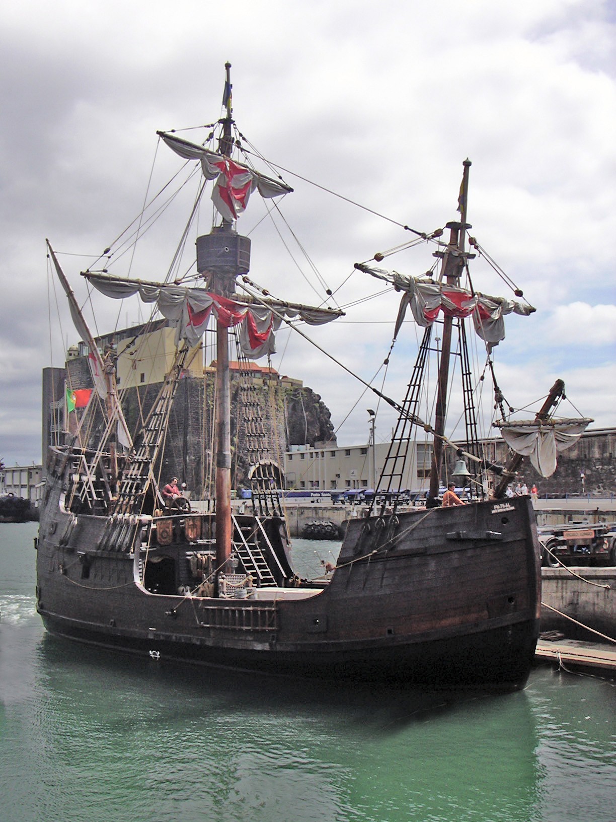
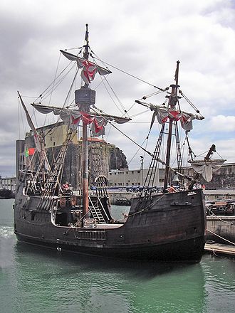 The Santa Maria - A replica of Christopher Columbus' Flagship
Categories
no subcategoriesTopics
- Topic outline of Atlantic Archipelagoes
- List of Atlantic Archipelagoes-related articles
Related portals
Africa •Antarctica •Arctic • Asia • Caribbean • Europe • Latin America • North America • Oceania


British Empire Colonialism Seamounts Volcanoes North Atlantic Archipelagoes 


Azores Bermuda British Isles Canary Islands 


Faroe Islands Iceland Isle of Man Madeira Tropical Atlantic Archipelagoes 

Ascension Island The Bahamas Cape Verde 


St Helena São Tomé & Príncipe Turks & Caicos Isles South Atlantic Archipelagoes 


Falkland Islands Sth Georgian Islands Tristan da Cunha WikiProjects

Bermuda Cape Verde Faroe Islands Iceland 
Isle of Man São Tomé and Príncipe WikiProject Council Things to do

- Join the WikiProject Atlantic Archipelagoes group to assist in the various listed tasks.
- Be bold. Wikipedia is for the people, by the people and needs YOU as a contributor to spread global knowledge.
Wikimedia
Cite error: There are<ref>tags on this page, but the references will not show without a{{Reflist}}template or a<references />tag; see the help page.Categories:- Atlantic Archipelagoes
- Portals under construction


Wikimedia Foundation. 2010.