- Oswegatchie Historic District
-
Oswegatchie Historic District
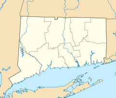
Location: East St., Riverside, Plant , Park Drs., and Sharwandassee and Oswegatchie Rds, Waterford, Connecticut Coordinates: 41°21′7″N 72°11′5″W / 41.35194°N 72.18472°WCoordinates: 41°21′7″N 72°11′5″W / 41.35194°N 72.18472°W Architectural style: Colonial Revival, Classical Revival, et al. Governing body: Private NRHP Reference#: 05001043
[1]Added to NRHP: September 15, 2005 Oswegatchie Historic District is a historic district in the town of Waterford, Connecticut. It includes examples of Colonial Revival, Classical Revival, and other architectural styles. It was listed on the National Register of Historic Places in 2005.[1] The historic district is located at the peninsula known as Sandy Point at the mouth of the Niantic River and represents a concentration of upper class summer homes built at the end of the 19th and beginning of the 20th centuries.
See also
References
- ^ a b "National Register Information System". National Register of Historic Places. National Park Service. 2009-03-13. http://nrhp.focus.nps.gov/natreg/docs/All_Data.html.
U.S. National Register of Historic Places Topics Lists by states Alabama • Alaska • Arizona • Arkansas • California • Colorado • Connecticut • Delaware • Florida • Georgia • Hawaii • Idaho • Illinois • Indiana • Iowa • Kansas • Kentucky • Louisiana • Maine • Maryland • Massachusetts • Michigan • Minnesota • Mississippi • Missouri • Montana • Nebraska • Nevada • New Hampshire • New Jersey • New Mexico • New York • North Carolina • North Dakota • Ohio • Oklahoma • Oregon • Pennsylvania • Rhode Island • South Carolina • South Dakota • Tennessee • Texas • Utah • Vermont • Virginia • Washington • West Virginia • Wisconsin • WyomingLists by territories Lists by associated states Other Categories:- Historic districts in Connecticut
- Colonial Revival architecture in Connecticut
- Classical Revival architecture
- Waterford, Connecticut
- Historic districts in New London County, Connecticut
- Connecticut Registered Historic Place stubs
Wikimedia Foundation. 2010.

